As I mentioned in my last post, my acclimatization to altitude is somewhat lacking. It hasn’t kept me from having a good time any time I’ve been to the mountains (no altitude sickness, etc.), but it does keep me from riding my bike as fast as I’d like to. When I lined up for the Vapor Trail 125, I knew that, and I planned my “race” strategy accordingly… do what I can, pace-wise, feed and hydrate well, and deal with the fact that I am basically in the granny gear or pushing my bike most of the time that I’m going up a hill. Sort of like a 125 mile Enduro race.
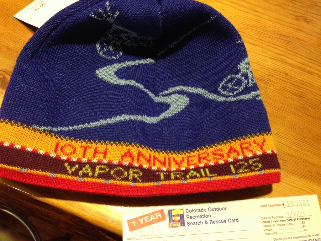
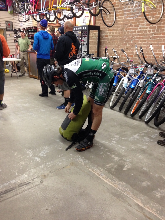
Saturday basically took forever. If you ever want to try and break a hole in the space-time continuum by making time go backwards, plan to do a bike race that starts at 10pm. I charged all my lights and unpacked/repacked my Osprey pack and drop bag more than once. Finally, 7pm came, and I went to Absolute Bikes to fill out my waiver and get a sweet race beanie.
The rider meeting was at 8pm, and, though I was tempted to do so by my nerves, I didn’t kit up yet.
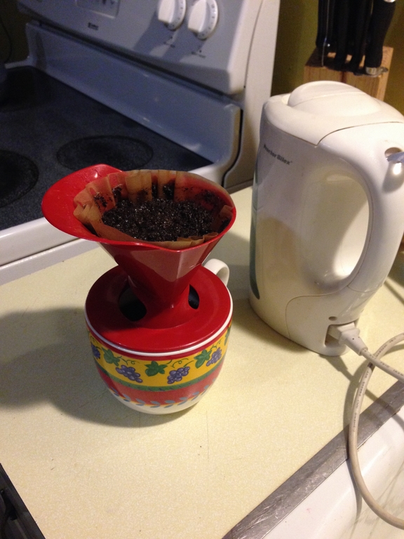
The enormity of the race really started to sink in during the meeting. I got nervous. As soon as the meeting was over, I went back to the hostel and made myself a soup bowl-sized mug of coffee to drink while I paced around getting ready.
A little before 10, everyone lined up at a bridge downtown for the neutral rollout. It’s actually pretty cool- since the racers need to cross a major highway to get to the race course, everyone follows a police car out of Salida to Poncha Springs just a few miles away, where it stops next to a small airport for a final pee/clothing adjustment break before continuing to highway 285, where several other police cars were waiting to stop traffic and let all of the racers cross safely as a group.
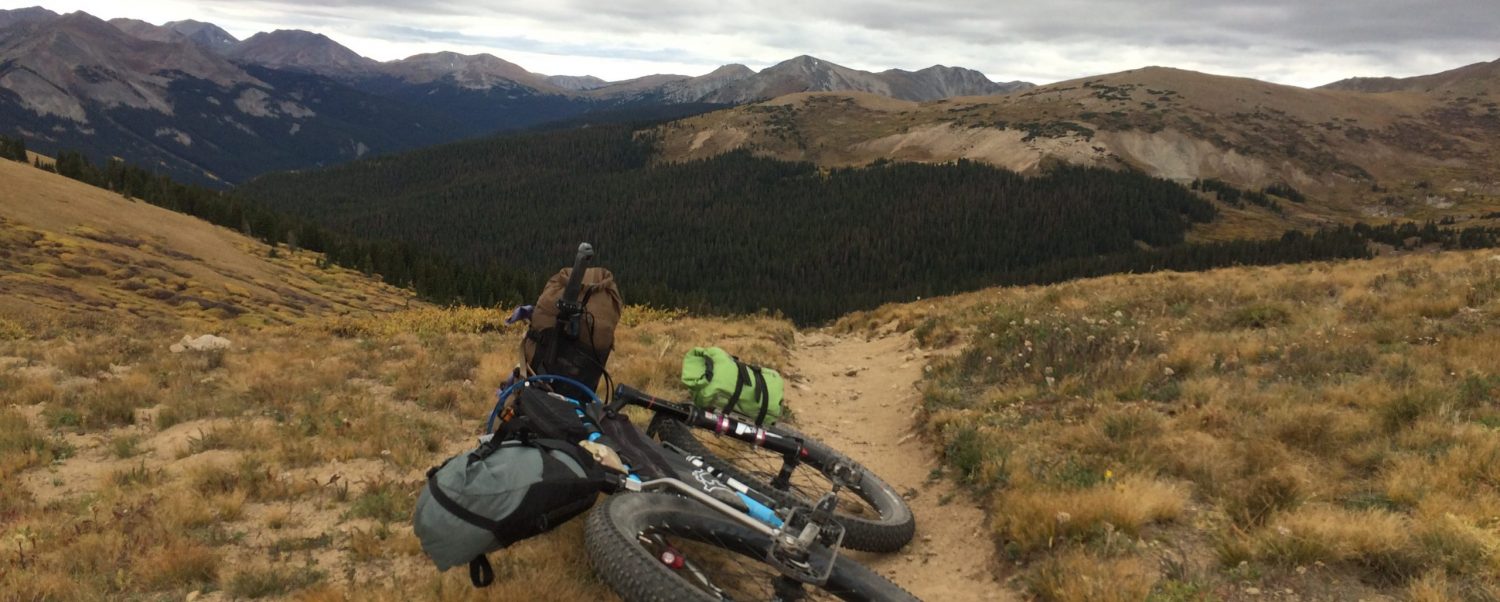
Once we were across the highway and the police car pulled away, the group quickly stretched out and split apart as we started the first climb several miles up a gravel forest road to the Colorado Trail (go back to my first VT125 post to see pictures & a Google Earth track). All of the women in the race were basically some sort of Colorado endurance superstar in one way or another, and they left me in their dust at that point (with the exception of Bec Bale, who was just a minute or so behind me). I just kept going at the pace that my physiological speed governor would allow.
Riding the Colorado Trail at night is a rush. I used a head and bar mounted set of Light & Motion Seca 2000 lights. They’re so incredibly bright that I was able to keep them on low power the whole time, with the exception of the final Colorado Trail descent and the descent off of the Alpine Tunnel pass. Bonus- the enduro model will run for 10 hours on low. I still carried spare batteries but never needed them. I arrived at the first aid station at 1:40am. Though it’s relatively early on the course, that aid station is the last one before the long drag in the mountains. I took a pee break, ate half a breakfast burrito, grabbed an extra base layer from my drop bag, and set back out.
The climb up to Alpine Tunnel is long and gradual, and can mentally break you if you let it. I alternated sitting and standing as well as awareness and staring at the ground in front of me, and the two hours to the top passed quickly. The moon was incredibly bright, and was competing with my lights for the reflection off of the frost that was on the pine and aspen trees along the road. At the end of the road at Alpine Tunnel trailhead, it was bright enough to dimly light the bare tops of the mountains around the pass… the view was surreal. I stopped for a pee break, and to just soak in the awesomeness before making my way to the Alpine Tunnel hike-a-bike.
It was at the hike-a-bike that I caught up to one of my female competitors. I started hiking before her and descended a little faster (she mentioned something about this being her first night ride in some extreme length of time). However, she caught up and left me when I stopped to change into a warmer jacket and gloves. The next section of road was gradually downhill for a couple of miles, and the temperature was somewhere below freezing. My hands can go from OK to useless ice flippers in the space of five minutes, so I enact a “disaster aversion” strategy of keeping my core warm and my gloves dry.
The next challenge was Tomichi Pass and the infamous hike-a-bike up Granite Mountain. I mostly walked up Tomichi, though I did find a few sections to be momentarily granny gear-able. Once I was on the other side of the pass, it was somewhere around 5:15 in the morning, and I began the long push to the top of the mountain. When I stopped for another pee break about halfway up (there’s a pattern emerging here), I noticed when I got back on the trail that my eyes had adjusted enough in the very slight morning dimness that I didn’t need to turn my lights back on. I made it to the top about the time the sun was turning the sky all sorts of cool colors.
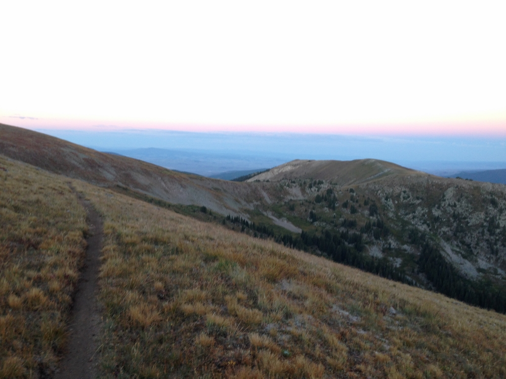

One of the “benefits” of being forced into riding slow is that the faster people are in the dark when they do the Canyon Creek trail descent from the top of that mountain. Also, since it was so cloudy during my pre-ride, I’d had no idea that the initial part of that descent was along the spine of the mountains. I took that as a satisfying consolation prize. Once you’re past the timberline, that descent is full-gas awesomeness. I raged it so hard that I caught up to several people who’d left the top of the mountain while I was still taking photos and enjoying the view (bonus- despite slowing down and chatting with a couple of the caught guys for a minute before passing them, I got the Strava QOM for the lower half of the descent). You basically take about an hour to lose all of the elevation that you spent all night gaining.
The next aid station is at the bottom of that descent, and my arrival time was 7:41am. Though I was very stoked from going downhill and seeing morning in general, I wasn’t feeling my most awesome. Imagine riding all night, doing a metric crap-ton of climbing both on and off-bike, then rolling into the aid station at the bottom of another 2 hours worth of climbing and saying, “Hey, I’m ALMOST halfway done with the race course now!” On top of that, though I’d had what I’d consider a “normal” amount of water for an effort of that duration/intensity/temperature, I was peeing way more than normal, which made me think that my electrolytes were off. I mixed up some Gu Blueberry Pomegranate Brew (double sodium, and the single-serve stick packs are really convenient to pack for a ride), and decided that I’d drink all of it on the way up to the next aid station at the top of Monarch Pass.
If I had to pick a place that was my “low point” of the race, I’m probably not alone in saying that it was somewhere on the Old Monarch Pass climb. I did my best to zone out and not think about it, and made it to the top somewhere in between daydreaming about pizza and using a roadside rock as a pillow to take a nap.
Two and a half hours after leaving the previous aid, I arrived at Monarch Pass… the place where most people who want to DNF do the deed. Though I was at kind of a dark place in my experience, I knew from past races that a short break and some self-care can really turn things around. So, I sat down while two very kind aid station volunteers brought my bag and gave me various food choices. I took off my base layer and knee warmers, had a cranberry muffin, some bacon, and a 16oz Redbull along with a couple of electrolyte pills. It rejuvinated me enough to enjoy the sweetness of the next part of the course- the Monarch Crest Trail. It has a couple of tough kickers in it as far as climbing, but it’s mostly rolling with some fun downhills and gorgeous views. Bonus- picked up another downhill Strava QOM for the descent to the aid station at the Starvation Creek loop.
The Starvation Creek loop is about as fun as it sounds. You start by climbing about 500ft on jeep road until you reach the singletrack descent (I accidentally passed it in my sleep-deprived state and had to turn around and find it when I reached the dead end of the road). The singletrack drops down… and down… and down… it’s so long that you quickly stop enjoying the downhill and start dreading how much you’re descending. I literally slowed down because I wanted it to be finished. Then, you cross the creek and start climbing a rocky jeep road back up- about 2000ft back up. It’s warm at the bottom (hearing people complain about how “hot” it was made me chuckle a little), and there are biting black flies that will circle and nail you right when you’re suffering most. If someone at the aid station for the loop had given me the choice of either doing the loop or opting out with a full-force kick to the liver, I’d choose the liver kick.
I made it through in about 2.5 hours… actually not too terrible of a time, considering I required two pee breaks, and I either granny-geared or hiked during the entire climb out. When I passed through the aid station for the second time, I ate several handfuls of really salty potato chips and took another electrolyte pill. That seemed to do the trick for extending times between pee breaks, because I didn’t have to go again until I was back and showered, despite continuing my same water consumption. I could also just about smell the finish line 25 miles away.
Leaving Starvation Creek is the last of the long climbs of the course. You get on the Colorado Trail and go up and up and up until you make it to the descent down Silver Creek. I quickly realized that I was getting a little fatigued and sloppy with my downhilling and decided it was in my best interest to back it off a couple of mph so that I wouldn’t end myself or my bike that close to the finish. Once I was down that, I found the last aid station at the bottom, where they had the best treats of the day- bacon and egg rice bars as well as salt and vinegar chips. I wanted to stay and eat more, but the last section- the Rainbow Trail, was calling my name.
Definitely one of my favorite parts of the course, BTW. It does have a couple of steep hills that I had to hike, but all of them are followed up with the payoff of flowy goodness. It was a perfect icing to my 127 mile cake. The hardest part of the rest of the course was navigating the highway 285/50 intersection. The entire course had been marked with pink pin flags and tape, and the construction zone at the intersection had wooden stakes and pink flagging stuck in to both sides of the road. Being mildly delirious, I was momentarily stupefied, but then noticed the pink course flags mixed in amongst the construction markers. I followed them to find the county road back in to town- downhill the whole way.
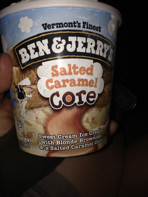
I finished in 19 hours, 27 minutes… near the bottom of the finisher list. However, to be a finisher on that list feels like an accomplishment in and of itself. Aside from the sleep deprivation and requisite soreness from riding/pushing so much, I actually felt slightly less bad than when I finished any other sea-level 100-mile mountain bike races… another discovered advantage to the physiological speed governor. Then, I got hungry.
That used to be a gigantic hamburger with bacon and avocado

I also needed dessert
Rather than putting myself through the torture of driving back today, I’m taking the day to relax, nap, eat, and get a massage. It will make the 17 hours of going back home slightly less bad, though it’s always sad to see the mountains in my rear-view mirror.
Great race report, how do you remember all of those details when you are basically “brain dead” worn out while you are experiencing them?
Have a safe ride back to “M” town.
Andrea – Congratulations on finishing. Very inspiring. Thanks for opening my eyes to this race.