2014 Training Camp #1

The space from December 24th through January 1st seems like a time when a lot of people and businesses are thrown out of their usual routines and everything is a little turned on its head. So, this year, I decided to run off to the cabin on the 26th to avoid the fluster of the holiday week and get some intense training on the Syllamo Trails and surrounding forest roads.

Before Arkansas, we went to Christmas lunch at my Grandmother’s house in Drew, Mississippi.

IMG_6184 (Copy)

I have several more pictures of the family, but my mom hates pictures of herself, and she’s in most of them.

My cousin Brent, who is closest to my age of all my cousins, bought his five year old daughter one of the greatest presents in the history of “presents for 5 year old girls”…

IMG_6187 (Copy)

IMG_6186 (Copy)

She rides it by herself (with the speed governor turned down, of course).

Speaking of presents, Matt put Ronda Rousey on the wall over my workbench. Now I flinch every time I walk through the garage.

IMG_6192 (Copy)

Thursday, Ryan and I left for the cabin. We made it in time to get in a short ride and to start on a stack of puzzles- my new favorite thing to do at the cabin besides ride, eat catfish, and watch procedural crime dramas.

IMG_6193 (Copy) IMG_6196 (Copy)

Saturday morning, we had breakfast at Rainbow cafe in downtown Mountain View.

IMG_6199 (Copy)

Some sort of animal hid its breakfast corn from the deer feeder in the bathroom light cover.

IMG_6200 (Copy)

Saturday, I kept having an odd pain on the upper left-middle area of my back and a corresponding spot in my ribs on the front of my torso. It nagged at me all morning before I realized it was shingles. I had a full-blown case back at Breck Epic a couple of years ago, and they still periodically hurt from time to time. This was aching bad enough that I was worried that it was going to go full bore. Luckily, the pain subsided in a couple of days.

That day, it had rained, so we stuck to forest roads. I wanted to try and ride to the Sugarloaf Mountain Lookout (upper right corner of the map), but the “back way” in that didn’t involve riding a large stretch of Highway 5 was gated off with “private property” signs.

IMG_6202 (Copy)

Sunday night, we went to Tommy’s Famous Pizza with my dad.

IMG_6227 (Copy) IMG_6223 (Copy)

IMG_6222 (Copy) IMG_6220 (Copy)

IMG_6228 (Copy)

When the sky is clear, one of my favorite things to do is sit on the porch and have a glass of wine while the sun sets. It’s a nice opportunity to reflect and enjoy the mountains.

IMG_6214 (Copy)

IMG_6213 (Copy)

IMG_6212 (Copy)

IMG_6236 (Copy)

It’s cold out right now (daytime highs have been in the 35-40 range with 70-90% humidity). I didn’t take riding photos while we were out because stopping is a surefire way to get chilled with a quickness. Since a lot of you don’t ride these trails all the time, it’s probably not really interesting for me to list a bunch of trail names (if you’re interested in routes, you can look at my Strava account). This is also a relatively “serious” time for training. Less sightseeing, more steadiness.

…and, more puzzles.

IMG_6210 (Copy)

Here’s my one ride pic:

IMG_6208 (Copy)

aaaaaaand:

IMG_6232 (Copy)

Monday, Ryan left with my dad. I took it as a recovery day and rode at a leisurely pace on the blue and green trails. The sun was out for the first time in a few days, and it was a balmy 44 degrees. I can’t really put in to words how I feel alone in the woods. It’s like my safe place where no one can get me… sort of like the feeling you get when someone really big and strong gives you a large and gentle hug.

IMG_6231 (Copy) IMG_6230 (Copy)


Solo Syllamo Weekend

I made a mid-week decision to go for a solo trip to Syllamo over the weekend. Before I left town, I had some stuff to do…

IMG_6075

That’s an Ancestory.com DNA kit. The whole site makes me cringe a little with its subscription-ness, but the “spit in a cup and we’ll tell you about your ancestors” part is wholly fascinating to me. So, I’m anxiously waiting on that to process.

Thursday, I explored some horse trails. Along the way, I saw (literally) a ton of deer as well as a turkey and an owl. I also found large quantities of mud in a couple of spots.

IMG_6086

IMG_6088

IMG_6087

Given the large quantity of mud I had to clean off/out of my bike on top of an already busy Friday, I didn’t get out of town until around 4pm. Apparently, there’s a never-ending Friday night congestion of U.S. Highway 64 between all the small towns across Arkansas. Who knew? There’s a more northern route that’s a few minutes shorter, but I’ve always felt a bit of an adventure connection to 64 since it’s been a part of many of my travels to races and whatnot in both directions across the country.

Anyway, Turbo and I made it in enough time to make dinner and start a new puzzle.

IMG_6097

IMG_6104

(OK, so the second photo is from the morning, as evidenced by my coffee, but that’s all I’d finished the night before)

This winter, I’m embracing the “just get out and ride” method of free-forming my base miles. I’m also embracing some interesting ride food, like rum-soaked fruitcake:

IMG_6105

I came up with a route that I dubbed the “Baby Epic,” because in the future, I’ll add more singletrack to the eastern side of it. If you take a look at the map: http://www.strava.com/activities/229517383, you’ll see that, following Branscum Rd. (which is actually a pretty rough/steep horse trail), I used a combination of Green Mountain Road, the last 4 miles of the Red Trail, and the last short/tech section of the Orange trail to return to where I started. Next time, the plan is to add the Blue trail from the 2nd trailhead to the Orange, and, as a final “Big Epic,” add the long/hard section of the Yellow on top of that. That’s bound to be an all-day ride for sure.

Along the way, I did some futzing with my suspension as well as making a stop to take photos from the little side trail to a waterfall at the bottom of Branscum “Road.”

IMG_6108

IMG_6116

IMG_6113

That last one is from underneath the waterfall overhang. You can see the water coming down from the upper right side of the photo. It is gorgeous out there, and the trails are generally in great shape. After my journey, I arrived back to the parking lot and saw another Shelby County vehicle parked next to mine. The occupants (including Fullface Kenny) had left some dust art for me.

IMG_6118

I unscrewed their gas cap.

IMG_6119

Ginger Ale and recovery candy.

Back at the cabin, I snacked, cleaned up, and worked on my puzzle some more. After a trip to WalMart for provisions, I came back and made a kickass dinner and watched the ever-present A&E Criminal Minds procedural crime drama marathon.

IMG_6123

Sunday was a day for survival and not photos. I rode from the 2nd Green Mountain Road trailhead without much of a plan other than “explore side roads.” Turns out, most side roads just lead you to logged-off meadows. My legs were thrashed from the day before, so it was a 2.5 hour exercise in keeping the pedals moving and trying to enjoy the scenery and little bit of excitement that comes with exploration… all the while, trying to ignore the fact that my legs were still back at the cabin drinking coffee and working on a puzzle.

Driving home from the cabin depresses me. Aside from the lack of multiple cute animals, it’s like my safe, cozy fortress of solitude where I can go and ride some of the most difficult terrain available then relax in the peace and quiet of the Ozarks. It’s one of those things where the whole way back, I’m already planning the next trip in my head.

IMG_6130 IMG_6135

The Long Weekend

Since my family acquired a cabin near the Syllamo Trails, I’ve been going over there for Thanksgiving. The past two years, it’s been a family event, with one or more relatives coming to visit. I decided to take Turbo this year since she’s been fighting off pneumonia for the past two months and the extra exercise of being able to trot around and pretend to chase deer (there’s not much real “chase” when you’re a large 13-year-old dog) is good to help clear her lungs. On Wednesday, I took her to a small local bakery/grooming shop called Woof Gang Bakery where they offer self-service baths/blowdry. She loves the attention…

IMG_5963

Speaking of dogs… look how cute these two are:

IMG_5966

Also on Wednesday, I made the best green bean casserole, ever. I love it when I find a recipe like this one that’s been bastardized by pre-made/canned food and take it back to the basics to remind everyone that even a casserole can taste like actual food and not just salty mush.

Thursday morning, Ryan and I left early so we’d make it to the cabin for lunch festivities. Everything was pretty delicious, though I refrained from gorging too much because we planned on squeezing in a post-lunch ride that afternoon. Not long ago, a professional work crew cleared the entire 13-ish mile Red Trail, and, even though it’s not my favorite one in the system, I hadn’t ridden it in more than a couple of years because it’s continually been in bad condition. Other than a couple of branches and lots of leaves, it’s now super open and nice. We also checked out the Yellow trail on the non-trailhead side of Green Mountain Rd. between the Red trail Trailhead and the Yellow/Blue Trailhead. Half of it was clear and open like the Red Trail, and the other half is thorny with several trees down.

Thursday night brought about my newest Thanksgiving tradition- an obnoxiously large and difficult puzzle. This one was particularly terrible because the photo used for the puzzle is mostly out of focus.

IMG_5980

Spoiler alert- we never finished it.

Friday, I wanted to ride a potential Enduro course. Details are mostly a secret, though I will say the transition climbing is going to kill the shuttle-runners off with a quickness. It’s very scenic, though.

IMG_5973

IMG_5974 IMG_5975

IMG_5976

Sunday, we attempted to ride the “hard” part of the Yellow Trail from the middle Green Mountain Trailhead going clockwise (reverse race direction). It still has some overgrown spots- especially in the logged-off areas (of course) and a pretty steady amount of downed trees. However, the rock gardens are in prime condition. Ryan wasn’t enjoying the looseness of the leaves and marble-y gravel beneath them, so we ended up bailing off at a logging road just after the Overlook.

IMG_5982

We extended our ride on the nearby gravel roads and checked out the scenery at the bottom of Sandy Flat before heading back to the cabin to eat and pack up for home. Conclusion? The trails are about 85% awesome right now. The more traffic they get, the more the leaves will be unfluffed, and the better they’ll ride. If you’re on the fence about going to Syllamo because of past conditions, I’d say it’s worth the trip.

Sunday, I wanted to get in another good ride back in Memphis. The weather was super nice, with highs somewhere up in the 60’s for much of the day. Since it hadn’t rained in a while, Matt and I decided to try checking out the “Epic” trails- a sort-of system of 4×4 trails that winds through the narrow strip of woods between the Wolf River and Interstate 40 across most of the length of Memphis. Because of the neighborhoods it crosses, it’s not a place to go alone, and there are mudholes there that could swallow a jeep, however, when it’s in good shape, it’s a lot of fun to explore as long as you know what you’re getting in to.

Along the way-

IMG_5988

IMG_5989

IMG_5990

We found out very quickly that it was way too muddy. We probably should have taken a hint from this guy, who we found stuck in a hole near the beginning of the trail-

IMG_5991 IMG_5992

My tires clogged with muck within a mile, and both wheels couldn’t turn. Our adventure thwarted, we turned around and hiked out. Lots of other people were out enjoying the mud and nice weather, so we had some entertainment along the way back.

IMG_5996

IMG_5997

I recorded a little video:

http://youtu.be/mkMdeDbWneM

Our bikes were pretty trashed in a short period of time, so we rode back home and, following a little errand-running, drank just enough alcohol that playing “you be jab, I’ll be cross” with my boxing gloves and later “trade leg kicks” sounded like a good idea. Ryan didn’t participate, and, lo & behold, he was the only person in the house not walking with a slight limp on Monday morning.

Now, it’s back to the grind for the time being… mostly. There’s currently another Syllamo trip in the planning stages. I’m also about to have a bit of a change in my MMA training. Since my fight back in July, John and I have been training a little on Tuesday and Thursday mornings. However, since the building that Ingram’s Martial Arts was in is being taken over by another lessee, they’re moving their classes to UFK, and I’ll be starting in with them tonight. It’s slightly uncomfortable to be the “new kid,” but I’m pretty sure it’ll turn out just fine.

Arkansas-Induced Happy

Sorry (a little) for making bummer posts lately. My trip to the cabin/Syllamo Trails was gorgeous. I only got to ride on Saturday because of some crummy weather that came in Saturday night, but it was totally worth the trip (as always). We rode the Orange and Blue trails, and they’re in excellent shape right now.

Riding for any length of time on those trails will confirm that nearly every inch of them wishes for you to fail or break down. Matt flatted on a forest road, at which point, I decided that the Syllamo Trails are like the Australia of trail systems- there seems to be a disproportionate number of things there, both large and small, that will injure your equipment or your person. That probably only makes sense when you realize that Australia is home to lots of things that want to kill you.

image4

image8.

Flats and falls aside, it is, and will always be, one of my most favorite places in the world. It’s quiet, remote, and beautiful.

image11

image6

I’m excited to go back this weekend, ride, and do some trail work on the less excellent areas. From what I’ve heard, the Red trail (which was definitely the worst as far as overgrowth and deadfall), is now clear, thanks to a crew brought in by the Walton Family Foundation (most people in Arkansas would agree that the trail systems in the state wouldn’t be what they are today if it weren’t for the generous donations from the Walton Family).

If you’re a follower of Mountain Bike Radio and listener of Just Riding Along, you’ve heard all that before. If you aren’t a listener, you should definitely start this weekend. You can go to the MBR website and listen directly, or click on whichever of the “download/listen here” buttons most suits your fancy. You’ll be entertained and/or informed during your hours of Thanksgiving travel. If you’re new to JRA, you should definitely go back in the archives and learn about the hazards of the trailside Armadillo. That way, you’ll be fully prepared to get a t-shirt once we have them printed:


MBR001_logo

No Plans Other than the Weekend

Too often on blogs and other social media, individuals paint a shiny, perfect picture of their lives. I’m not in to that. Even if it loses a few readers, I like to keep it real. It’s also somewhat therapeutic to organize and describe my feelings in neat and coherent paragraphs. So, for my next therapy session…

That last post got me down a bit. I was really enjoying the break from my usual grind and looking forward to the upcoming marathon challenges. I’ve basically written off being well enough for the December 6th LOViT Marathon. My tendinitis is still there and wants to flair up if I do any sort of ballistic movement with my left leg. I can, however, ride a bike without any pain, so I’ve been getting back on the trail on two wheels… not really with a plan, but that feels alright for now.

I do plan on working with a good PT in the coming weeks. I think that my injuries are all stemming from the last round of hamstring injections I had back in late September. I have to figure out the root cause and deal with it in order to train as hard as I want to without continually injuring myself. As for what I’m training for? I don’t know yet. I’m going to bike race next year, but I haven’t felt compelled to put together a schedule other than “Crested Butte Enduro Stage Race.” I’m not sure if I want to keep it more regional, maybe go to Pisgah a little more often, or try and get out to Colorado more than once.

All of my hesitation to make a 2015 plan boils down to my ability/inability to train. Living in Memphis, training on the road is almost required. I used to enjoy it. Then, I got hit by a car, and it became a necessary evil that I fought through and tolerated. My ability to do so has become almost totally exhausted. I dealt with PTSD once before after aiding in cadaver recovery (with a recovery K9) at the World Trade Center following the 9/11  terrorist attacks. It took a long time for that to go away, but I realized the other day when I passed a burning car (which smells almost exactly like a burning World Trade Center) and didn’t have any sort of panic or flashback feelings, that I could call myself 99.99% healed from that experience.

Dealing with the hit-by-car thing has been way different. The best way I can describe it is it’d be like if you’d worked in the World Trade Center and barely managed to survive the terrorist attacks, and then immediately went back to work in another high rise office with airplanes constantly circling it, and on most days, at least one of the planes would buzz your window and/or play chicken with your building, and at least once a week, you’d have a friend or a friend of a friend whose office was exploded via another errant plane. That’s basically where I am now.

I’m not saying that I am giving up- far from it. I’m just saying it’s going to take some extra work and determination to do most of my riding away from vehicles. I’ve had a few people suggest group rides. Being tucked in a group does nothing to make me feel safer the same way being in a high rise office with hundreds of other people wouldn’t make the person in my example feel safer.

I decided to run off to the cabin for the weekend to get back in to some fun riding. The mountains are very much my sanctuary when I’m feeling stressed or overwhelmed by anything. I’m not all doom and gloom, it’s just going to take time to work through my fears and figure out what I can tolerate and where I can compromise. I have never been one to stress over uncertainty… I actually don’t mind it at all, because it leaves the future open to anything rather than corralling me on to the same worn path.

IMG_4959

Syllamo Running Weekend

My Halloween running trip to Syllamo was definitely a success. Wednesday night, I made a last minute pumpkin and candy purchase so that Ryan would be prepared for Friday. There were only a few pumpkins left, so I picked the one with the most interesting face…

IMG_5762 IMG_5763

After some Thursday morning jiujitsu, I packed up the car and made it over to the cabin just in time for a sunset run around the Green Trail. I figured the 4 mile mix of rolling hills and occasional rock gardens would be a good shakedown for the new shoes I’d bought earlier in the week (the Altra Olympus). I’ll save you all the full-on shoe review and say that once I figured out that I could actually lace them tightly and be comfortable, I liked them well enough to try them on my longer run the next day.

Made it to one of my favorite spots just as the sun was setting…

IMG_5771

The next day, I’d decided to run most of the length of the Sylamore Creek Trail. It’s one I hadn’t really been on, save a short hike or two, because it’s closed to anything but foot traffic. Since my dad was at the cabin, I parked my car at the eastern end (the Allison trailhead) and he shuttled me to the Barkshed Camp trailhead- the one just to the east of the western terminus of the trail (I’ll do the whole thing next time I go out there).

IMG_5779

There was a couple at the Barkshed Camp that had an adorable little beagle that they’d rescued off the side of the road. She’d been hit by a car, and one of her legs had to be amputated…

IMG_5781 IMG_5782

I got started on my run, and quickly realized that the changing trees and rock formations were some of the most gorgeous I’d witnessed in years of traveling to the area (we usually wait until a little later in the year to ride the trails because of the overgrowth, so the trees are all leafless and brown).

IMG_5784

IMG_5785

IMG_5787

The trail is actually pretty “easy,” elevation-wise. It mostly follows the creek, so it’s mostly rolling hills.  The surface is often rocky, though, and I found that the shoes I was trying out, while extremely comfortable on smooth ground, were treacherous on rough and technical spots. It was still a great time, though. The miles clicked off quickly, especially since it was really easy to break the trail down into sections as I passed through the campgrounds along the way (Gunner Pool and Blanchard). I got a little lost at the Blanchard Springs trailhead because you basically come out of the woods at this sign…

IMG_5788

…then see a couple of blazes on some trees going towards the road, then nothing. I tried following the road across the creek into the camping area and didn’t see the trail, so went back and crossed a bridge to a little (closed) nature center parking area and discovered the trail in the back corner of its parking lot. Between refilling my water and wandering around looking for the trail, I probably killed a solid 20 minutes of time before getting started on the last 5 miles to my car.

The last section of trail is fun… it starts out nearly flat and very smooth, then the last mile is the rockiest of everything I’d run that day. It culminates in the famous (infamous) creek crossing before ending back up at the trailhead where I’d left my car…

IMG_5790

Success! I was a little tired and sore, though probably a little less than what I was expecting, given I was more than doubling the mileage, elevation, and technicality of any of my most recent runs. (time/distance below includes both photo stops and “wandering” in search of the trail)

IMG_5791

That evening, I ate large quantities of catfish and hushpuppies then vegetated in the recliner flipping between marathons of both COPS and Criminal Minds on satellite TV. Turbo vegetated on the bear skin rug.

IMG_5797

The next day, I was slightly more sore (as expected), but I still managed to run/hike a 7-mile loop of the Orange Trail (all business, no selfies). Back at the cabin, I packed and headed home.

Sunday morning, I’d left my schedule somewhat open to either running or going for a recovery bike ride, depending on how I was feeling. Since my soreness level was about what I’d expected (no localized, specific spots hurting), I decided I’d watch the guys race cyclocross then run home the long-ish way.

IMG_5800 IMG_5802

I performed obligatory beer hand-ups for the singlespeed race…

beer

Once that was over, I took off on foot, running part of the Tour de Wolf trail then linking in to the unfinished section of the Greenline that goes right behind my house. I kept the pace in the 8:30-8:40min/mile range, which is just “easy” enough that I can do it for a long time as long as I don’t let my mind wander too much.

The additional 5 miles gave me a week-long wrapup of 37 miles and about 7 hours. I’m very happy with how my legs are handling the large increase in volume (the previous week was 13 miles/2.25 hours). Also, I switched on Saturday to a pair of Vasque Pendulum shoes. They’re definitely better on technical terrain versus the Altra Olympus, but I was hoping they’d be like my previous (and extremely worn out) pair of Vasque Velocity shoes. They’re OK, but not quite a home run. I’ll use them for now, but the “new favorite” shoe search is ongoing.

The plan for this week is to take it easy today- a trip to the dog park, some rolling/stretching, and maybe a short ride. The rest of the week, I’ll likely go for more jiujitsu and  speedwork on Tuesday, an easier day Wednesday, then a couple of longer runs Thursday and Friday morning before heading over to Iron Mountain for the DirtSmart MTB Clinic. The bike time should serve as a good leg break before diving back in to the pre-marathon buildup.

Syllamo Adventure Time

This weekend didn’t go totally as planned. Originally, I thought I’d race the Crossroad Clash cyclocross race, but Sunday morning, I was there and ready, and no other women showed up. With the course markings being a bit vague and the course heavy on the barriers, I didn’t really feel motivated to race the dudes considering my current training priorities (more on that in a second). I’m reasonably certain that the double-up Memphis Velo/Outdoors Inc. Cyclocross races should be different as far as attendance since the Omnium Prize has now grown to $250 for the top lady of the weekend (P.S. If anyone else steps forward with a cash donation, there will be a second place award as well).

Instead, I changed clothes and headed off on a pretty intense run workout. If you haven’t followed along, I’m in the process of cramming for the LOViT Marathon on December 6th. I’m doing my best to strike a balance between training my ass off and not getting injured, and I’ve basically come up with my own training program that’s building up long run distance with a few speed/interval workouts sprinkled on top. Since I don’t have any natural rock in town, and Arkansas is heavy on rock, I’ve taken to running the overgrown/intermittently loose & deep gravel of the unfinished greenline that runs behind my house. Even though it’s flat, I feel like it’s pretty good for building up some lower leg strength and balance. This week, I’ll also be testing my legs at the Syllamo Trails with some running/hiking/trail work. I’m going to take this along as well… just in case.

SS

Speaking of Syllamo, after about a year of talking, planning, and paperwork, what started as a desperate email plea to IMBA for help rehabilitating the Syllamo Trails has grown in to this: Friends of the Syllamo Trail. This week, there’s a 6-person work crew (courtesy of the Walton Foundation) clearing the Bad Branch (red) trail, the longest of the trails in the system that’s also been the worst as far as overgrowth and deadfall. In addition to that, sometime after Christmas, there will be a crew of inmates coming from Calico Rock prison to continue the clearing and tread repair. Good things are happening out there, and I’m excited to see the system being slowly turned back into its former glory.

One thing I realized about making a trip over to do some foot-based training is that I can check out the Sylamore Creek Trail. It’s a foot traffic only trail, and, based on the small section I hiked a while back, you wouldn’t even want to attempt riding a mountain bike on it. It’s been a nice break from bike training so far, though I’m looking forward to getting this initial bit of conditioning over with so I can get slightly closer to the volume I’m used to.

Scratching the Itches

I keep getting this relentless itch. It happens every time I, for whatever reason, go out for a run or see one of my Facebook friends on some sort of trail running/ultramarathon adventure (especially local Billy Simpson– his post about Arkansas this morning is literally the thing that pushed me over the edge on this).

If you’ve been around since I started my blog, you might remember that my cycling addiction began when I was an avid trail runner (thanks to the Warthogs running group. If it weren’t for them, I probably would have never thrown a leg over a bike as an adult). I’ve run a handful of 50ks, trail marathons, and various other long-distance off road races. Running- especially trail running- is something I turn to when I need an off-season break but still want to stay very active. I thoroughly enjoyed all 5 runs I did in preparation for the USARA event (er, I probably should have done more than 5).

This fall, I’ve been unable to convince myself that I want to keep up with any sort of formal training that has to do with cyclocross. I’m missing most of the pretty small Memphis schedule of races (one race is the same day as the 12hr night nationals, and the other two are the same weekend as the Enduro clinic), and, with all of the late-season traveling I’ve done and still have ahead of me, I don’t feel like driving a metric crap-ton to race in Arkansas and Nashville. So, I’ve tentatively decided to do this: LoVit Trail Marathon at the beginning of December as a warm-up to this: Athens-Big Fork Trail Marathon in early January (I ran that one a long time ago, and it was, by far, the most challenging thing I’ve ever done on foot). Then, it will be back to my regularly scheduled regimen of bike training to get ready for the upcoming 2015 mountain bike season.

Not only do I feel the trail calling me, but my fear, anxiety, and growing dislike of riding on the road has really started to eat away at my soul. While I still plan on doing plenty of cycling during the time from the end of October (after Night Nationals) until the first week of January, focusing more on trail running through then will help me put off doing some the winter road miles I’m facing. And, yes… I’m serious when I say I’m going to wait to start marathon training until nearly the beginning of November for a marathon that’s on December 6th. Trust me… I’ve done this before. I have the base fitness- it’s just a matter of conditioning my body to take the impact of running in order to put that fitness to good use.

tm


USARA Nationals

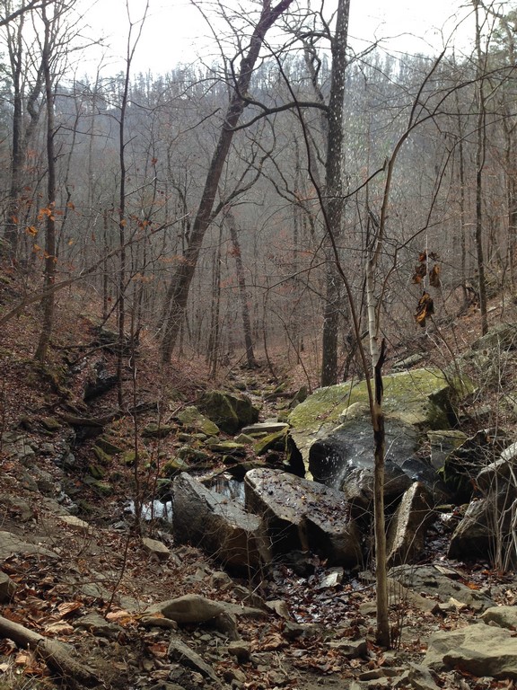
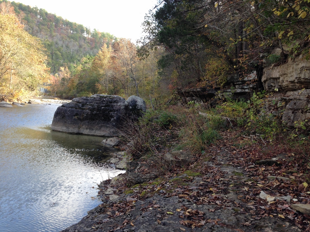
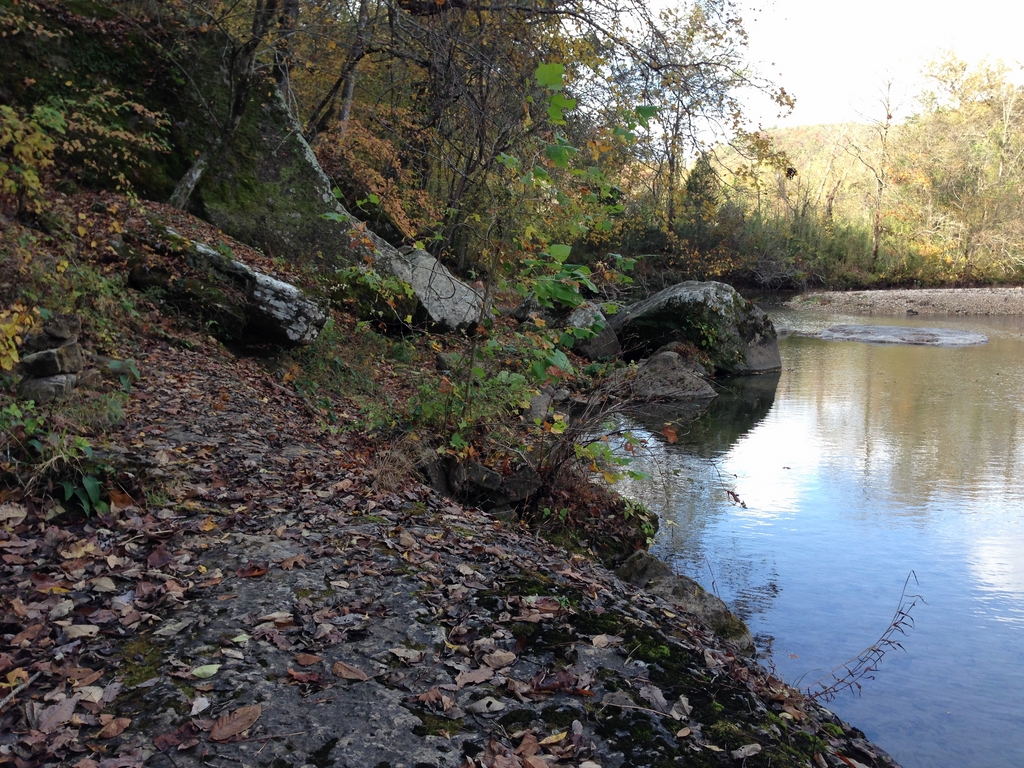
Back around the beginning of August, I was contacted by JRA fan/listener Tony Misovski about racing with his team at the Adventure Race Nationals. I’ve dabbled in shorter races, and I enjoy the format and variety of adventure racing, so I jumped on the opportunity to take on a longer, more challenging event with a very experienced team (the Michigan Racing Addicts). The race was held in McHenry, Maryland, snuggled right up in the foothills of the Appalachians. The area is gorgeous (especially this time of year with the leaves nearly at peak color) as well as rugged.

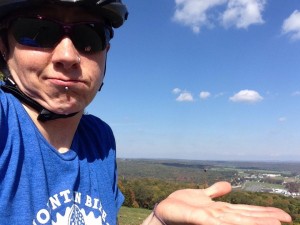
I arrived at the Wisp ski resort (race home base) Thursday afternoon. While waiting on Tony and Mike to arrive so we could check in, I decided I’d thrown on my shoes and helmet and go for a spin to check out the bike path I’d seen on the way in to the resort. Somehow that ended up with riding to the top of the ski hill.

hill

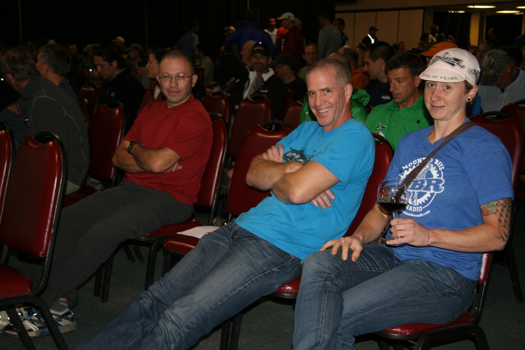
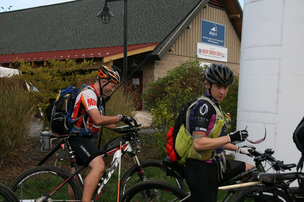
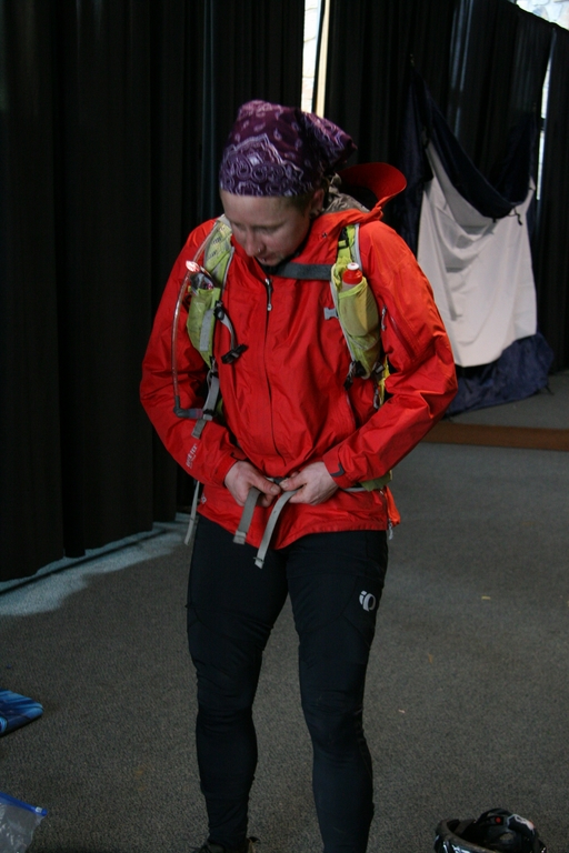
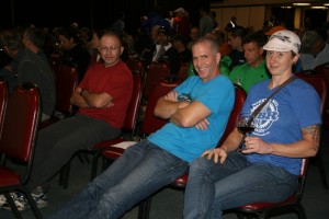
Not long after that, the Michigan caravan arrived. After we said our hellos and whatnot, we found our way to registration and our hotel room, where I commenced to dumping all of my clothes out (two of everything) and wondering WTF I should bring with me for 30 hours that would include everything from sun and 70 degrees to rain and 60s dropping to the low 40s. The 7pm racer meeting gave me a slightly better idea of how the race would go as far as when and where we could access gear as well as the order and transportation mode of each stage.

IMG_0297

P.S. It was freezing in the race meeting room. Also, pinky out = classy as ufck.

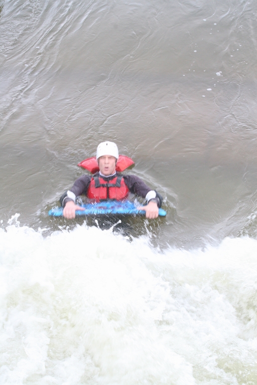
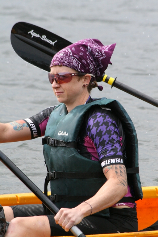
Following the meeting, I’m pretty sure it took me a solid 2 hours to decide what clothes to take where and when and get stuff packed and organized in a way that would make it easy to grab and go in whatever fatigued and/or sleep deprived state I’d be in. The exciting part was that the entire day would kick off with a float down the whitewater course at the top of the ski hill. I’ve never even ridden in a boat on whitewater, so I was excited to see what would happen when I’d be taking it on with a helmet, life jacket, and a boogie board.

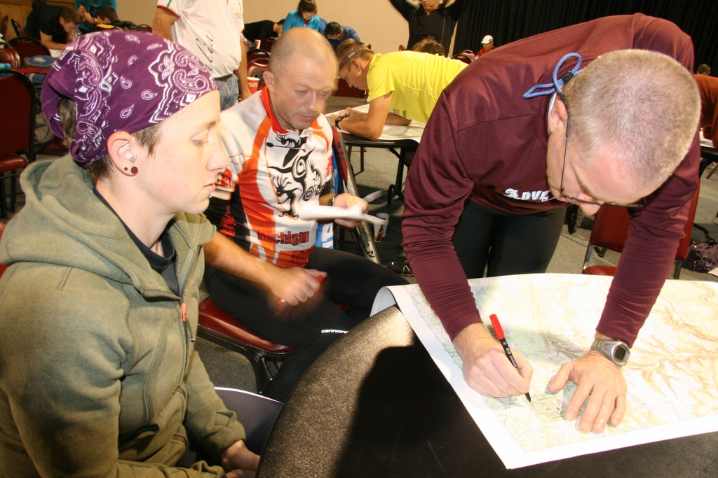
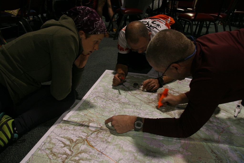
After a few hours’ sleep, we were out of bed and back down to the meeting area to receive maps, checkpoint coordinates, and final race instructions…

IMG_0325

IMG_0327

IMG_0340

IMG_0342

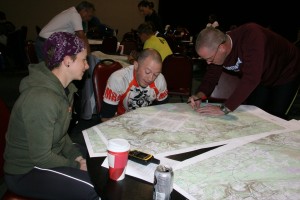
Essentially, the two hours that elapsed from the time the maps came out until the 8am race start were the shortest two hours you could possibly imagine. Checkpoints are plotted first, then the route between checkpoints is planned, highlighted, and measured. In my head, I broke the race up into two parts. Part one would be the whitewater ride, bike orienteering #1, then paddling/orienteering/paddling. Part two was another bike section- much longer, and broken in half by a “score-o” orienteering on foot section that was much more difficult in both length and elevation than the first one (and performed mostly in the dark).

course

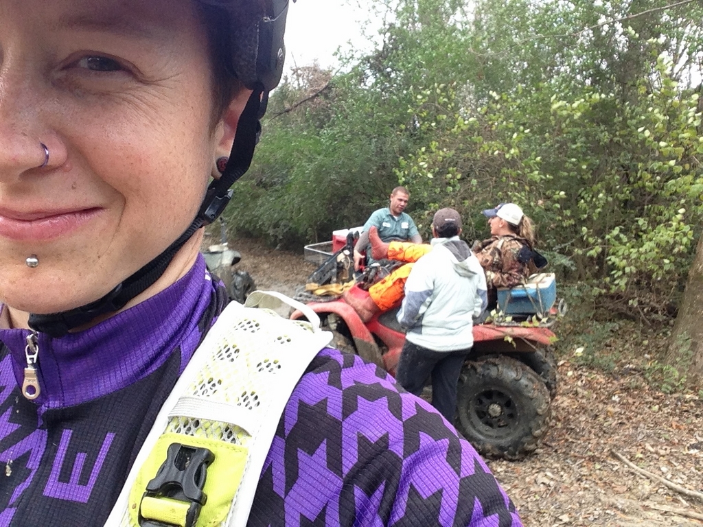
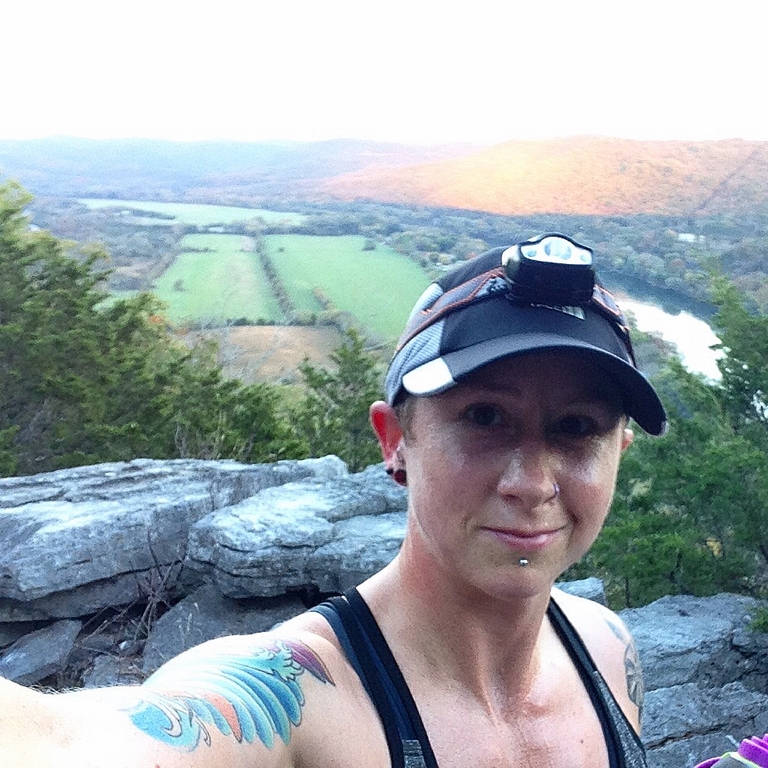
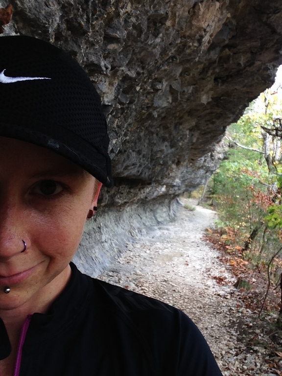
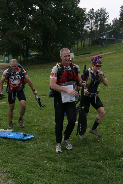
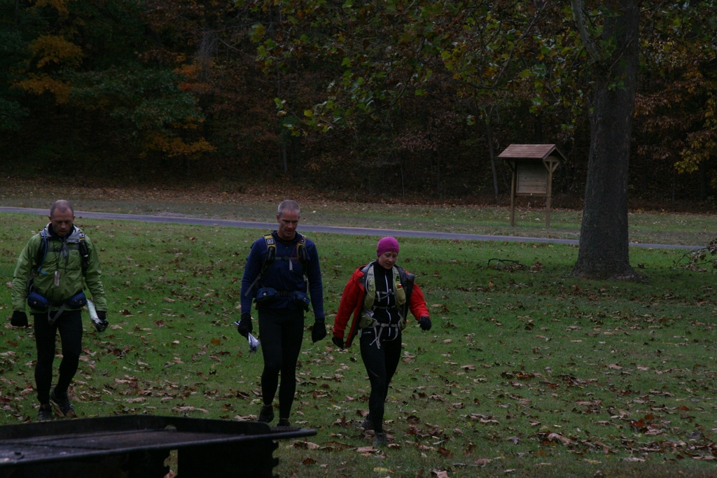
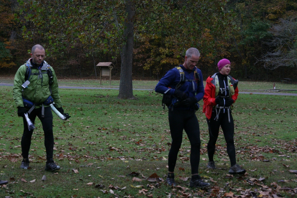
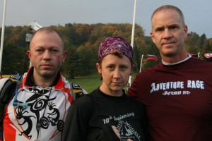
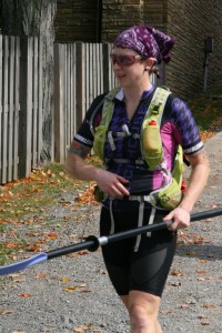
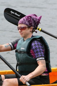
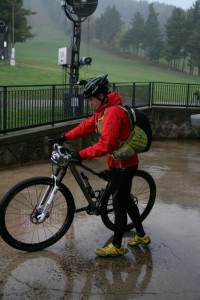
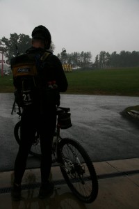
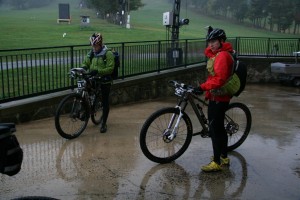
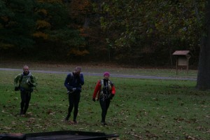
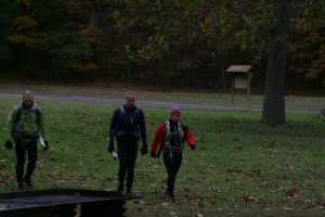
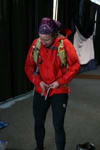
It seemed like 10 minutes passed before we were lined up and ready to take off on foot up the ski hill to the whitewater area. Mike’s wife Angie was there with the camera wherever we’d go, so she got some great pictures…
(she told us “serious face” for this one)

IMG_0359

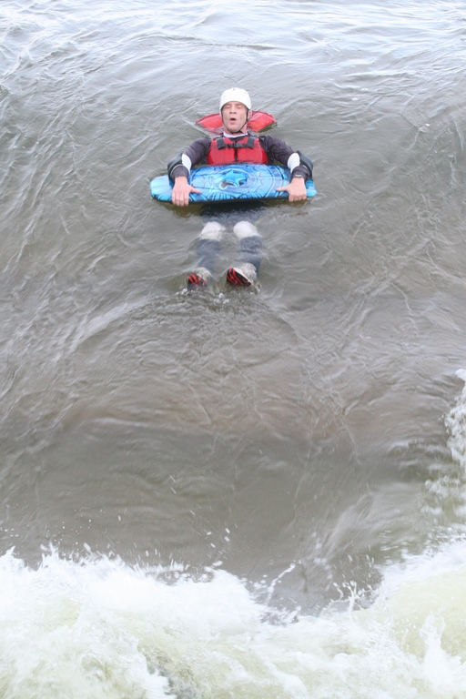
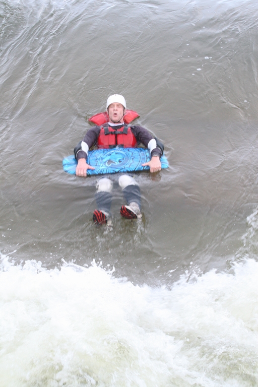
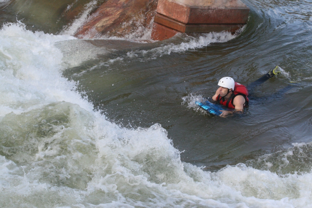
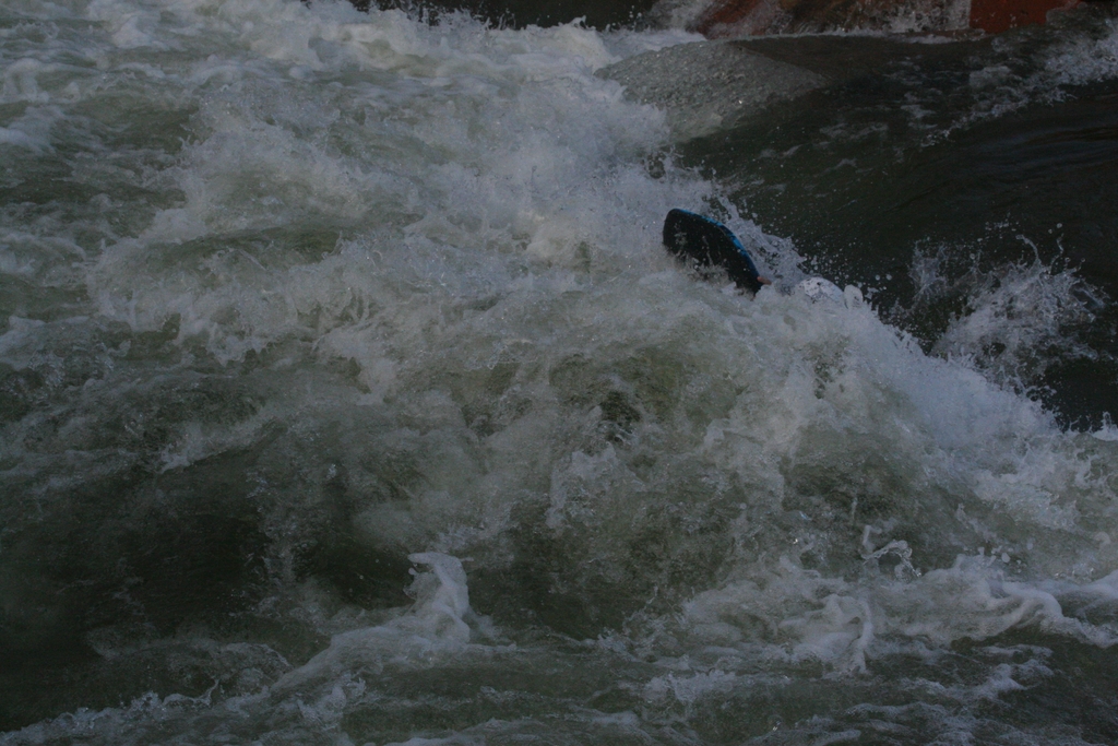
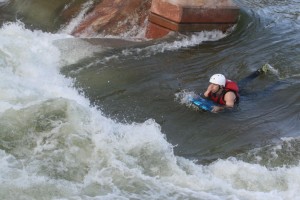
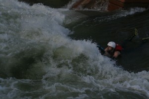
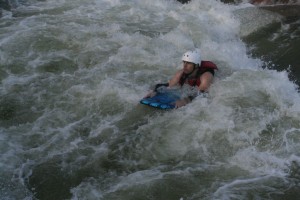
That was a hell of a hike to get us started… and the whitewater was pretty awesome. I don’t have pictures of myself in the water, but here’s my teammate, Mike, going in to the first rapid…

IMG_0394 IMG_0395 IMG_0396

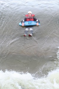
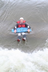
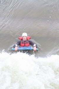
That shit was no joke… it’d smack you in the face then hold you under water for a couple of seconds:

IMG_0475 IMG_0476

IMG_0477  IMG_0479

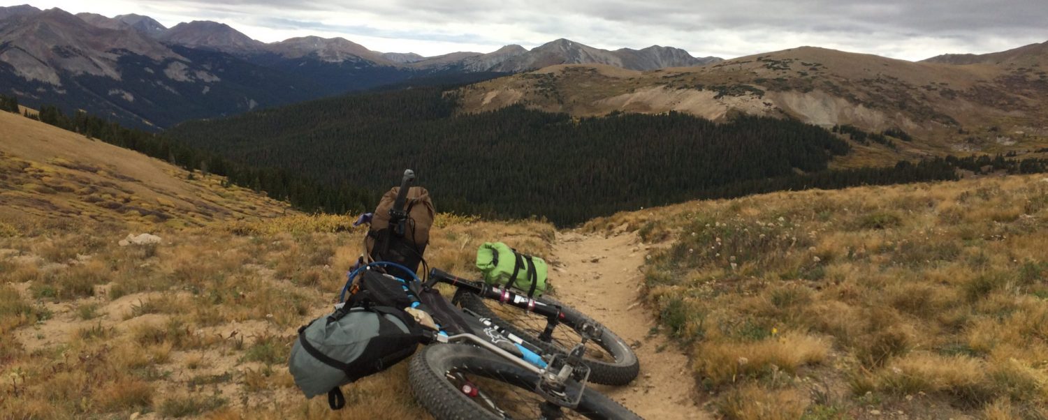
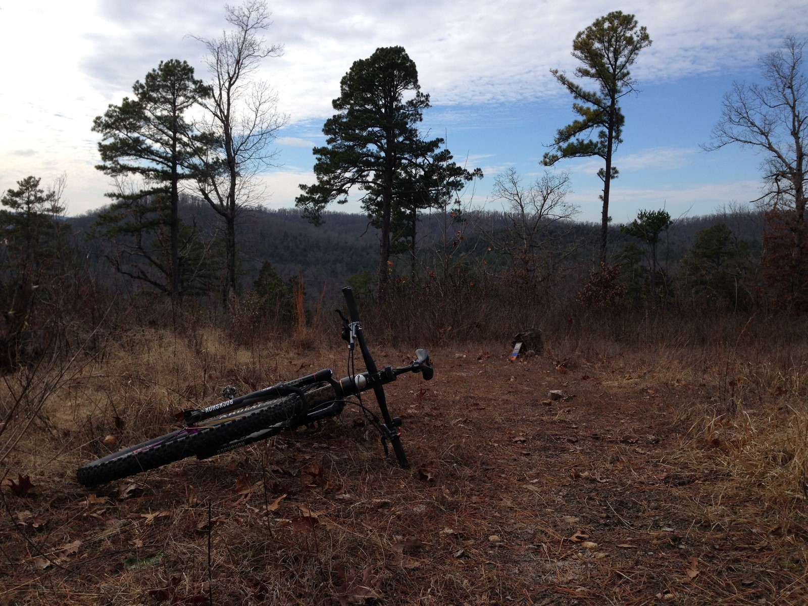
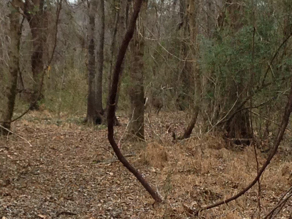
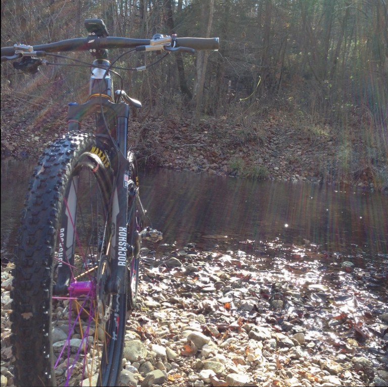
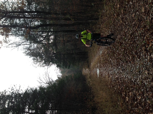
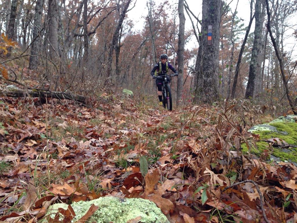
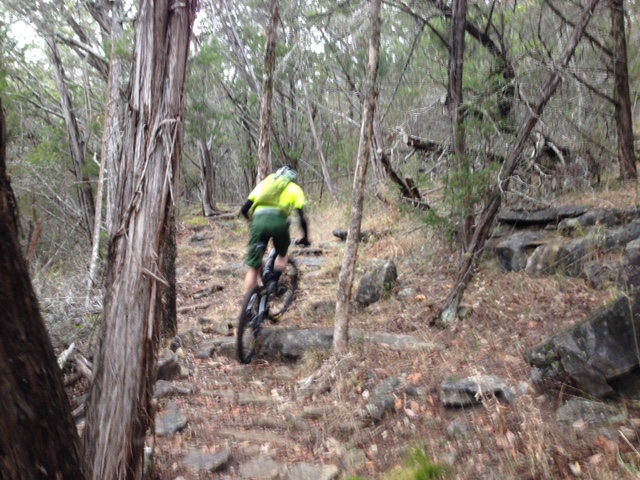
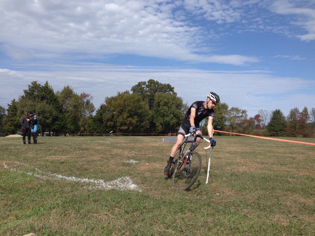
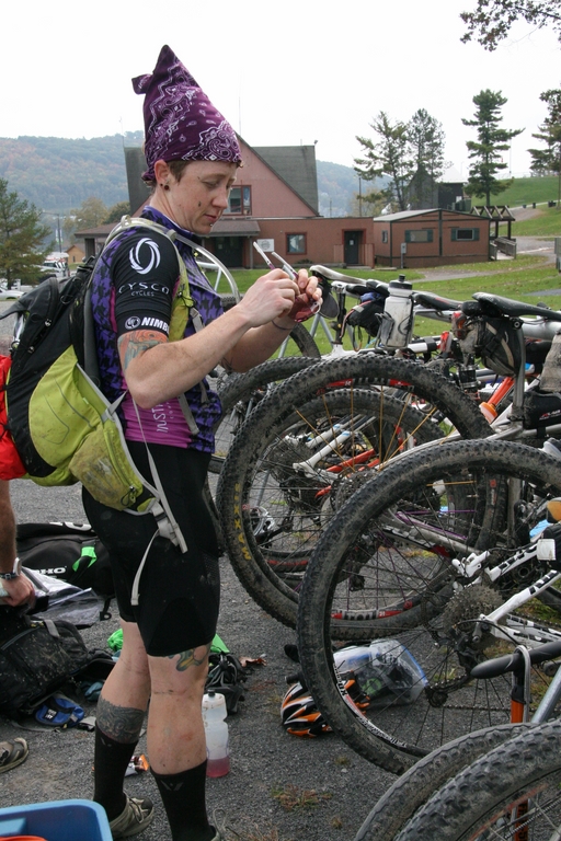
We made excellent time on that section and found ourselves running back down the hill with some of the top teams. For the next stage, we hopped on our bikes, rode back up the ski hill access road, past the whitewater center, and into the nearby trail system. It was some awesome stuff- lots of rocks that reminded me of the trails in the Transylvania Epic.

IMG_0489

IMG_0508

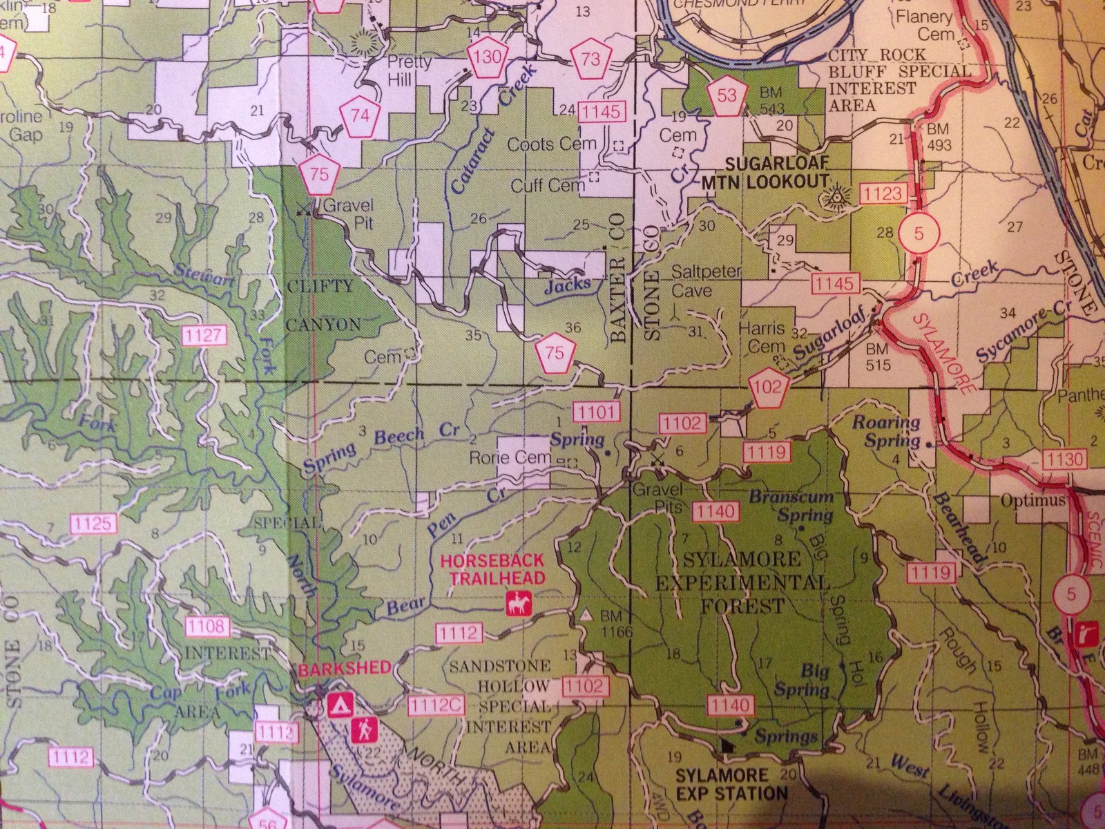
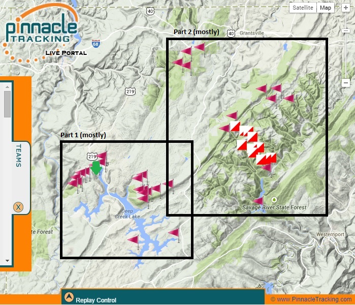
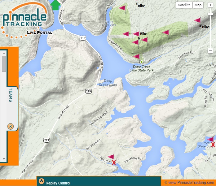
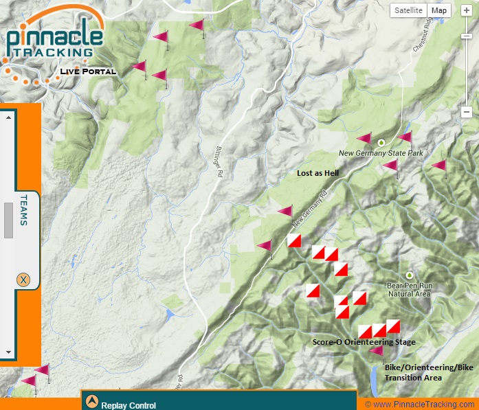
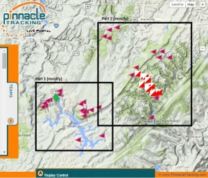
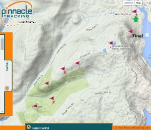
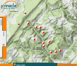
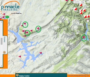
Looking at the map, you can see the start area is the green arrow. We ran to the whitewater center and back then rode to the checkpoints in the green area (with the exception of the checkpoints with the red x’s and the one labled “final,” which were final stage bonus points- more on that later).

Part 1

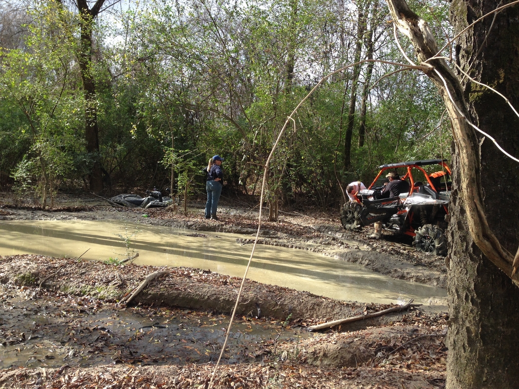
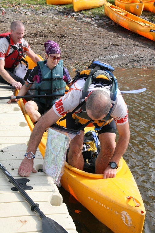
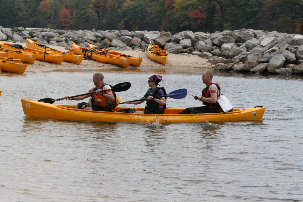
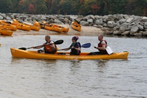
We had one mix up in our navigating somewhere in there and lost some time. It was very early in a long race, though, so we didn’t stress it too much and hustled back to the ski resort to start the paddling and orienteering stage. With that one, you had the option of going for all the paddling CPs first (two were waaaay out on the far end of the lake), then orienteering and going back to the transition area, or you could paddle to the orienteering area, clear it, then go get those two far-flung paddling CPs (or not).

Part 2

The headwind and associated rough water on the lake was rowdy. Two boats capsized in that section. Luckily, we made it to the orienteering area halfway down the lake without incident (though we’d taken on a lot of water from waves crashing over the front of the boat). I was very happy that I didn’t get seasick.

 IMG_0519 IMG_0511 IMG_0526

 IMG_0547 IMG_0540

IMG_0543

IMG_0549

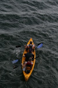
The orienteering went mostly smooth. We did have one point that took a while to find because it was on a fairly flat, mostly featureless spur that was covered in thick ground cover. The combination of that along with the length of time it took us to get there with the initially bad conditions meant that we skipped going for the two other paddling CPs. While we were on land, the weather associated with the wind passed through, bringing us a little rain but also flat water and calm skies for the return trip. That’d be the last of the good weather we’d see for the remainder of the race.

When we arrived back at the transition to start what I labeled as “stage 2” in the map above, a heavy, steady rain started. According to the weather forecast, it’d stick around for several hours, and the temperature would drop steadily from that point on. We changed in to some warmer clothes and hit the road.

IMG_0596  IMG_0599 IMG_0600

IMG_0598

The next part was one of the few places that really sucked. We had to ride for what seemed like forever up the shoulder of highway 291. It was busy, getting dark, and pouring down rain. I was really happy when we finally made it to the back road that’d take us to the next cluster of checkpoints (they’re the ones at the top of the pic).

Part 3

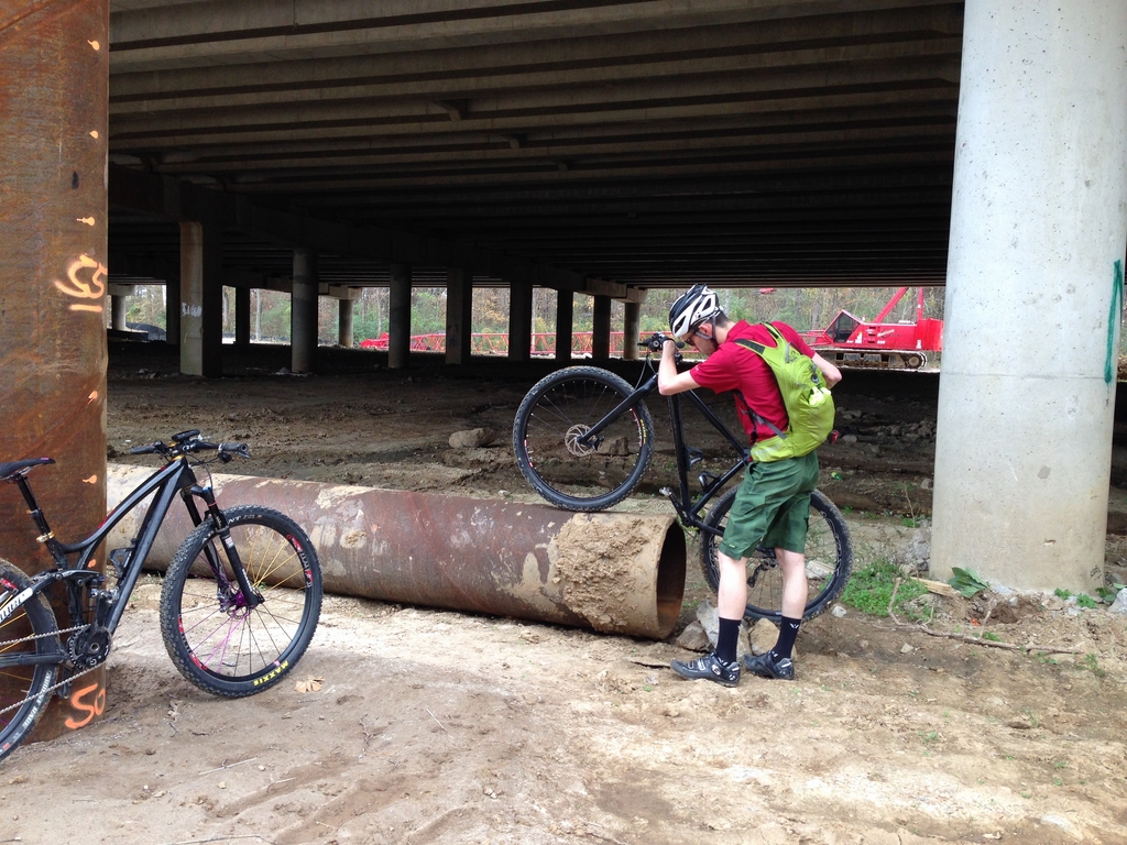
It was gorgeous just before dark… the trees along the road were all yellow, and the road itself was covered in a layer of fallen yellow and red leaves.Then, it was dark, and we found ourselves on a long-ish road climb that someone had painted with words like “agony” and “suffering.” It wasn’t really that bad… I towed Mike up most of it until he had a flat tire and we stopped to fix it. At that point, we were almost at the turn off to go into the trail system where we’d find the next set of checkpoints.

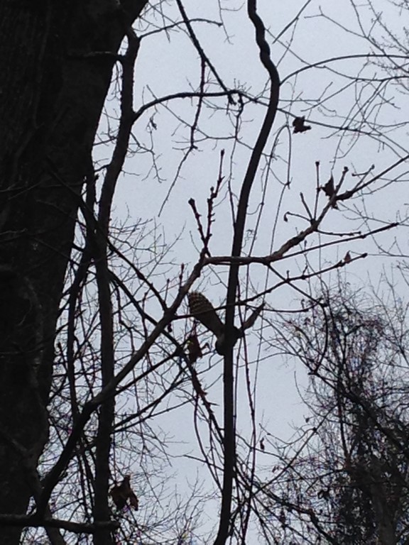
Those went well. It was really late at night by then. I saw a porcupine and a flying squirrel. At first glance, I thought that the porcupine was a giant armadillo from Hell. I was feeling really fresh at that point and having an awesome time.

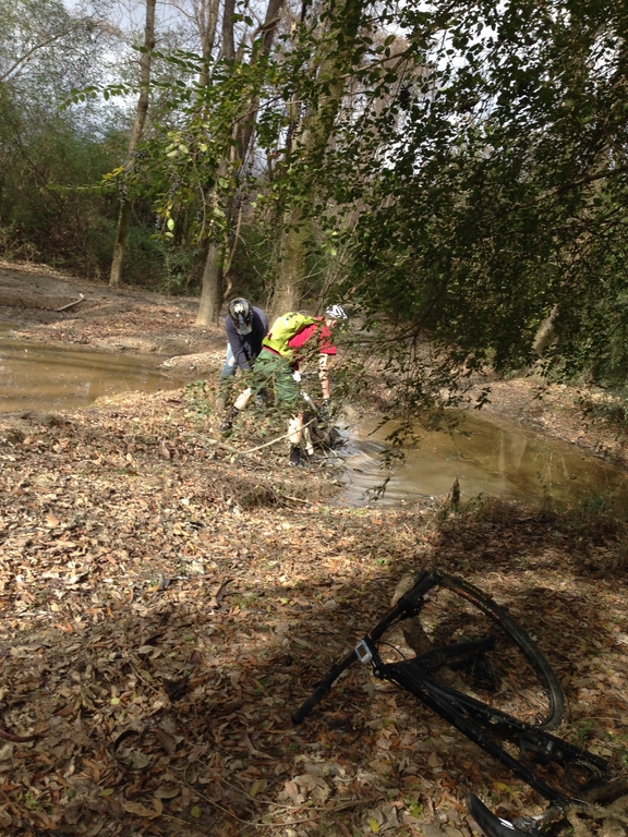
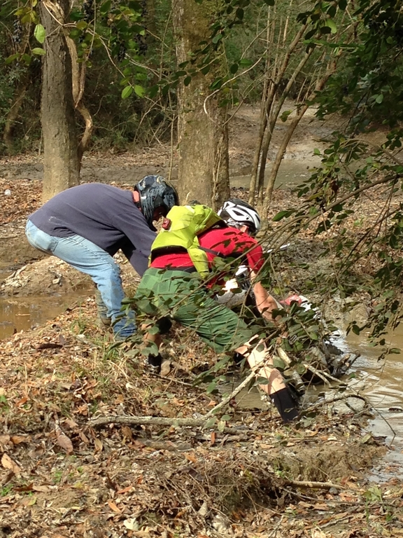
The next CPs to gather were the ones along the ridge in the middle of the map (the flags, not the boxes). I don’t really remember the exact order of how we found them, except that I know that somewhere between the two clusters of them, we missed a turn, then found it, then the guys decided that wasn’t it, and we went back down to where we’d come from, only to go back to the turn we’d found before. From passing where we should have turned until we were back on track, we probably lost a good hour of time and did a healthy chunk of extra climbing. We eventually found everything, though, and made it down to the next transition area for the “score-o” orienteering section.

The idea behind that type of orienteering is that there are a bunch of points to find (these weren’t given to us before the race- it was a separate map provided once we arrived at that transition area), and each one is assigned a point value according to how far away and difficult it is to get to. For the purposes of this race, they added up your points from what you found, and divided your score by ten (rounding up), and that’s how many checkpoints towards your race finish you’d receive. So, in our case, the point value of what we found was 74, so that gave us 8 checkpoints towards our finish. The most you could get from the score-o section was 10. It was, by far, the roughest terrain we covered. Everything felt straight up or straight down, and the rain had made the leaves, deadfall, and rocks treacherously slick. I fell down repeatedly.

scoreo

It was still dark, and we started by making the hardest push up and over a ridge for three high-value points. I vaguely remember following Tony’s green jacket and headlamp through the woods. A large portion of the “hiking” we did was straight up hills so steep that I was using my hands on the ground in front of me. As the sun came up, I was fading hard. My joints and toes hurt really bad, and I fell asleep while I was walking down the road. Luckily, I woke up as my knees buckled and I caught myself with a large stumble.
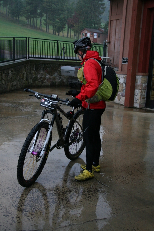
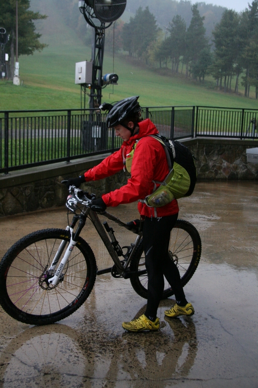
Mike and Tony did a very good job of calculating what time we needed to leave back for the last of the bike CPs and finish, and, based on that calculation, we collected a couple more nearly-vertical score-o points and hustled back to the TA to change and get on our bikes. Angie was there for more photos and encouragement.

IMG_0601

IMG_0602

IMG_0603

I’d packed my warmest riding tights and a long sleeve jersey, which ended up being the perfect choice, because I think it was in the 40s by then, and the wind was howling.

IMG_0610

Our next task was to collect the last 4 of the bike CPs (circled in green) on our way to the final transition area, where we’d have the option of either finishing, or going back out for the last few orienteering (on foot) points on and around the ski area.

orienteering

That was a hell of a ride back… if I had to take an educated guess, I’d say that the score-o transition area was probably the lowest point on course. We did a lot of climbing, and the headwind was relentless. Once we punched the three points in the area where we’d previously been during the canoe/orienteering stage, I put it in hammer mode. Tony’s stomach had turned on him a few hours earlier, so he was bonking. I paced the guys into the wind, then towed Tony the last few miles. We still passed several teams who were succumbing to the beatdown from the wind. Someone said something about hail. I never noticed.

We arrived back at the final transition area at 1:15pm. Looking at the map, the guys initially thought that we wouldn’t be able to go for any of the extra CPs (we had to finish by 2:00pm). However, another team who had already finished clued us in that one of the points was just a short hike halfway up and around the ski hill. We quickly grabbed our packs and turnt up the hustle…

IMG_0640

IMG_0643

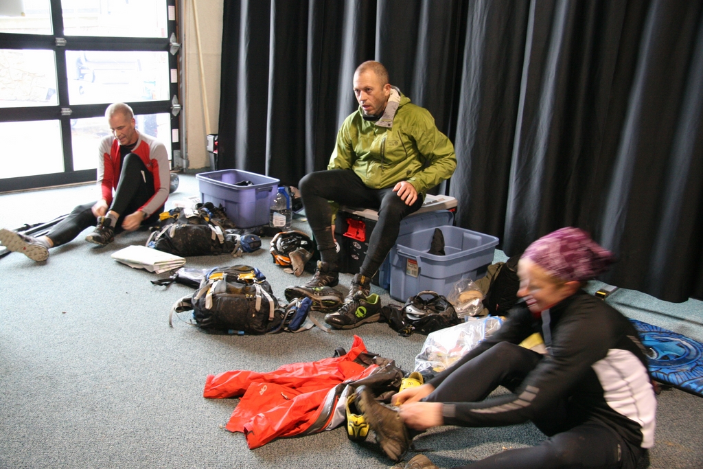
If you scroll all the way back up to the first zoomed-in map, you’ll see the point that I labeled as “final” (as well as the couple of others with red x’s that we didn’t have time to go for). We hiked up, punched it, then ran back down and hit the finish line at 1:40pm. We totaled 39 of 46 available checkpoints. Only three teams out of the 60 in attendance were able to clear the entire course. The effort landed us in 13th place in the coed team division and 15th out of all of the teams at the race (two masters teams finished ahead of us).

IMG_0636

Super solid work.

It was an awesome experience. Mike and Tony have this stuff nailed down… all I had to do was show up, do what I knew how to do, and listen to their direction for whatever I didn’t. Angie was an amazing support person as well. The highlight of the weekend was saying something in passing to her about pizza as we were hustling out to get the last checkpoint, and, once we were back, finished, and laying around not quite knowing what to do next, she walked in with two gigantic pizzas. I could have cried, but I was too busy stuffing my face with pizza.

Fun blog fact- a 30 hour adventure race yields a 4 hour marathon of blog reporting.

Also, based on my rough memory and trash count, I ate 8 packs of Gu Chomps, 3 Roctane Gels, 6 Salted Watermelon Gels, 1 Salted Caramel Gel, a bottle of double strength blueberry pomegranate Brew, 3 Pro Bars, 2 Snickers bars, 1 peanut butter sandwich, 1 Clif Bar, 2 Clif Turbo Shot Gels (100mg caffeine boost!), half a bag of honey mustard & onion pretzel bits, three cups of hot chocolate, and 5 mini Reece’s PB Cups.

Getting stuff off my chest

It’s time for me to get my after-road trip crybaby rant out of the way so that I can move on with prepping for the next big adventure. I generally try to keep the mood of this blog positive, because that’s how I generally exist in life. However, it’s not always like that, and, in the spirit of “keeping it real” in the blogosphere, I’m making this post.

I’m pretty sure that the obligatory post-road trip depression actually set in before I’d even left Salida- about the time that I could summarize a week’s worth of local news for Memphis with “2 murders and a mob-style beating by a gang of teens, mostly minors.” The icing on the cake- one of my good friends from Arkansas (Scott Penrod) was hit by a car and in the ICU.

I’m going to get off on a tangent for a second, because, in the scope of cyclists and cars, I always hear the same thing. “It could have been so much worse.” I’m guilty of saying it myself. You know what, though? It could always be worse. You got hit by a car and only had cuts and bruises? Definitely could have been worse. Oh, you got put in the hospital, but were out a few days later? You aren’t dead, so it could have been worse! A driver killed a cyclist? Well, the way they ride in groups all the time, it definitely could have been worse, because it was only one, and not more!

Fuck that. It could have been better. The drivers who can’t get it through their thick skulls that there are other people on the road who aren’t surrounded in steel and airbags could get their collective thick skulls out of their asses and pay attention to their surroundings. The police and justice system could stop siding with distracted drivers and start punishing them for being negligent human beings instead of just saying, “Oh, what a terrible accident, but it could have been worse.”

Last weekend, I rode my bike for more than 19 hours, and during that time, interacted with traffic for less than an hour. It’s not that I think that drivers outside of where I live are any better or paying any more attention, it’s that I was in a place where it’s possible to ride a bike for 19 hours without coming into contact with people wrapped in steel and their own agendas. Since I was hit a year and a half ago, I’ve been fighting my own fears and panic attacks, gritting my teeth and saying, “I won’t let this beat me,”  but it’s slowly wearing me down.

I went for a late-afternoon walk while I was in the mountains, and was told to take pepper spray. It wasn’t because there were ill-intended people around- no mobs or murderers. It was because I wasn’t at the top of the food chain. I’m OK with that.

Along the theme of people wrapped up in their own agendas, while I was gone, Matt rode out to look at a bandit trail that’d been recently cut. He found a twisty, staub-filled path that basically followed none of the sustainability recommendations put fourth by IMBA. It (along with other illegal trails) is cut in an area that’s designated as a “Natural Area,” which means that, by the law, mountain bikes aren’t allowed. Thankfully, the park stopped enforcing that rule years ago, but all of the signs and the written laws are still intact, waiting for the wrong hiker/walker/etc. to get pissed off and raise enough stink that we’re tossed out again. The people doing this crap are brazen enough to cut illegal trail, then name it something like “El Bandito” on Strava- I showed someone that didn’t believe me, and he was flabbergasted, saying, “wow, that’d get you arrested out here!” They just. don’t. care. Matt called the trail-cutter out on a local facebook forum and was the subject of all-out ridicule that verged on bullying. These people have no idea how good they have it in Memphis, because they’ve never lived in a place where trail access to mountain bike has been reduced (like odd/even days for hikers/bikers on some urban Colorado trails) or eliminated altogether. No, they just want more trail, so they go out into the woods and cut it whenever and however they please- legality and sustainability be damned. Don’t you dare question it, either.

I love mountain biking. I can’t question that, because if I didn’t, I wouldn’t put up with all the crap I put up with in order to ready myself to ride and race mountain bikes in places bigger and more awesome than my hometown. It just makes the crap so much more obvious when I go someplace else. It makes it hard to come back.

Alright. That’s all out. time to move on.