North Rainbow Loop FKT Route Info

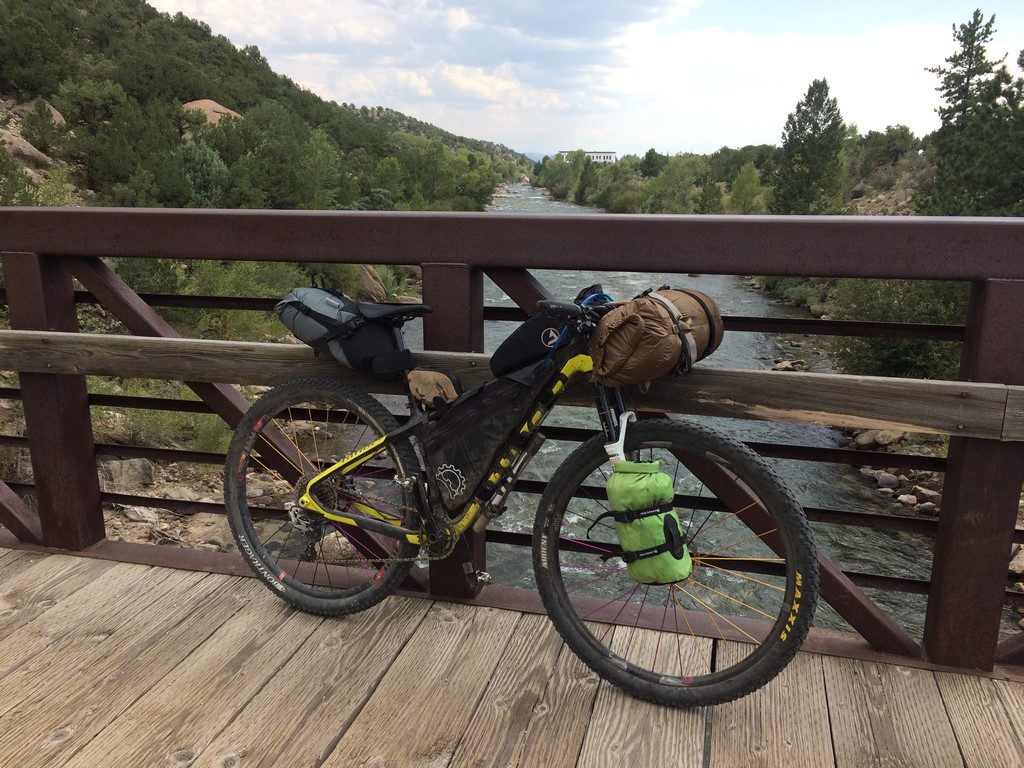
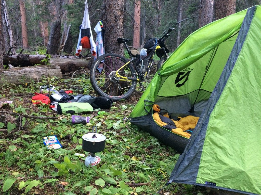
It’s a tough  time for everyone right now, and athletes have the added layer of trying to keep themselves occupied and motivated while racing is mostly canceled. I’ve designed this route to be do-able in a totally unsupported, touch-free manner. The start/finish is at a BLM area with dispersed camping (there is no water there, so bring it with you), and the length of the route is short enough that you can carry all the food you need. As long as travel into and out of the area is legal, this is an excellent challenge for social distance (the bike path in Salida proper can get a little busy, but it’s ~1 mile of 83).

If you’re going to go for an FKT, let me know ahead of time. I’ll timekeep here, and I can post links to whatever ride report and/or photos you have. You can email me- andrea at brickhouseracing dot com. Standard FKT/Solo/Support rules apply (here’s a link on the Tour Divide site, but these are the commonly accepted ethics of these sorts of things)- you’re welcome to do this ride with other people, but your time will be recorded as so, and not eligible for individual men’s/women’s records.

Here is the public route page on Gaia: North Rainbow FKT Loop

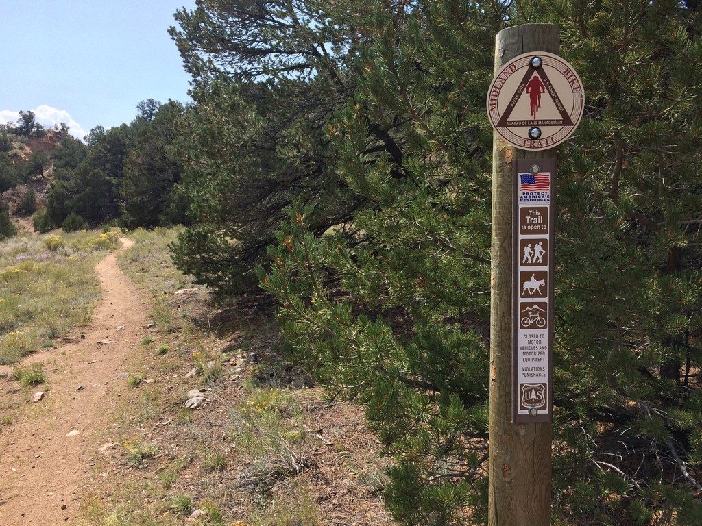
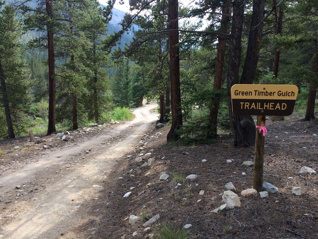
About the Rainbow Trail:
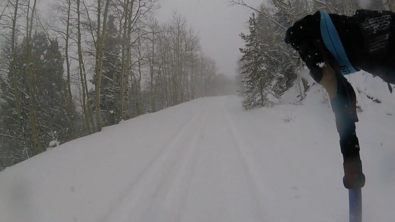
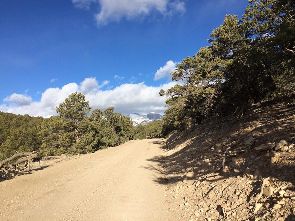
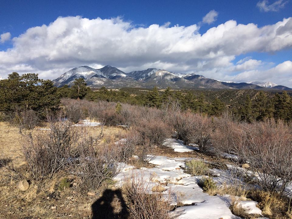
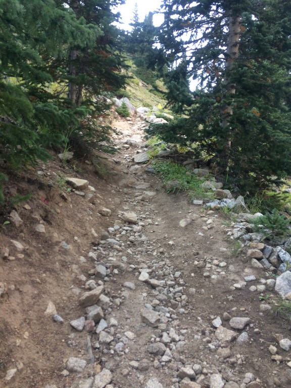
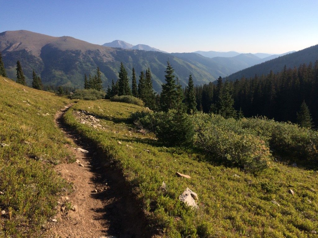
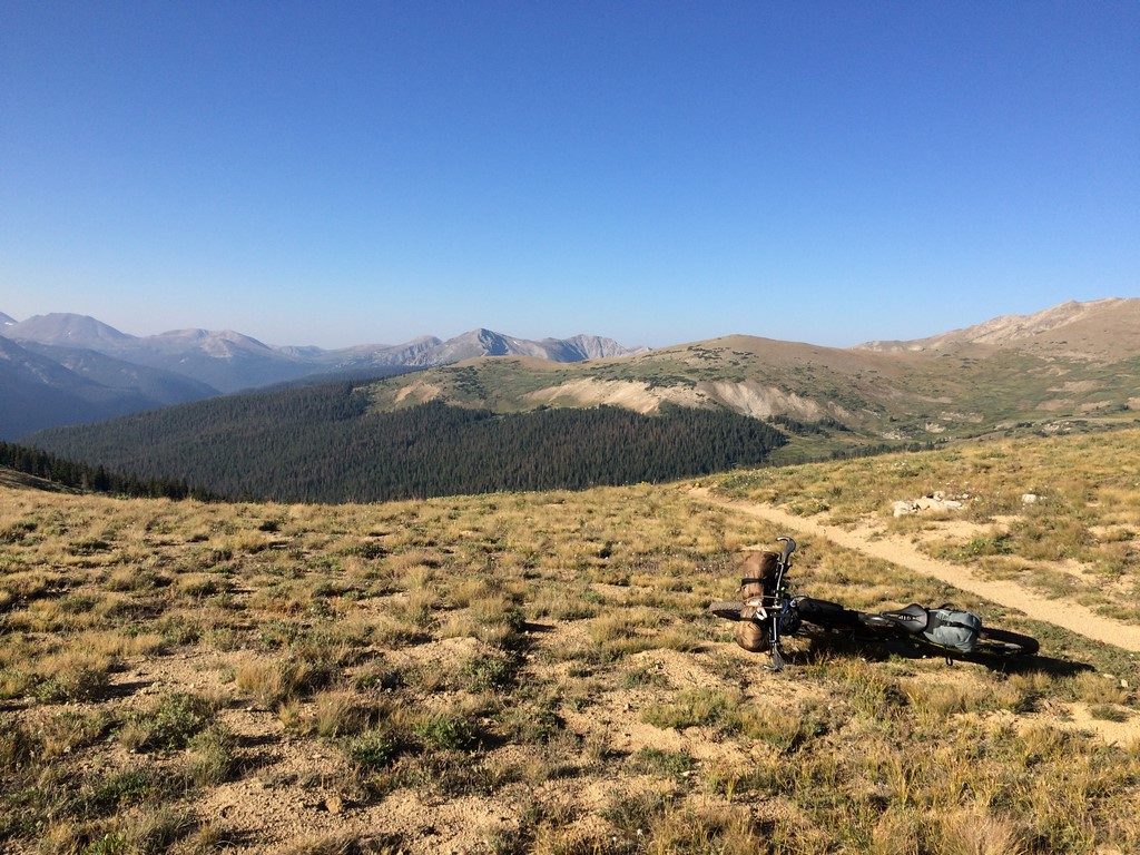
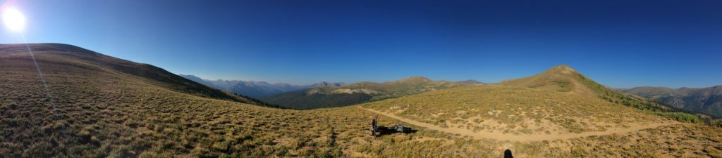
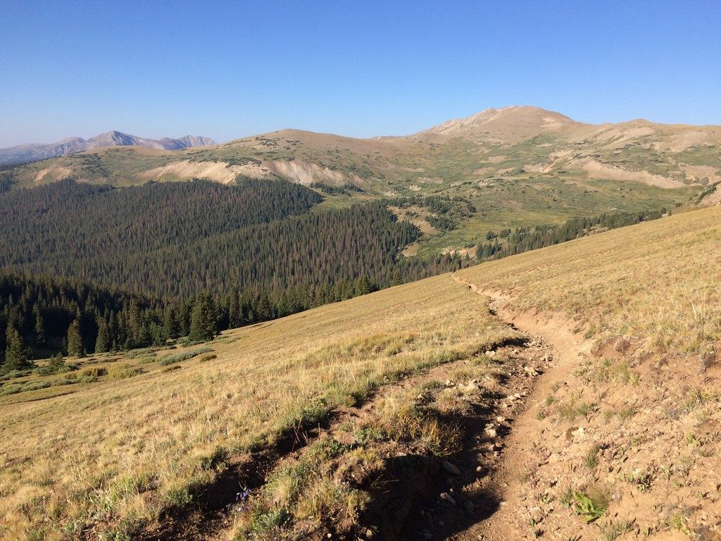
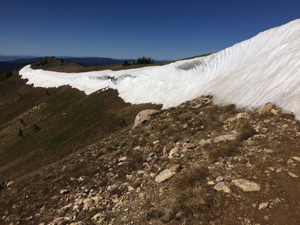
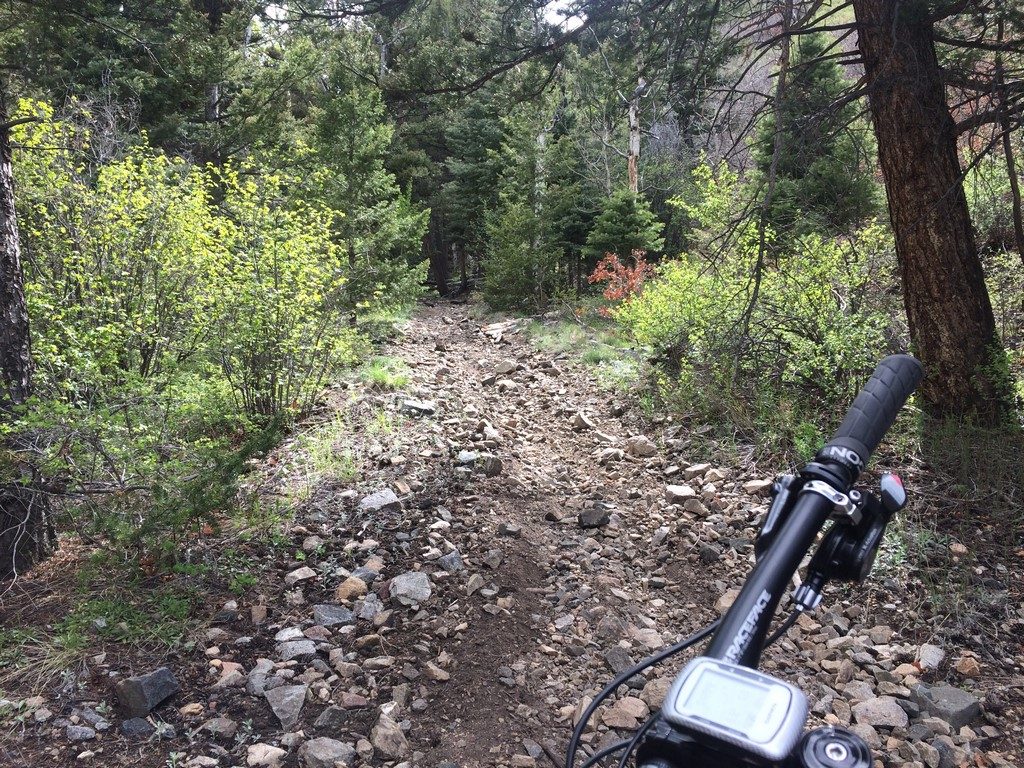
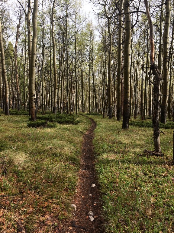
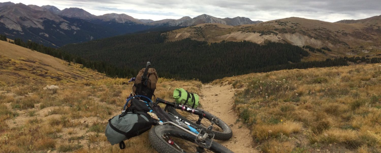
This is a moto-legal trail. It is steep, loose, and rugged with ample hike-a-bike. How much? That depends heavily on rain and moto traffic within the past 24 hours. If you can time your ride within the 24 hours after a soaking rain, the trail is significantly more ride-able because the powdery dirt and gravel mixture that covers much of it becomes temporarily consolidated. In a “normal” snow year, the highest section of trail over Poncha Mountain melts off sometime after mid-May.
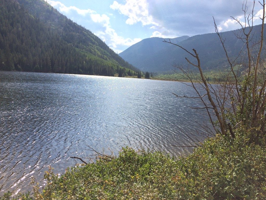
Water on Route:
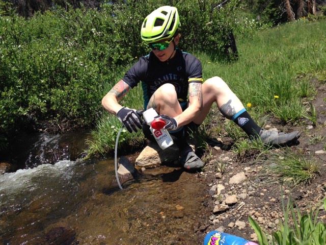
In the Spring, anything labeled on the map as a creek will have flowing water, and most smaller drainages on the map will be flowing. As the melt-off progresses and tapers in the summer, the creeks will still flow, but the smaller springs and unnamed flows on the map will be dry.  There are multiple creek crossings between Hayden Pass and Bear Creek. Once you get to Bear Creek, you should filter enough water at the Bear Creek trailhead to get you all the way to Silver Creek (there are a couple of small water crossings between Hwy 285 and Silver Creek, but Silver Creek at the end is going to be the year-round reliable source following Bear Creek).
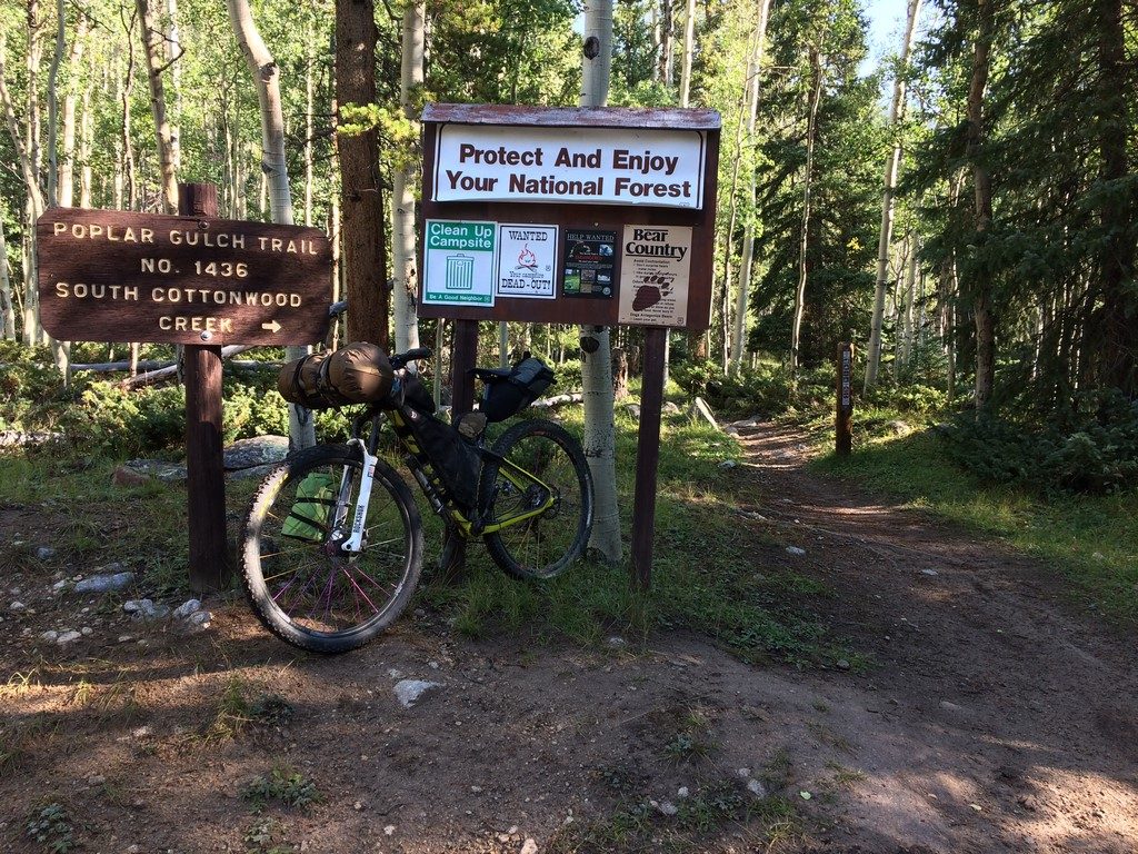
Route Etiquette:
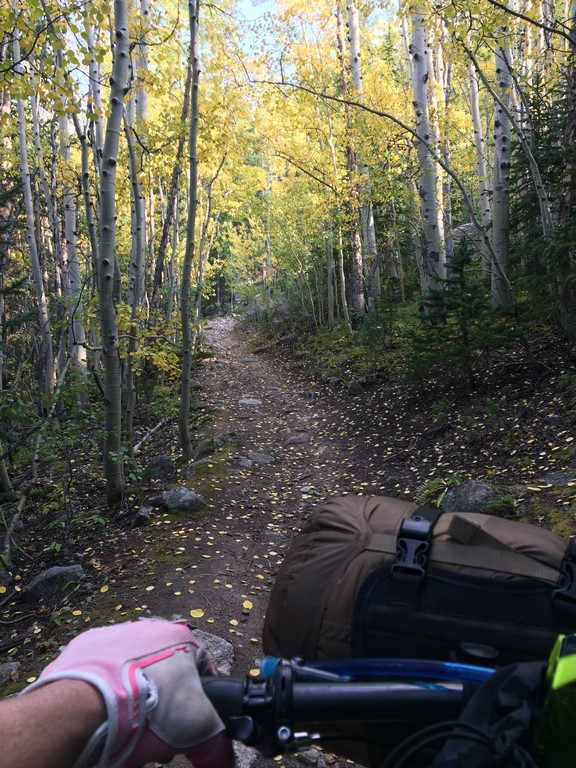
This is a moto trail. It is maintained almost completely by the Central Colorado Mountain Riders. These are some of the nicest and most conscientious trail users you’ll encounter anywhere. They are extremely diligent with cutting fallen trees every Spring, and I didn’t have to dismount once to climb over deadfall. They will almost always yield the trail to other users when they’re able (most of the ones I encountered on my ride pulled over and turned off, too). That being said- there are a lot of blind corners out there, so keep an ear open for motos- you can almost always hear them before you see them. It makes everyone’s ride easier if you learn moto hand signals to indicate how many riders are following- they understand if you hold up a closed fist that you’re alone, and you’ll know how many motos to expect ahead when the lead rider of an oncoming group signals to you. Expect more trail users of all types in the area between Bear Creek and Silver Creek. While the descent off of Poncha Mountain to Hwy 285 is one of the best in the county, it’s also a popular hiking route (as an out & back from 285), so stay alert and in control. Be Nice. Say hi!
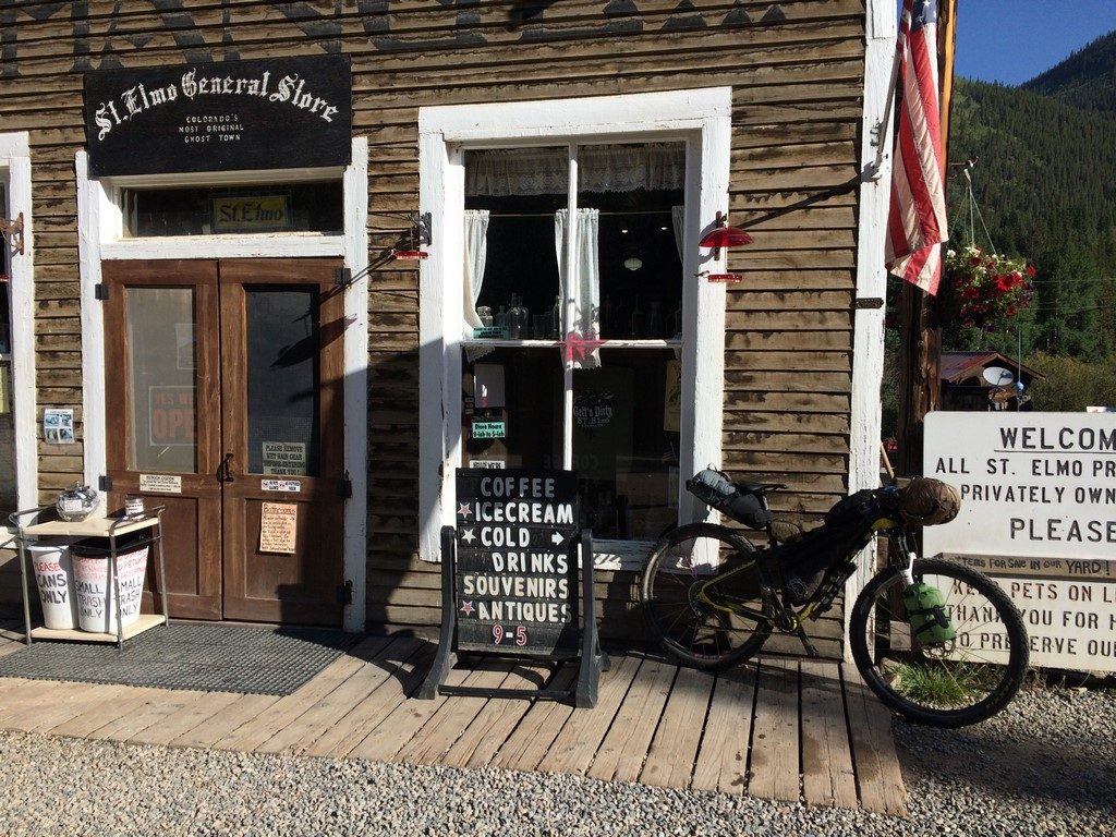
There are no bathrooms at trailheads along this trail. There is a vault toilet at the Shirley Site, a public bathroom at the boat ramp in Salida, and another vault on the BLM road between Swissvale and Howard. Otherwise, you’ll need to follow proper backcountry procedure for dealing with your waste. Some old-time locals blame cyclists for leaving all manners of trash on the trail- like beer cans, etc. We all know that this isn’t likely the case, but if you happen upon some litter while you’re out there, take it with you if you’ve got the room (I have a nice souvenir lip balm from my trip!)

Route Safety:
The Rainbow trail passes through the 2019 Decker Fire burn scar. Flash flooding in this area can be deadly, and will violently remove parts of the trail when it happens. If you feel as if the weather in the area has the potential for a downpour/flash flood while you are in the burn scar, it is safest to abandon the trail and seek safety outside of the burn scar. There is no prize for getting the FKT here- don’t die trying to do it. Familiarize yourself with the location of roads 101 (Bear Creek) and 108. Those are the exits you’ll take in case of flooding emergency (I’d recommend against using the Columbine Trail unless you’re well ahead of approaching weather).
Moose have been seen on the Silver Creek section of Rainbow trail. Black bears and mountain lions also roam all parts of the route, though they are rarely a danger to cyclists.

What if I just want to shuttle and only ride the trail?
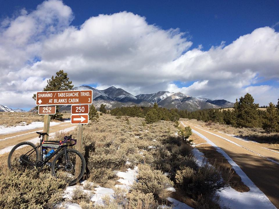
Hayden Pass Road to the Rainbow Trail is drive-able by any passenger vehicle. The same passenger vehicle could pick you up from the Shirley Site trailhead a few miles down from where the trail ends at the Silver Creek trailhead. Silver Creek road does turn to a high-clearance/4×4 road for several miles between the Shirley Site and the Rainbow Trail. There is dispersed camping available at both ends of the trail. I made a segment on Strava if you want to compare times: North Rainbow Trail- Hayden Pass to Silver Creek 

My personal FKT report: North Rainbow Loop FKT Report

A Reflection on Longest Offseason Ever and a 2019 Plan

Finally… I can’t go on without some structure and goals.

My year-long Longest Offseason Ever break has evolved (devolved?) in to feeling uncomfortably unstructured in my everyday life (other than work). As of late, I’ve literally felt envious when I’ve seen other athletes talk anything training related. I can’t stand it much longer. I’d wanted to do a better job at making the break something fun and exciting to follow along with, but it turns out, I needed a break from that as well. I’m all breaked out now, though.

The hard truth is, I take shit care of myself when I don’t feel the need to recover and maximize my training efforts. It’s like, “well, my body is useless now, so why bother?” I eat too much junk food, I stay up looking at dumb memes on the internet instead of reading a book so that I sleep better, I drink too much alcohol, I don’t exercise very often, and I haven’t done yoga more than a handful of times for a long time. My body feels like a tent rather than a temple.
It’s a hard thing to accept because bike racing doesn’t always make me happy (I wouldn’t have taken a year off if it did). However, it feels like having that external motivation is the only way I can be motivated to not treat myself like a garbage dump. When “normal” people look at an athlete and wonder, “what internal demons is he/she running from?” well… there you go. Future me will have to face this demon again at some point, but for now, I’m going to keep running.

So, its time to come up with a plan for next year. When I lived in Denver, it was easy to hop over to Winter Park on a Saturday and bang out a 2 hour race, then come home in time to have a beer and relax for the afternoon. I love that about cross country, but since I don’t have that within a reasonable distance of my house any more, I’ve got to look elsewhere.

This is where y’all come in. I don’t have many good ideas for races that are new and exciting (to me) other than The Lake City Alpine 50 (a new event for 2019 that looks absolutely gorgeous), and whatever Vapor Trail 125 evolves into. Both of those are late-ish in the season, so I’m looking to add to the front end. There’s always the early June Vail GoPro games as well… as much as I hate Vail, it’s got a wicked singlespeed payout.

Once I’ve got a season plan, I’ve been toying with the idea of a coach. For me, having someone to be accountable to is a huge motivation. I don’t know if it’s in my budget, though. If I can’t figure that part out, I have TrainerRoad, which is a great training program that I’ve experienced good results with. It’s a great “plan B,” but it’s just not the same as having a live human put forth the effort to hand over a program and me dutifully destroy it (in a good way).

Longest Offseason Ever Update

The best thing about Longest Offseason Ever is that it’s a malleable, flexible thing. My original thoughts and plans involved a lot of running and no real training plan. Then, I came down with raging plantar faciitis. It’s a lot better now, but I’ve scaled that part of my summer down to a lot of hiking later in the summer (more on that in a minute).

Pretty quickly after I decided that I wanted a year-long offseason, I also figured out that without a goal to work towards and train for, I am not a happy person. So, I’ve made a June FKT (fastest known time) ride on the Rainbow Trail my goal. The timing is just right so that I can train really hard for it and then coast with amazing fitness though the high-country-big-ride-season that starts sometime in July. The FKT ride isn’t a super high-pressure thing, either. There is currently no FKT for a mountain bike passage on the Rainbow Trail (at least non that I can find on the internet). I literally just have to finish and accurately record my time and a GPS track. I want to do well, of course, but I also don’t have a time goal with which to pressure myself. From what I’ve gathered, a good moto rider can do it in 10-12 hours, and I’ve found a report from a runner that did it in 31ish hours.

As for the hiking part, that will be in the form of scouting for elk (I hope). I’ve applied for the elk draw to hunt this fall for a cow elk in Game Unit 56. It’s the most rugged one in the area, which I’m banking on for my success. I plan on systematically wandering the mountains a couple of days at a time to elk-watch and then hopefully put food in my freezer come fall. I find out if I got a tag in June, so I should be able to start the scouting soon after my FKT ride. If you want an idea of just *how* rugged, go to yer Googler, search for “Colorado Game Unit Map” and look at 56. Then, take a look at CalTopo.com and check out the contours (that link should hopefully take you to a map of the area). Spoiler alert- there are two 14ers in there, and the westernmost boundary is the Continental Divide.
I’ve hunted since I was a kid… personally, I believe that if you’re going to eat meat, it’s the most ethical and healthy way to do so.

Other than a continually evolving plan, Salida life goes on… Episode 2 of Longest Offseason Ever is up on MBR YouTube if you want to see how that goes.

New Things and Wild Places

One of my favorite things about aging in the mountains is the constant opportunity to experience new things. This winter, I’ve been learning how to ski. I decided (as usual?) to go with whatever is most difficult first (downhill/resort skiing is not an option on my budget). So, I went to the Nordic Center near Leadville and took a skate skiing lesson.

nordiccenter

skate

I absolutely loved it. The only hangup I have with it is the need for a groomed track. If I lived in Leadville or Crested Butte, I’d be all over it. I just can’t imagine driving 1-2 hours to recreate if I don’t have to. So, next I tried my second choice- classic skiing, not on a groomed track… attractive because it can be done anywhere up until you start getting into steeper terrain, which, for now, I avoid because I know just enough about avalanches to know that I don’t know nearly enough about avalanches to venture into their territory. I rented a set from Salida Mountain Sports a couple of times and then took the plunge with a set of my own.

newskiday

They’re a slightly wider (for an XC ski), metal edge, waxless ski. With the help of the experts at Salida Mountain Sports, we settled on these because I’ve got more than enough fitness to haul them around, they’re better for non-groomed places than narrower skis (we all know how I am about non-groomed places), and the width/edge will help with my current lack of handling skills. I had a couple of fun adventures up Hancock Road (of Vapor Trail 125 infamy) right off the bat-

hancock3

hancock2

hancock

ghosthouse

Of course, I had to start mixing things up almost immediately.

snowbike

ski

You can watch a little video of that one over on the Mountain Bike Radio YouTube Channel: https://youtu.be/vA0lYCYL9q4

I plan on skiing somewhere else tomorrow morning, though I’m not sure exactly where yet. The weather is currently “socked in.” Salida has a magical property about its weather. When storms move through, the surrounding mountains will be invisible with snow clouds. More often than not, we get wind and sun… occasionally a few inches of snow, but the donut hole of fair weather corrals the city more often than not.

Such was the case this morning. I decided I’d ride my newest bike- the Ibis Hakka MX, on a road loop I’ve dubbed the Dirty Shavano Loop (mostly because of the fantastic views of Mt. Shavano you get on the way up).

https://www.strava.com/activities/1415756750

The wind was blustery on the way out (as I expected), but the sun was shining and made 38 degrees feel more like 50. I stopped and took a bunch of pictures on the way up.

shav1

shav2

shav3

Once you’re at the FS252/250 split in the last pic (also Vapor trail 125 infamy), you cruise through several extremely peaceful meadows right under the watch of the Angel of Shavano. The meadow is about as close as you can get to the mountains and still get a sense of how large and vast they are before you’re close enough to just be “on” the mountain itself. Once you turn at the split, there are a few north-facing areas to navigate. They’re starting to hold a good bit of snow (finally).

snow1

snow2

Eventually, you hit Droney Gulch (where CR250 turns right and becomes CR251-1 on the Strava map) and start descending quickly back towards Highway 285. It was there that the sun disappeared completely, and the wind went from “just there” to “holy s**t.” As I plummeted from ~9k feet to 7something, the temperature went down just as quickly. I had to stop several times and warm my hands up inside my gloves, and, as I reached the highway crossing, the wind and snow became suddenly blinding.

Within a couple of miles of crossing the highway, the sun was out, and the valley air was warm again. I looked behind me (towards the mountains I’d just been in) for the first time since I started my descent, and they were engulfed in a snow cloud.

Just missed it.

So, for the first time in my 36.5ish years of living, I was chased by a snow storm.

I’ll never forget, back when I was in Salida to race VT125 when I was chased down Chalk Creek by a thunderstorm for the first time. I had no idea that it was the first of many. Getting chased out of the mountains by bad weather seems like a basic rite of passage. I’m quickly learning that there’s something about an approaching storm that you don’t have to see to know that you need to GTFO RIGHT NOW.
I first noticed it when I ignored it (once, and only once) when I lived in Blackhawk and got pounded by hail on Rollins Pass. The next time I felt uneasy when headed upwards, I listened and turned around. The storm I avoided produced lightning that struck 15 hikers on a nearby 14er (and killed a dog). Today, I didn’t consciously register that the sun was gone and the wind speed had doubled… I just knew that I needed to be down lower, faster. It wasn’t a super gnarly storm or anything, but it hit that part of my subconsciousness that’s like, “yo… you need to be someplace besides where you are, and you should go there quickly.”

This place has an amazing wildness about it. I feel like I’ve only just begun to find all of its corners and edges.


Prepping for #longestoffseasonever

As Winter is (very) slowly starting to take a hold on the mountains, my plans for the next year are starting to gel. First order of business- learning how to ski. I’m still holding fast on part of my original plan of “winging it” on some of the local railroad grade and trail for classic-style Nordic skiing. However, I’m slightly modifying that with taking some skate skiing lessons at Tennessee Pass first. I’ll likely be on rental skis until I really figure out what I like and how far I’m willing to travel for the sake of exercise. Leadville is about an hour and half away, but considering I used to commute 45 minutes each way (on low traffic days), 5 days per week in Denver/Boulder, I don’t think one day a week of driving to Leadville is a big deal. There’s hardly any traffic, and the scenery is, well… effing amazing. Skate skiing seems like a pretty amazing way to build some Winter fitness, but it takes some groomed trails. Classic skiing is closer, but I’m not sure if I’ll enjoy it quite as much. Time and experience will tell.

My main 2018 objectives are set on three specific feats of strength- the 200something mile bikepacking route I’ve plotted (and failed to complete because of cold/weather/Raynaud’s), Rainbow Trail in a Day (on bike), and a traverse of the north half of the Sangre de Cristo mountain range (on foot). Rainbow Trail on foot is still in the back of my mind for sure, but the other two are top priority at the moment.
I’d likely take on the Sangre traverse with my newly found friend Liz, who I met at the group runs out of 7000 Feet Running Company (the “LRS” of Salida). Liz and I have already tackled some pretty rad day hikes in the Sangres- Like the one where we tried to go to Electric Peak, but there were 40-50ish mph winds at the saddle we’d aimed for prior to traversing the ridgeline to the peak. So, we took this pic and went back from where we’d come from.

Liz

The process involved with prepping for those goals over the winter is equally as demanding as prepping for a race season (if not moreso). Rainbow Trail in a day is no easy task. It’s likely going to take longer than any other 100-mile race I’ve ever faced. At the same time, I need to maintain an ability to travel quickly on foot to keep the North Sangres Traverse in mind.

I’ve been basically JRA (R=riding/running) since Vapor Trail. I’m going to visit Memphis and Arkansas sometime after New Year’s. Following that, I plan on increasing my running distance while simultaneously beginning some trainer workouts and adding in Nordic Skiing to get me prepped for another strenuous bout of early season riding. It worked out well for racing last season, so I’m hoping to get the same killer legs for next summer.

While I’m back Southeast, I might do this:
http://www.runarkansas.com/ABF/index.htm

I did it once back in the day. Depending on how I’m feeling, I might give it another go. It’s billed as the most difficult trail marathon east of the Rockies. Honestly, after being out here for a few years now, I’d say it’s on par, short of the high elevation. I’ve had a touch of plantar faciitis, but I feel like I’ve got it well-controlled by switching from Altra shoes to La Sportivas and adding some custom insoles to the shoes I stand in at work every day.

I always try to keep an open mind for whatever comes up, but it’s nice to have at least a vague direction to travel in to.

Longest Offseason Ever

I can’t tell you the number of racing years that I’ve reached the middle of the race season and thought, “I’d really love to go do _________, but I have to stay ready for ________ bike race.” I have quelled that thought countless number of times- my heart lies in both adventure and in competition, so I’ve let the competition side win every time.

Next year will be something different.

In the world of training periodization, the post-season (what I talked about in my previous blog entry) would be considered taking a break. The Off-season is when you lay the foundation for pre-season and in-season training. Off-season training is often less specific (at least in the early phases). It often includes strength training and other sports that can build similar fitness to the demands of your sport (for example- if you’re a road cyclist, you probably wouldn’t make gymnastics or table tennis  your off-season sport for training, but you might mountain bike, run, hike, play soccer, or XC ski… things that require cardiovascular endurance that aren’t necessarily riding a road bike).

So, in the spirit of Phil Gaimon’s “Worst Retirement Ever,” I’m taking on the “Longest Off-Season Ever.” I have no plans other than to take on whatever the mountains call me into.

Ok, well, that’s sort of a lie. I have several things I want to do but that I’m leaving myself open to not doing if they just don’t work out:

-Bikepack my big regional loop that I failed on in September
-Summit all of the peaks >13k feet within that loop (human-powered only for the approach to them would be a bonus)
-Rainbow Trail in a day on bike (on or around the summer solstice, most likely)
-Rainbow Trail on foot in <30 hours

I’m not saying I won’t go to any bike races, running races, burro races, or the like. I’m just saying that my focus is going to be taking a year off from planning my outdoor activities around the goal of bike racing. I feel like I’ve always bike raced not just in the spirit of competition, but also in search of new trails and challenges. For me, that latter aspect of bike racing has died off. While there’s lots I haven’t done, I feel like my sample of racing successes are representative of some of the most challenging events in the sport. The first few that come to mind:
– Three seasons of NUE 100s, the middle season being totally singlespeed and still finishing 5th overall in the series for Pro Women (also finishing 5th overall in the 3rd season, but with a geared bike).
– Breck Epic 3x singlespeed, with 2x 2nd place finishes and 1 win.
– Dirty Kanza 200, 3rd overall woman
– Vapor Trail 125 win and “new” course record.

Races, no matter how difficult, technical, etc, are still required to stay within the confines of permits, emergency access, course marking/sweeping, aid station support, and general safety for their participants. I’m looking to take on feats of endurance that are outside of those confines.

mountains

Now, for the “audience participation” part of the show. How do you want to watch this? Should I keep doing like I have with spotty blog posts and most frequent pictures on social media? Or, should I move forward into the increasing popularity of the YouTube Channel? All of those? At some point, Time becomes a factor (the infrequency of blog posts being example #1). I kinda feel like uploading a video blog might be easier. I’ve definitely videoed my thoughts while out on previous adventures only to delete them later for one reason or another.

Hit me up.  I’m here to entertain. You let me know the vehicle.

Hoodrich Transients, Volume 3

Well, more accurately, Transient. I went solo on my latest trip.

I’ve got a grand scheme of sorts that I’ve stared at on various internet maps since I moved to the area. MyTopo.com is an addictive resource- I start there, then, when I see a route I want to check out, I use a combination of a paper map of the area, Strava Heatmaps, and Google Satellite view to see if the road on the aged topo map is actually still in existence and open to the public. I’ve come up with a grand loop of the area, and the trip with Levi along with my most recent one this weekend served as scouting journeys.

This weekend, I wanted to check out the route to Tincup Pass. It would only take a handful of hours to ride there from Salida, but I wanted to use the route I’d come up with for my big loop, which meant taking the long way up through Aspen Ridge and Buena Vista to Cottonwood Pass where I’d then split off down CR 344 to the Green Timber/Poplar Gulch trail to St. Elmo at the base of Tincup Pass. I knew I’d be camping somewhere between Buena Vista and St. Elmo, but not 100% sure as to where, and my plan was to ride Tincup Pass and loop back to Williams Pass and back home the next day.

I packed up, dropped Marley off at dog daycare, and started up to Aspen Ridge around 9am. The aspens are just starting to get patches of yellow, and the intermittent views of the Arkansas River Valley below were really cool, albeit smokey.

IMG_1841

IMG_1842

IMG_1843

From the top of Aspen Ridge, the route generally descended down through the Castle Rock area towards Hwy 285 a few miles east of Buena Vista. At 285, I completed the scariest part of the journey- 3/4 of a mile on the highway with a narrow shoulder and a ton of holiday weekend traffic (on the map, I’d seen a connecting “road” that paralleled the highway between CR 315 and 305, but it was indistinguishable in the scrub). I turned on a really bright taillight, waited for traffic to clear, and had at it. It wasn’t quite as bad as it could have been, but it wasn’t fun. Luckily, it was short.

I arrived at the Midland Bike Trail ready for lunch.

IMG_1844

IMG_1845

IMG_1846

It’s a really cool trail- mostly singletrack on an old rail bed, punctuated by technical bypass dips where the old trestle is gone. I arrived in Buena Vista and refilled my water from the river instead of from a fountain- something I’d regret later, but preferred at the time, because filtered river water tastes way better than tap water from the trailhead fountain.

IMG_1847

The next portion of my route was some more road out Cottonwood Pass to CR 343. It was a little hot, and there was a little traffic, but the view was nice. I was pretty glad to be off pavement once I was there, though. Once I was on gravel again, I ate some more and continued up the climb towards the Green Timber Gulch trailhead. Somewhere along that part, the distance, elevation, and hours traveled started to get to me. I got tired and cranky, but the view and the temporary leveling off of the grade along Cottonwood Lake soothed me a bit. I was glad that I still had a few hours of daylight to get up higher on a trail, because the valley was full of weekend campers.

IMG_1848

I finally reached the trailhead just before 5pm, where my plan was to fill my water and head up to treeline to camp.

IMG_1849

I knew the trail would be rough, steep, and mostly hike-a-bike, especially with the loaded hardtail. I stopped to refill my water and found that my MSR Trailshot filter was clogged- something that I’d heard of, but not yet experienced (Chris Plesko nearly succumbed to dehydration during the Colorado Trail Race when his did the same thing, and Levi reported something similar. You’d think I’d learn to take a fresh filter with me when it really mattered). I removed and flushed the filter repeatedly in order to get at least a trickle of clean water out of it. Eventually, I nursed it back to semi-health and was able to refill my water, though I’d wasted about 30min of daylight in the process.

I started the hike-a-bike at around 5:20, and told myself that I’d begin looking for camp spots at 6. The combination of thick tree cover and the gulch I was traveling up meant that the light would fade slightly earlier, and I wanted to set up camp and get to cooking dinner before sunset. As far as hike-a-bike goes, this one was one of the hardest I’ve ever done- especially at hour nine of a long day of pedaling.

IMG_1851

It was pretty scenic, though.

IMG_1850

Sometime around 6:20, I passed a flat-ish spot in the trail. At first, I kept going, determined to find a spot closer to treeline that’d rival the Sargent’s Mesa spot I’d camped in with Levi. The sun peeking over a distant saddle drew me up like a siren, as its presence through the trees indicated that I was close to the elevation I desired. However, I stopped at the next really steep hike-a-bike, looked at my GPS, and realized that I was already at 11,600 feet and that the trail would not really level off again until almost 12,000 feet where it turned to make the final push to the summit. I decided to turn back to the small flat spot I’d passed a minute earlier.

Day 1 Map: https://www.strava.com/activities/1165270231

It was, admittedly, too close to the trail according to the ethics of backcountry travel (I was at least far from water, though). However, it is a seldom-traveled moto trail, and I was, as I’d find out while setting up camp, way more exhausted, cold, and low on calories than I realized when I was still moving upwards. Being a seasoned endurance athlete nearly got me into trouble, as I’d been ignoring all of those things in the pursuit forward motion.

I noticed the cold first, and, as I unpacked my warm camp clothes, immediately stripped off my damp cycling kit (I told you it was secluded), dried myself off, and bundled up. It took a huge mental effort to pitch my tent, including 4 tries at getting the correct side of my rainfly facing up. I’ve been that cold/tired/bonky before, though, so I kept it together and soon enough, I was sitting in my tent watching dinner cook.

IMG_1852

IMG_1853

The best part of that camping spot was that it was totally silent of all things human. I could hear the woodpeckers’ toenails on the trees around my tent. The result of warm food, lots of pedaling/pushing, and total silence was falling asleep before it was even dark. My tent was like a sensory deprivation chamber in the middle of the woods- the sort of quiet where your heartbeat and breath seem loud.

I never sleep great in a tent, especially at that elevation. So, I had weird dreams and woke up three or four times. Eventually, I woke up to creeping morning light. I made some instant coffee and oatmeal before packing up to continue my bike pushing adventures.

IMG_1856

My read on the topo lines of my GPS were spot on- I didn’t pass another place that would’ve been good for camp until I was well above treeline, which would’ve been another 20-30 minutes of pushing and another 500 feet higher/colder. Even the first view above treeline was a little too sloped & rocky. I would’ve been in the basin just below the summit.

IMG_1858

The summit was about another 50 minutes of pushing from my campsite, and was gorgeous (as always).

IMG_1860

IMG_1861

At the top, the name of the trail changes to Poplar Gulch. Despite the fact that I had to hike-a-bike 99% of the 3-ish miles of the Green Timber Gulch trail on the way up, I was glad I’d gone that direction, because the Poplar Gulch trail was slightly more moderate in grade and rockiness, meaning it was easier descending on a bike that’s a little sketchy at descending.

IMG_1862

It was nice to feel the air begin to warm as I dropped down to the trailhead.

IMG_1863

I rolled in to St. Elmo as the general store was waking up and ventured inside to buy a couple of bottles of water.

IMG_1864

It was also the time of day that at least 50 (not exaggerating) off road vehicles of various sorts were staging to climb Tincup Pass. Ugh. According to the clerk at the store, “Tincup pass is going to be an absolute zoo today.” Given that, along with my failed water filter, I felt like the responsible thing to do at that point was to go home instead of continuing on my planned route. It was a little disappointing, as my legs felt like they were up for it. I just didn’t feel like dealing with a zoo of off-road vehicles. So, yeah- poor planning on my part in both filter and route considerations. I’m not too upset, though. knocking out that mileage & gain the weekend before Vapor Trail 125 may have been a bit ambitious.

Day 2 Map: https://www.strava.com/activities/1165271847

Once I was home, I performed my favorite recovery rituals of eating and tubing.

IMG_1865

Afterwards, I picked up Marley from daycare. I’m not sure which one of us was more exhausted.

IMG_1875

I’m excited for Vapor Trail this weekend, and maybe even more excited to get out more more than an overnight on my big loop afterward. I might even have a different bike to utilize as my pack mule by then, but I’m hush-hush on the details for now because they’re still in the works.


Breckenridge 68 Race Report

It’s been a rainy summer here in the mountains. Saturday’s Breck 68 was no exception. I haven’t raced on this exact course since 2010, when it was my first singlespeed 100 (I am glad I don’t have the same strong feelings about the bump in the road that is French Gulch, since that climb is in basically EVERY Breckenridge bike race). I was happy to come back and do it over again with way more experience/fitness/acclimatization and without the 6:00am first lap start up Wheeler Pass.

It rained a lot. I packed the car in the rain, drove in the rain, picked up my race packet in the rain, set up my pit cooler in the rain… you get the idea. Not sprinkles, not storming (yay!), just a constant, steady rain.

rain

There’s some variation of a quote about there never being bad conditions, just bad clothes. Saturday was no exception. The temperature in Breck was 50. However, on the drive to Breck, the temperature was 42 over Hoosier Pass- an elevation I’d be racing at more than once on course. It had also been raining all week in the mountains, so there was sure to be standing water and high creek crossings on course, even if the rain stopped.

So, I dressed for a day of 40s and rain. It’s really easy to cool off if you overdress and get hot. It’s wayyyyy harder to warm up in those conditions if you get too cold. I saw a lot of people dressed for an hour of 50 and rain. I also saw a lot of people DNF because they were hypothermic. I wore normal summer kit, waterproof socks, rain pants, a real rain jacket, and mid weight gloves. The gloves were my weak point. I don’t own an waterproof gloves. Later I was given the advice to put latex gloves under my normal gloves. That definitely would have been an improvement, given my issues with poor circulation. I also put a few extra things (cap, arm/leg warmers, warm gloves) in plastic bags inside my pack (my Osprey Rev pack with no reservoir) in case the isht really hit the fan, weather-wise. I don’t usually race with a pack, but in this case, it was important to carry the rain clothes if it got warmer and to carry the other stuff if it got colder. It’s a super light piece, so without water in it, it’s hardly noticeable.

I entered the Pro Women’s category because there wasn’t a women’s singlespeed category available at registration. Also, I have been turning course times similar to Pro women, and there’s usually money available for placing. Once the race started, though, I didn’t really pay attention to who was ahead/behind me. I figured it was going to be a long day, and that things would just shake out however as long as I was keeping a good pace.

First order of the course was to climb up to/over French Gulch. I swear that climb is smoother/easier since the first time I did it back in 2010. We descended American Gulch on the other side, where I had flashbacks from Breck Epic 2015 when Sara Sheets and I battled up that climb after trying to kill each other over two other mountain passes. At the bottom, I stopped at the aid station to refill a bottle and swap to dry gloves (the aforementioned bad circulation was biting me in the ass). It took some effort to get the dry gloves on because the muscles controlling my right fingers had basically stopped working, so it was like trying to cram wet noodles into a glove. One of the aid station workers rubbed my hand between hers to get the circulation back, and I was able to manage getting the glove on. It was a bad chunk of time to lose on course, but I feel like it was necessary for my hands to be functional in order for me to continue racing.

The next climb up the Colorado Trail is a tough one with an awesome downhill reward. The toughness level was increased by the number of wet roots on the steep parts. I walked a good bit. That was also the warmest part of my time on course. I removed my rain gear and stuffed it into my pack. At the bottom of an really awesome descent, I filled another bottle and headed out over the last hump of that loop (Tiger Road) before rolling back in to Carter Park and starting loop #2.

At the park, I grabbed my windbreaker out of my stuff. The rain had started alternating on/off, and it was a little windy and chilly, so it felt like the right clothing for the rest of the day. I kept my rain jacket & pants in my pack, because, even though the weather seemed to be improving, it could potentially turn to downpours at any time. I don’t screw around when it comes to weather in the backcountry.

The 2nd loop started with a hard climb up Indiana Creek to Boreas Pass. Again, I had some flashbacks from Breck Epic. Once at the top of Boreas Pass, the course goes down the Gold Dust Trail. It was there, that I had my only wreck of the day on a wet, sketchy, high-speed, off-camber bridge. If you want to hear the details, you have to listen to the latest episode of Just Riding Along. It’s funny in a self-deprecating way.

The Gold Dust Trail seems to go on forever, but I eventually made it to Como, where I fueled up in order to start the long climb back up Boreas Pass. I gathered all of my mental energy and made it my goal to have empty shells of legs at the top of the pass. That worked out really well, because I suddenly found myself approaching the aid station before I was expecting it. I could smell the barn from there, so I hauled ass over the top without stopping.

Somewhere on the last singletrack, another singlespeeder caught up to me. I asked if he wanted to get by, and he mentioned that we were racing each other. I told him that even though I was singlespeed, I was definitely entered in the Pro category. Fun fact of the race I figured out later- I ended up finishing a little less than 1 min behind him. If I had turned on “ludicrous speed” for the last downhill and beaten him instead of staying “conservative” and letting him by, I would have been 2nd singlespeeder of the day behind Dan Durland.

Looking at the results page for just the 68 mile race (not the 100 or the 32), here are your rain/cold Did Not Finish/Start (DNF/DNS) stats:

43 Finishers
4 DNFs during the 1st lap (started the course and quit before the end of the 1st lap)
26 DNFs who finished a 1st lap and didn’t start a 2nd
16 DNSs (people who looked out the window that morning and were like, “Nah”)

Hopefully some of those 46 people can read this and take it as advice on dealing with the weather. I’ve been hypothermic more than once in the middle of summer in Colorado, so I’m coming from a place of lots of personal experiences in doing it wrong.

I ended up 2nd overall woman by about 14 minutes.

podum

Carbon Drive is really awesome in those conditions. The only complaint about my drivetrain was the freehub on the Stan’s Neo Ultimate rear hub. It was popping/creaking during the race, and making me feel like it was going to catastrophically fail at any point. When I took it apart on Monday, I found that the rubber seal between the hub shell and freehub body had failed to keep mud out. The low points of the drive ring were filled with mud, and the lubricating grease had become mud-fouled as well. I cleaned/re-lubed everything, but I don’t know if it caused permanent damage. After years of Industry Nine reliability, I’m not at all impressed with the performance or reliability of the Neo Ultimate hub.

I’m still pretty shelled from the effort. It was a really nice hard day of training for Vapor Trail 125, though.

Adventure Dump #2- Matt Visits Salida

Before we get started, I just want to mention that the deer in Salida are pretty out of control. They aren’t afraid of people, and sometimes even act aggressively towards pets. They also poop everywhere.

IMG_1348

Now that’s over, time for Adventure Dump #2. Matt came to visit, and since he has been living at sea level since mid-may, I made the riding plans sub-epic (I don’t GAF, I’m taking that word back). It was perfect timing for more reasonable adventure, because I was racing on a duo team for Firecracker 50 the Tuesday following Matt’s visit.

Day 1, we rode Marshall Pass up to the Continental Divide/Colorado Trail to Starvation Creek. Afterwards, we hung out at the river and visited the local shooting range. I’ve shot plenty of shotguns and a rifle or two, but it was my first time shooting a handgun. It’s definitely a little harder to aim.

IMG_1388

Day 2, we rode some Colorado Trail from Blank’s Cabin. The section from Blank’s to the Angel of Shavano Campground is one of my favorites because of the Aspens.

IMG_1386

Day 3 was definitely the raddest. We caught the first shuttle of the year up to the Monarch Crest Trail. I had only ridden the full trail twice- once on my first-ever trip to Salida and once during Vapor Trail 125 (I honestly don’t remember much of the VT125 passage because I’d been riding all night).

IMG_1390

IMG_1391

IMG_1394

IMG_1395

There were still a couple of large snowdrifts to hike over.

IMG_1396

It’s a lot of fun to play around above treeline for a handful of miles on a clear/sunny day.

We stopped at my favorite water refill spot on Marshall Pass. I’ve been using an MSR Trailshot filter and loving it.

filter

You might notice from the photos that I put the RS1 fork on the 429sl. If you haven’t already heard me talk about it on Just Riding Along, I will say it again here- the RS1 is the cross-country Pike that I’ve always dreamt about. It’s not SID-WC light (weighs in between 1600-1700g), but it’s stiff, plush, and freaking awesome. If you have the $$, and you’re on the fence about it, I say go for it.

The three days of “normal person” adventures was a perfect lead-in to the Firecracker 50 race. I teamed up with Brad Berger- one of my other new-this-season Gates Carbon Drive teammates. He hammered a 2:12 lap, which put me someplace in the top 10 of 65 teams. I managed to reel in some of the ladies ahead of me, but also got passed by Cody (who turned a 2:02 lap)- the dude half of the eventual winners. My lap time was 2:27- fastest of any of the women who were on teams, and comparable to the mid-pack pro times. We ended up in 3rd place… not shabby, considering we were the only SS team on the podium.

F50 podium

The short/hard effort of XC-distance racing is a good blast of intensity to keep the watts topped off while I’m exploring for hours otherwise. With a couple of days of hard rest, I was ready for the hike-a-bike extravaganza that was my next weekend off/next blog post.

Over the Rainbow (again)

Since my days off from the shop are Thursday, Friday, and Saturday, I have quickly formed a tendency to do something a little “out there” on Thursdays, despite having a race on Saturday. Last week, it was another Rainbow Trail adventure.

If you recall from a recent post, I explored a section of the Rainbow Trail that people generally avoid due to an extended hike-a-bike. After figuring out that I’d gone the “wrong” direction before, I decided to go the other way on this outing.

The skies had been a little threatening most of the morning before I left, but I decided to pack a rain jacket and take my chances anyway. The trails here are super dry now, and any moisture that falls gets soaked up super fast. I headed up county road 110, hitting the Double Rainbow trail along the way. Once I made it to the Rainbow Trail, I started the walk.

IMG_1084

There are a couple of spots you can ride, but they are brief.

IMG_1086

It rained steadily for about half of the hike up. I was prepared, though, and thoroughly enjoyed being at the top of Poncha Mountain at the exact time that the sun re-emerged.

IMG_1089

The aspens up there are hardly believable.

IMG_1087

I have no pictures from the descent, because I was having too much fun. I will say, though, the view of Mt. Ouray on the way down nearly wrecked me with distraction.

The Route: https://www.strava.com/activities/1016899299

I bonked a little on the way home and drank the last of Leah’s almond milk in a recovery shake so I wouldn’t die all the way before I was able to make real food. A ride that includes two and a half hours of climbing isn’t my usual “thursday before a race” routine, but sometimes I just can’t help myself.