North Rainbow Loop FKT Route Info

It’s a tough  time for everyone right now, and athletes have the added layer of trying to keep themselves occupied and motivated while racing is mostly canceled. I’ve designed this route to be do-able in a totally unsupported, touch-free manner. The start/finish is at a BLM area with dispersed camping (there is no water there, so bring it with you), and the length of the route is short enough that you can carry all the food you need. As long as travel into and out of the area is legal, this is an excellent challenge for social distance (the bike path in Salida proper can get a little busy, but it’s ~1 mile of 83).

If you’re going to go for an FKT, let me know ahead of time. I’ll timekeep here, and I can post links to whatever ride report and/or photos you have. You can email me- andrea at brickhouseracing dot com. Standard FKT/Solo/Support rules apply (here’s a link on the Tour Divide site, but these are the commonly accepted ethics of these sorts of things)- you’re welcome to do this ride with other people, but your time will be recorded as so, and not eligible for individual men’s/women’s records.

Here is the public route page on Gaia: North Rainbow FKT Loop

About the Rainbow Trail:
This is a moto-legal trail. It is steep, loose, and rugged with ample hike-a-bike. How much? That depends heavily on rain and moto traffic within the past 24 hours. If you can time your ride within the 24 hours after a soaking rain, the trail is significantly more ride-able because the powdery dirt and gravel mixture that covers much of it becomes temporarily consolidated. In a “normal” snow year, the highest section of trail over Poncha Mountain melts off sometime after mid-May.

Water on Route:
In the Spring, anything labeled on the map as a creek will have flowing water, and most smaller drainages on the map will be flowing. As the melt-off progresses and tapers in the summer, the creeks will still flow, but the smaller springs and unnamed flows on the map will be dry.  There are multiple creek crossings between Hayden Pass and Bear Creek. Once you get to Bear Creek, you should filter enough water at the Bear Creek trailhead to get you all the way to Silver Creek (there are a couple of small water crossings between Hwy 285 and Silver Creek, but Silver Creek at the end is going to be the year-round reliable source following Bear Creek).

Route Etiquette:
This is a moto trail. It is maintained almost completely by the Central Colorado Mountain Riders. These are some of the nicest and most conscientious trail users you’ll encounter anywhere. They are extremely diligent with cutting fallen trees every Spring, and I didn’t have to dismount once to climb over deadfall. They will almost always yield the trail to other users when they’re able (most of the ones I encountered on my ride pulled over and turned off, too). That being said- there are a lot of blind corners out there, so keep an ear open for motos- you can almost always hear them before you see them. It makes everyone’s ride easier if you learn moto hand signals to indicate how many riders are following- they understand if you hold up a closed fist that you’re alone, and you’ll know how many motos to expect ahead when the lead rider of an oncoming group signals to you. Expect more trail users of all types in the area between Bear Creek and Silver Creek. While the descent off of Poncha Mountain to Hwy 285 is one of the best in the county, it’s also a popular hiking route (as an out & back from 285), so stay alert and in control. Be Nice. Say hi!
There are no bathrooms at trailheads along this trail. There is a vault toilet at the Shirley Site, a public bathroom at the boat ramp in Salida, and another vault on the BLM road between Swissvale and Howard. Otherwise, you’ll need to follow proper backcountry procedure for dealing with your waste. Some old-time locals blame cyclists for leaving all manners of trash on the trail- like beer cans, etc. We all know that this isn’t likely the case, but if you happen upon some litter while you’re out there, take it with you if you’ve got the room (I have a nice souvenir lip balm from my trip!)

Route Safety:
The Rainbow trail passes through the 2019 Decker Fire burn scar. Flash flooding in this area can be deadly, and will violently remove parts of the trail when it happens. If you feel as if the weather in the area has the potential for a downpour/flash flood while you are in the burn scar, it is safest to abandon the trail and seek safety outside of the burn scar. There is no prize for getting the FKT here- don’t die trying to do it. Familiarize yourself with the location of roads 101 (Bear Creek) and 108. Those are the exits you’ll take in case of flooding emergency (I’d recommend against using the Columbine Trail unless you’re well ahead of approaching weather).
Moose have been seen on the Silver Creek section of Rainbow trail. Black bears and mountain lions also roam all parts of the route, though they are rarely a danger to cyclists.

What if I just want to shuttle and only ride the trail?
Hayden Pass Road to the Rainbow Trail is drive-able by any passenger vehicle. The same passenger vehicle could pick you up from the Shirley Site trailhead a few miles down from where the trail ends at the Silver Creek trailhead. Silver Creek road does turn to a high-clearance/4×4 road for several miles between the Shirley Site and the Rainbow Trail. There is dispersed camping available at both ends of the trail. I made a segment on Strava if you want to compare times: North Rainbow Trail- Hayden Pass to Silver Creek 

My personal FKT report: North Rainbow Loop FKT Report

New Things and Wild Places

One of my favorite things about aging in the mountains is the constant opportunity to experience new things. This winter, I’ve been learning how to ski. I decided (as usual?) to go with whatever is most difficult first (downhill/resort skiing is not an option on my budget). So, I went to the Nordic Center near Leadville and took a skate skiing lesson.

nordiccenter

skate

I absolutely loved it. The only hangup I have with it is the need for a groomed track. If I lived in Leadville or Crested Butte, I’d be all over it. I just can’t imagine driving 1-2 hours to recreate if I don’t have to. So, next I tried my second choice- classic skiing, not on a groomed track… attractive because it can be done anywhere up until you start getting into steeper terrain, which, for now, I avoid because I know just enough about avalanches to know that I don’t know nearly enough about avalanches to venture into their territory. I rented a set from Salida Mountain Sports a couple of times and then took the plunge with a set of my own.

newskiday

They’re a slightly wider (for an XC ski), metal edge, waxless ski. With the help of the experts at Salida Mountain Sports, we settled on these because I’ve got more than enough fitness to haul them around, they’re better for non-groomed places than narrower skis (we all know how I am about non-groomed places), and the width/edge will help with my current lack of handling skills. I had a couple of fun adventures up Hancock Road (of Vapor Trail 125 infamy) right off the bat-

hancock3

hancock2

hancock

ghosthouse

Of course, I had to start mixing things up almost immediately.

snowbike

ski

You can watch a little video of that one over on the Mountain Bike Radio YouTube Channel: https://youtu.be/vA0lYCYL9q4

I plan on skiing somewhere else tomorrow morning, though I’m not sure exactly where yet. The weather is currently “socked in.” Salida has a magical property about its weather. When storms move through, the surrounding mountains will be invisible with snow clouds. More often than not, we get wind and sun… occasionally a few inches of snow, but the donut hole of fair weather corrals the city more often than not.

Such was the case this morning. I decided I’d ride my newest bike- the Ibis Hakka MX, on a road loop I’ve dubbed the Dirty Shavano Loop (mostly because of the fantastic views of Mt. Shavano you get on the way up).

https://www.strava.com/activities/1415756750

The wind was blustery on the way out (as I expected), but the sun was shining and made 38 degrees feel more like 50. I stopped and took a bunch of pictures on the way up.

shav1

shav2

shav3

Once you’re at the FS252/250 split in the last pic (also Vapor trail 125 infamy), you cruise through several extremely peaceful meadows right under the watch of the Angel of Shavano. The meadow is about as close as you can get to the mountains and still get a sense of how large and vast they are before you’re close enough to just be “on” the mountain itself. Once you turn at the split, there are a few north-facing areas to navigate. They’re starting to hold a good bit of snow (finally).

snow1

snow2

Eventually, you hit Droney Gulch (where CR250 turns right and becomes CR251-1 on the Strava map) and start descending quickly back towards Highway 285. It was there that the sun disappeared completely, and the wind went from “just there” to “holy s**t.” As I plummeted from ~9k feet to 7something, the temperature went down just as quickly. I had to stop several times and warm my hands up inside my gloves, and, as I reached the highway crossing, the wind and snow became suddenly blinding.

Within a couple of miles of crossing the highway, the sun was out, and the valley air was warm again. I looked behind me (towards the mountains I’d just been in) for the first time since I started my descent, and they were engulfed in a snow cloud.

Just missed it.

So, for the first time in my 36.5ish years of living, I was chased by a snow storm.

I’ll never forget, back when I was in Salida to race VT125 when I was chased down Chalk Creek by a thunderstorm for the first time. I had no idea that it was the first of many. Getting chased out of the mountains by bad weather seems like a basic rite of passage. I’m quickly learning that there’s something about an approaching storm that you don’t have to see to know that you need to GTFO RIGHT NOW.
I first noticed it when I ignored it (once, and only once) when I lived in Blackhawk and got pounded by hail on Rollins Pass. The next time I felt uneasy when headed upwards, I listened and turned around. The storm I avoided produced lightning that struck 15 hikers on a nearby 14er (and killed a dog). Today, I didn’t consciously register that the sun was gone and the wind speed had doubled… I just knew that I needed to be down lower, faster. It wasn’t a super gnarly storm or anything, but it hit that part of my subconsciousness that’s like, “yo… you need to be someplace besides where you are, and you should go there quickly.”

This place has an amazing wildness about it. I feel like I’ve only just begun to find all of its corners and edges.


Longest Offseason Ever

I can’t tell you the number of racing years that I’ve reached the middle of the race season and thought, “I’d really love to go do _________, but I have to stay ready for ________ bike race.” I have quelled that thought countless number of times- my heart lies in both adventure and in competition, so I’ve let the competition side win every time.

Next year will be something different.

In the world of training periodization, the post-season (what I talked about in my previous blog entry) would be considered taking a break. The Off-season is when you lay the foundation for pre-season and in-season training. Off-season training is often less specific (at least in the early phases). It often includes strength training and other sports that can build similar fitness to the demands of your sport (for example- if you’re a road cyclist, you probably wouldn’t make gymnastics or table tennis  your off-season sport for training, but you might mountain bike, run, hike, play soccer, or XC ski… things that require cardiovascular endurance that aren’t necessarily riding a road bike).

So, in the spirit of Phil Gaimon’s “Worst Retirement Ever,” I’m taking on the “Longest Off-Season Ever.” I have no plans other than to take on whatever the mountains call me into.

Ok, well, that’s sort of a lie. I have several things I want to do but that I’m leaving myself open to not doing if they just don’t work out:

-Bikepack my big regional loop that I failed on in September
-Summit all of the peaks >13k feet within that loop (human-powered only for the approach to them would be a bonus)
-Rainbow Trail in a day on bike (on or around the summer solstice, most likely)
-Rainbow Trail on foot in <30 hours

I’m not saying I won’t go to any bike races, running races, burro races, or the like. I’m just saying that my focus is going to be taking a year off from planning my outdoor activities around the goal of bike racing. I feel like I’ve always bike raced not just in the spirit of competition, but also in search of new trails and challenges. For me, that latter aspect of bike racing has died off. While there’s lots I haven’t done, I feel like my sample of racing successes are representative of some of the most challenging events in the sport. The first few that come to mind:
– Three seasons of NUE 100s, the middle season being totally singlespeed and still finishing 5th overall in the series for Pro Women (also finishing 5th overall in the 3rd season, but with a geared bike).
– Breck Epic 3x singlespeed, with 2x 2nd place finishes and 1 win.
– Dirty Kanza 200, 3rd overall woman
– Vapor Trail 125 win and “new” course record.

Races, no matter how difficult, technical, etc, are still required to stay within the confines of permits, emergency access, course marking/sweeping, aid station support, and general safety for their participants. I’m looking to take on feats of endurance that are outside of those confines.

mountains

Now, for the “audience participation” part of the show. How do you want to watch this? Should I keep doing like I have with spotty blog posts and most frequent pictures on social media? Or, should I move forward into the increasing popularity of the YouTube Channel? All of those? At some point, Time becomes a factor (the infrequency of blog posts being example #1). I kinda feel like uploading a video blog might be easier. I’ve definitely videoed my thoughts while out on previous adventures only to delete them later for one reason or another.

Hit me up.  I’m here to entertain. You let me know the vehicle.

The Post-Season: a search for normalcy

The weekend after Vapor Trail, I ended up racing the Banana Belt XC race as part of the Salida Bike Fest. I didn’t want to go at it singlespeed, so I rode the Viral Skeptic- a belt-driven, pinion-geared hardtail. It’s a fun bike, and I like where the belt/pinion combo is headed, but it’s definitely suited to more burly riding than cross-country racing. Nevertheless, I won the race… barely. There was a nice write-up in the local paper.

IMG_2032

IMG_2033

Thus begins the post-season few weeks of emotional turmoil. It’s hard to describe, because it starts out as a feeling of relief, but then spirals into feelings of emotional turmoil and drinking too often. You’re trying to act “normal,” but athletes don’t usually do a good job of being normal people. I thought that I was the only one who felt like that until Josh Tostado came through town a couple of weeks ago, and we hung out over a beer. I found out that not only do we eat exactly the same way during races (a gel flask supplemented by whatever looks tasty at aid stations), his description of activities following Vapor Trail was similar to mine.

So, yeah… my level of normal is “Josh Tostado.” I’m cool with that, though.

The weekend after Banana Belt, I wanted to knock off and bikepack in the mountains a bit. I loaded up the Viral and set out with an ambitious route. I only made it one night, though. The forecast before I’d left on Thursday morning called for nice weather until Saturday afternoon. I figured I could manage a half day of bad weather. I packed for it. However, Friday morning, the wind was insane and the skies were dark. I stopped in the St. Elmo general store for a snack and extra coffee, and the store owner spoke of bad weather moving in early. Apparently, it had already snowed on the other side of the Continental Divide (where I was headed). I pressed on up Tincup Pass, but before I could reach the top, I encountered more wind and winter precipitation in the form of graupel. I didn’t know graupel was a thing until I moved to Colorado. It’s like spoonfuls of shaved ice being thrown from the clouds.

Bad circulation in my hands is something I’ve battled since I was a kid going duck hunting with my dad. It’s only gotten worse with age. Despite my preparedness in water/windproof clothing and chemical heat packs for my warmest gloves, the brief chill I experienced on Tincup went straight into my hands and turned them into useless flippers. I couldn’t bear the thought of dealing with early bouts of bad weather and bad circulation for the whole trip (as opposed to just half a day), so I turned and went home. As I got lower/away from the weather and felt the circulation return to my hands, I stopped and took these photos-

IMG_1956 IMG_1955

Part of turning around goes back to my “trying to be normal” part of the post-season. I’ve pushed myself though the same discomfort of loss of hand circulation *conservatively* hundreds of times by now during the racing/training process. My bikepacking trip was supposed to be fun, and, battling cold and snow, even with all of the clothes I needed to be safe and warm, wasn’t going to be fun. However, it’s hard not to view quitting as just that- quitting. If you’ve ever wondered how I keep going when races or training rides seem physically impossible, it’s because the emotional pain that I experience when I quit is far worse than any pain of pressing on in difficult situations.

At least I got some nice photos while I was out…

DSC00819

DSC00806

DSC00822

I’m slowly starting to get my shit back together and getting back into my safe space of being an athlete. I’ve gone for  couple of hikes, started running a little, and started a little light weight training with a local trainer. I’ve kept the riding somewhat short and fun, and I hope to get in to some snow-related activities once winter really sets in (if my hands can tolerate it). I’ve shopped a little for heated gloves- holy crap, they’re expensive. I’m hoping I’ll have some cash left over for a set once the 429sl sells and I’ve purchased its replacement.


Vapor Trail 125

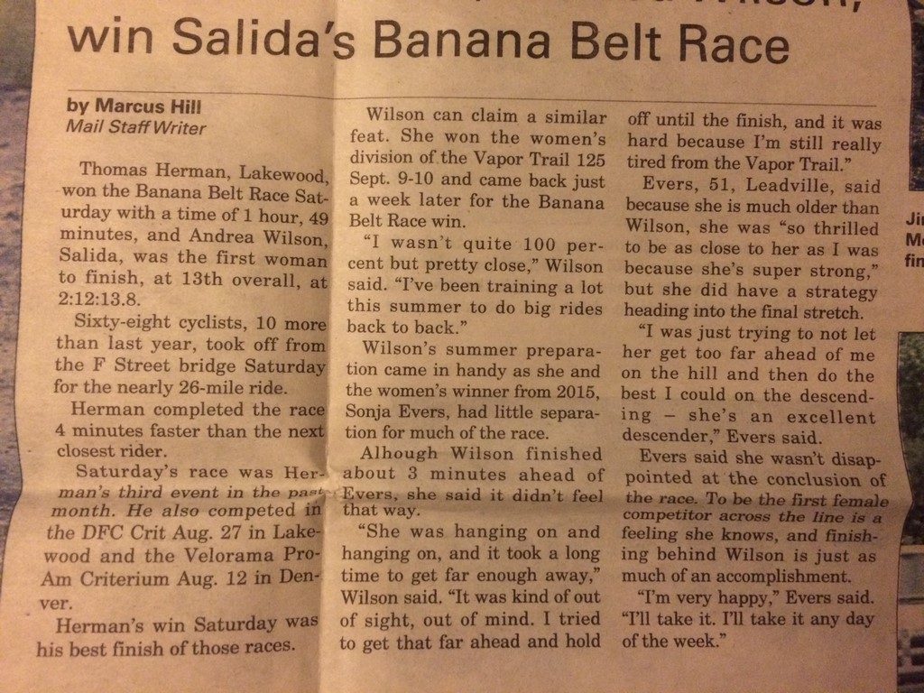
This is a long one- settle in with a snack.

I approached Vapor Trail 125 with an attitude of strategic indifference. If there’s one thing I’ve learned from racing it once and listening to the stories of others, it’s that if you set lofty expectations other than “do everything you can to ensure finishing strong” then you will often fail miserably. I held any other goals as well as the expectations of others at arms’ length, making my only goal an easy one- apply my improved fitness, experience, and elevation acclimatization to this year’s race and better my previous time of 17 hours, 36 minutes. That’s it- go faster than Memphis Me from 2014.

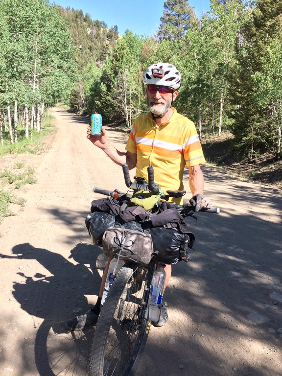
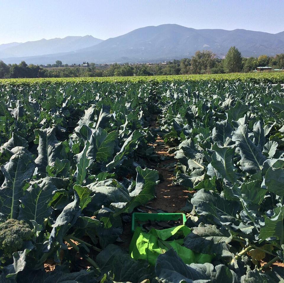
One thing that’s a bane to all racers is what to do on Saturday before the race other than lay around desperately trying to take a nap. Lucky me- the local farm-to-table had a field-gleaning day. They opened up the leftovers of the corn, broccoli, and cabbage harvest to the public to come in and take whatever they could find for free.

field1

broccoli

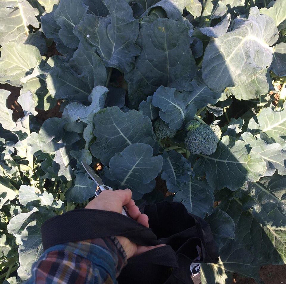
Matt and I picked for a couple of hours and then went home and took to processing it all. We blanched corn and broccoli for hours and ended up with a freezer full of veggies for the winter:

freezer

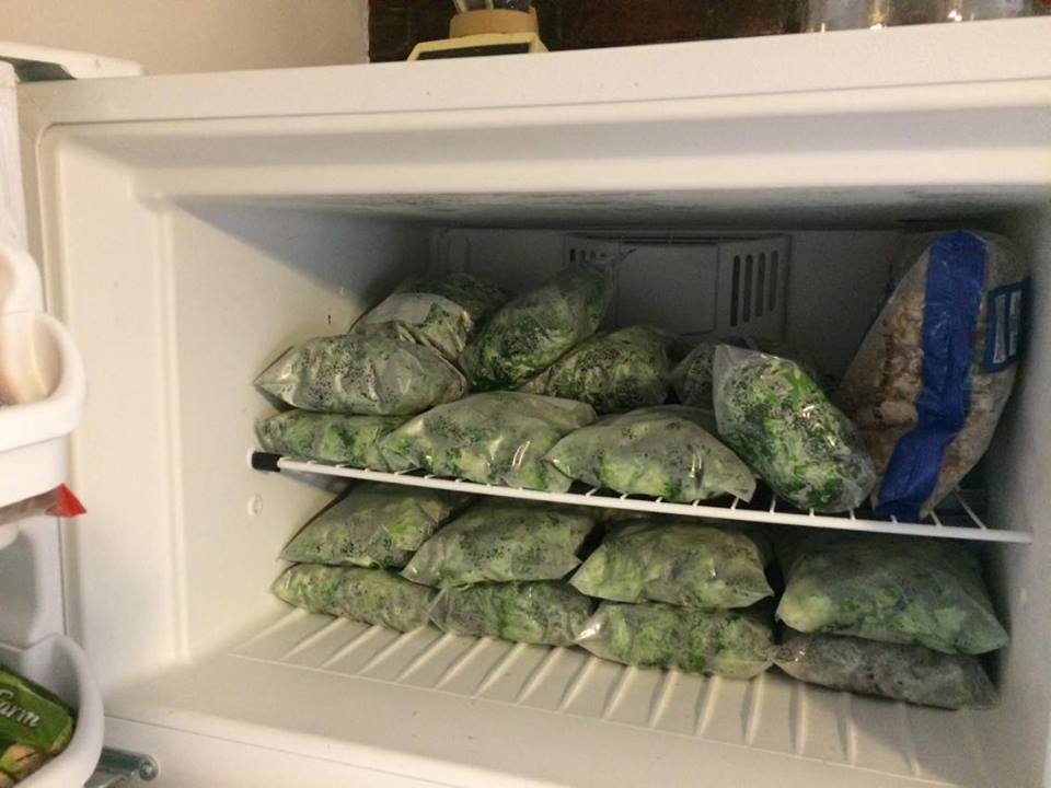
I had several gallons of broth in there prior to harvesting the veggies, so that went in the fridge to thaw. Yesterday, Matt turned the thawed broth and various veggie/potato additions in to nearly 8 gallons of soup. We’re pretty set for the winter now.

I digress…

So, most of my day was spent thinking about the vegetable blanching and freezing process. Around 5pm, we were winding down and cleaned up, so I ate dinner and got all of my stuff prepped for the 10pm race start. My plan was to sustain myself off of mostly Gu Roctane gel and blueberry pomegranate drink mix. I’d grab some solid food from the aid stations as needed and carry a Snickers bar in case I got hungry between (which I did, given that the time and effort between aids one and two is long and the most difficult portion of the course).

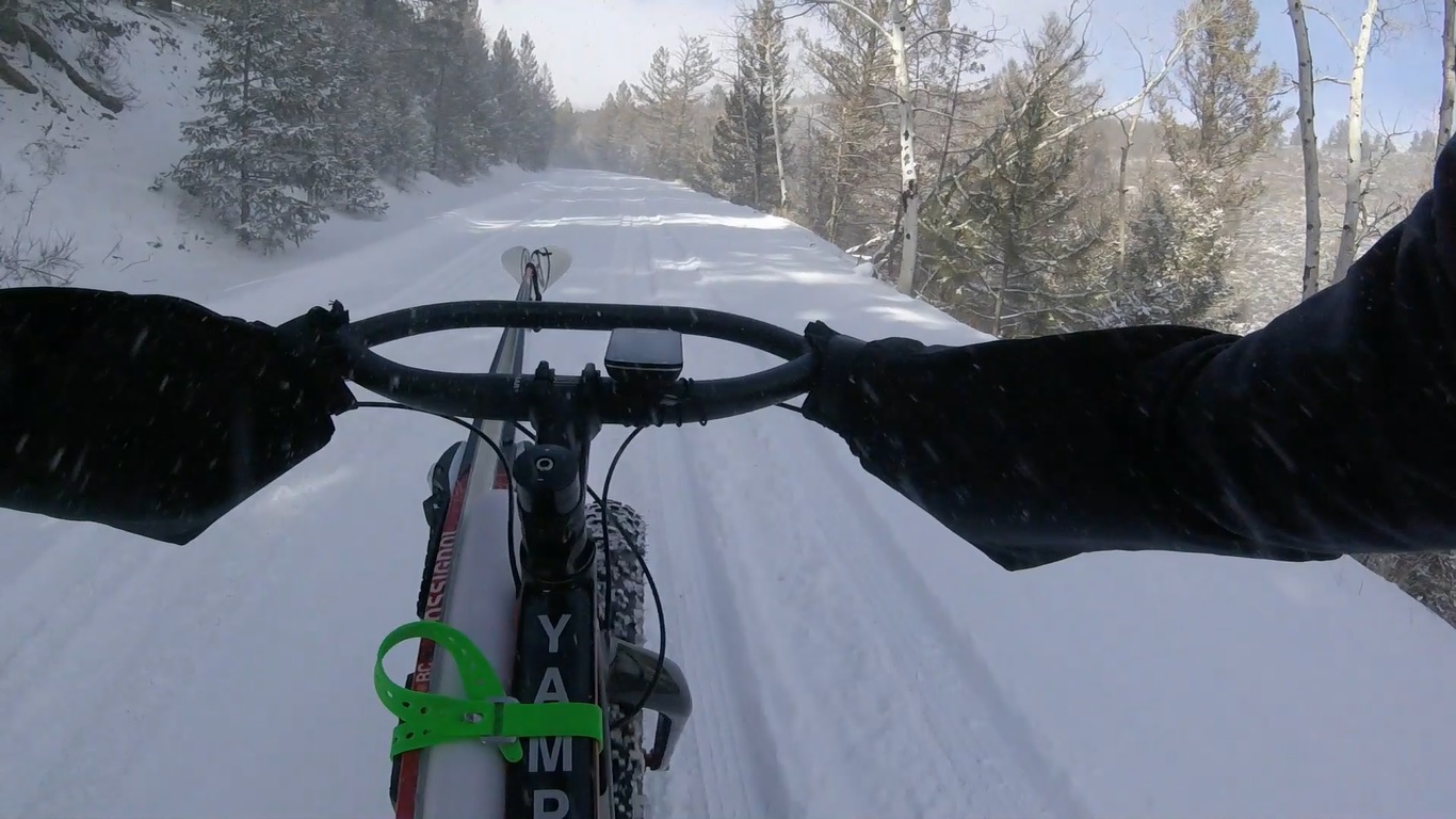
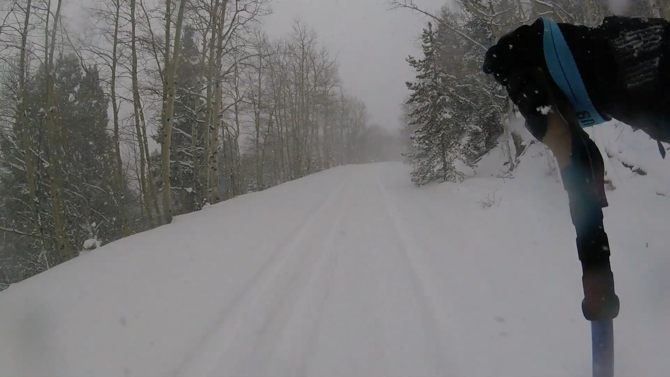
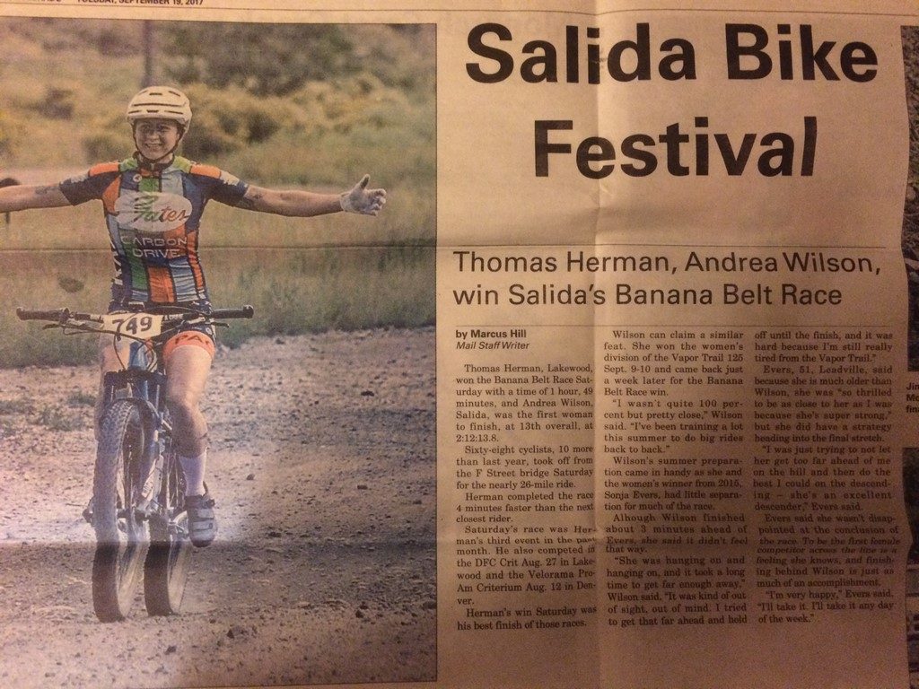
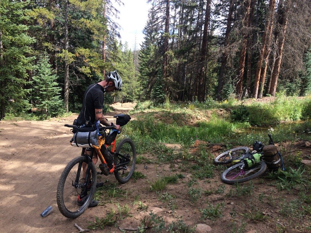
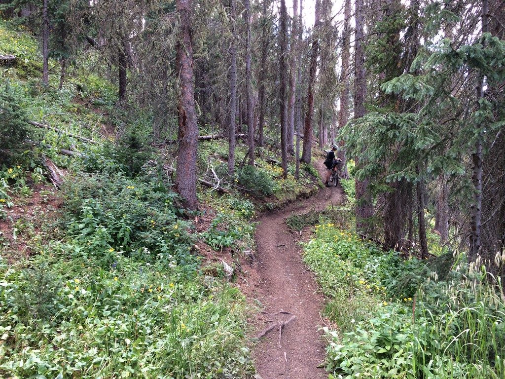
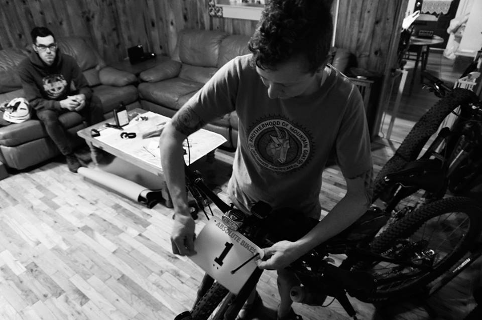
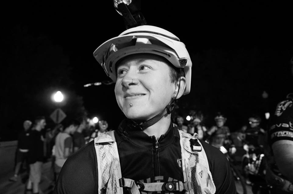
All of the black and white pictures coming up were shot by Jeff Kerkove as part of Ergon’s coverage/support of the race.

I’m not sure who came up with the number plate strategy of distributing them in alphabetical order, but they did, so I ended up with plate number one. I felt weird about it. That number is “supposed” to go to the previous year’s winner, and they handed it to me with Josh Tostado (said winner) in line behind me. I briefly begged letting us exchange numbers, but it was already set in race-stone.

absolute

number

map

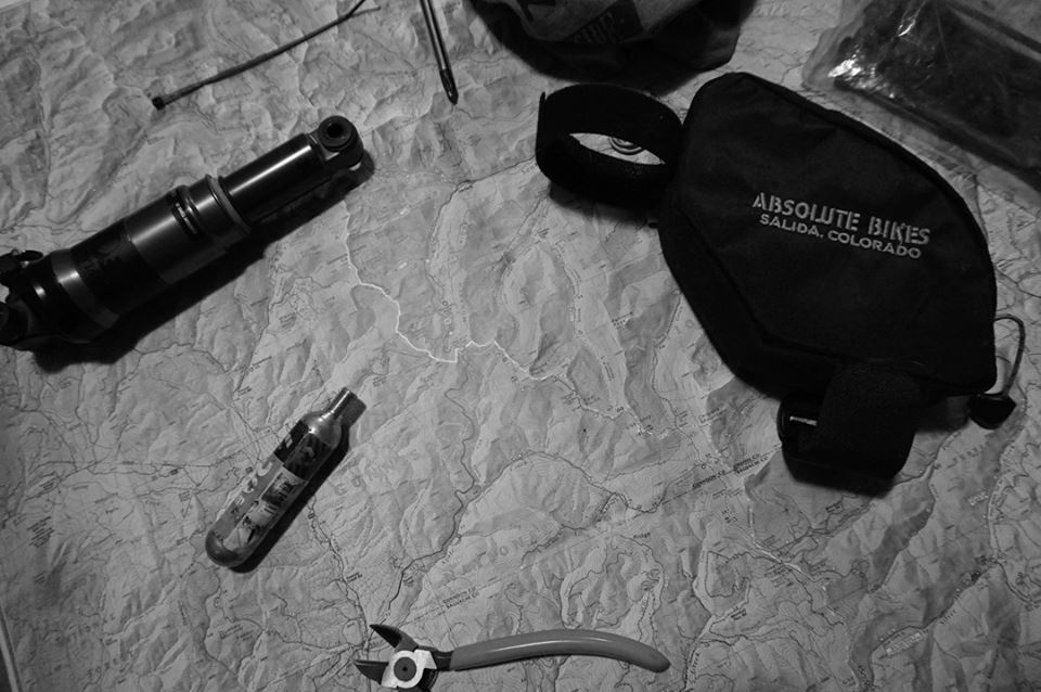
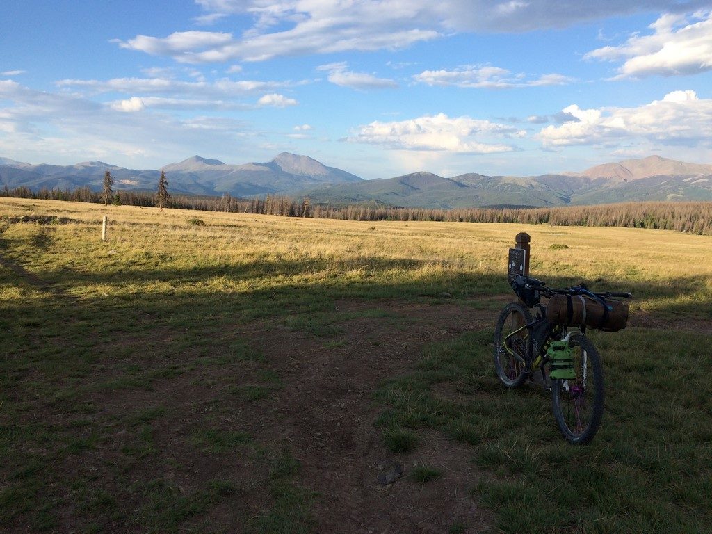
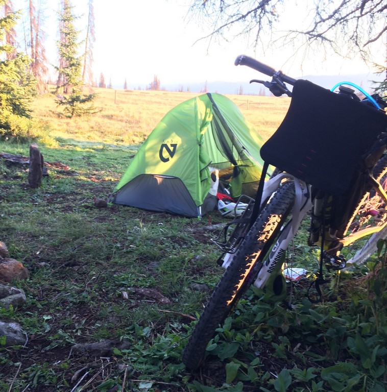
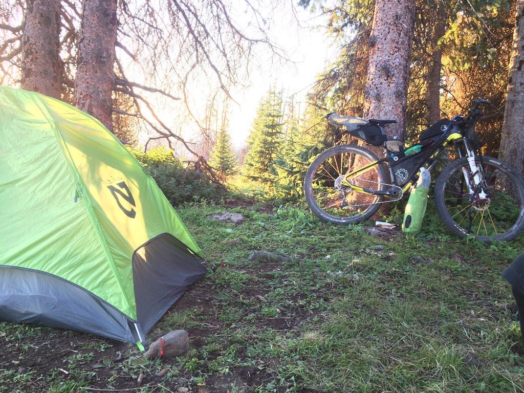
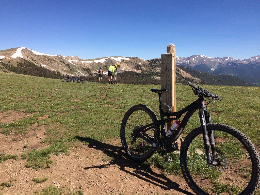
That last one is my coffee table. The map of this area stays open there 24/7 as a permanent fixture.

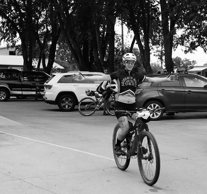
I sat around drinking beet juice until the last possible minute before changing and rolling to the start a block from the house.

lineup2

lineup

start

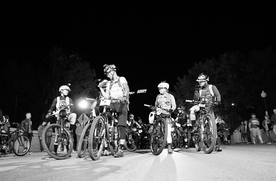
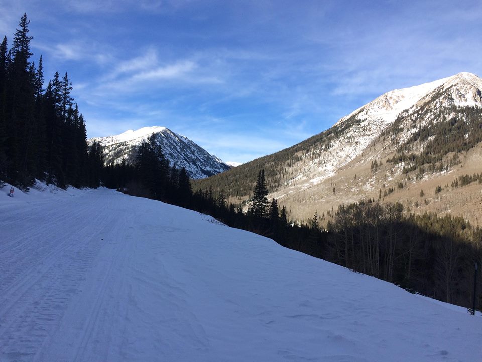
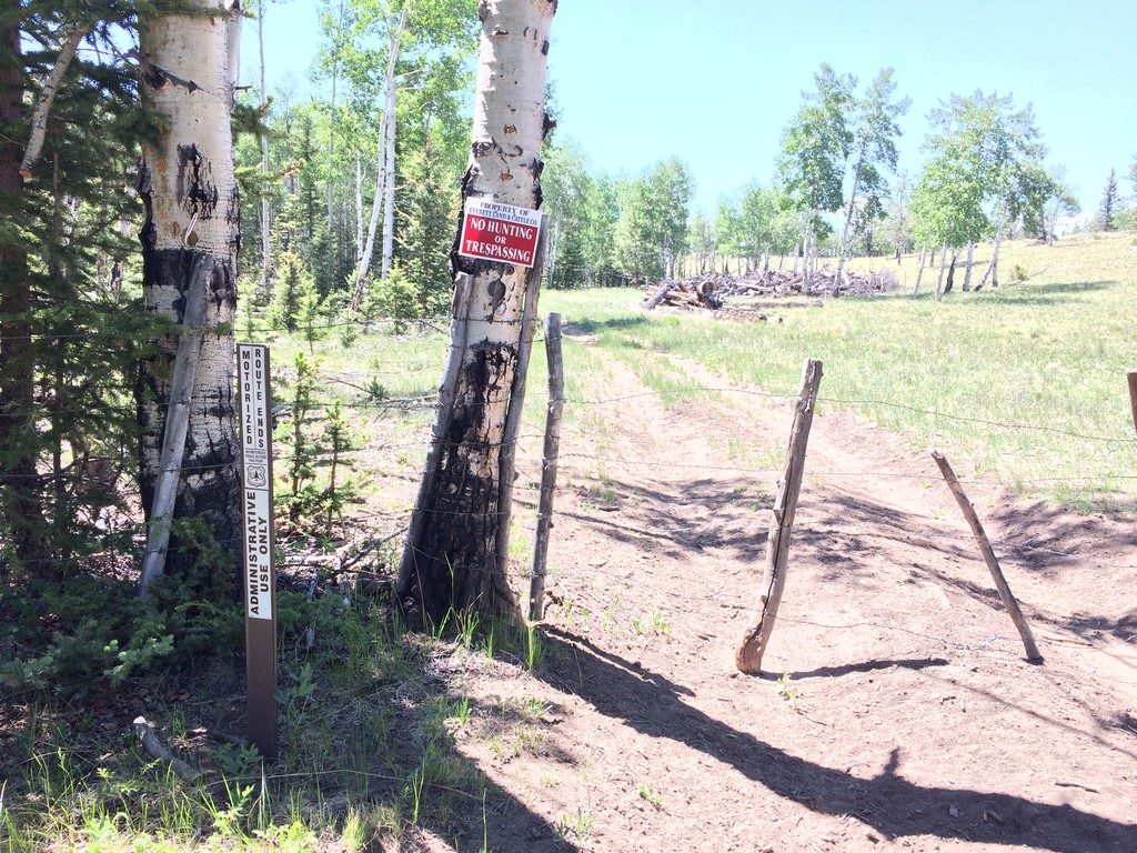
The race begins with the most neutral rollout of any race in endurance racing history. We get a couple of miles out of town, stop for a pee/clothing adjustment break, then roll slow for a couple more miles until we get across highway 285 (safely crossing the highway as a group is the main priority for the neutral rollout). Not long after the crossing, the course turns up CR 250 towards the Colorado Trail, and the race is on.

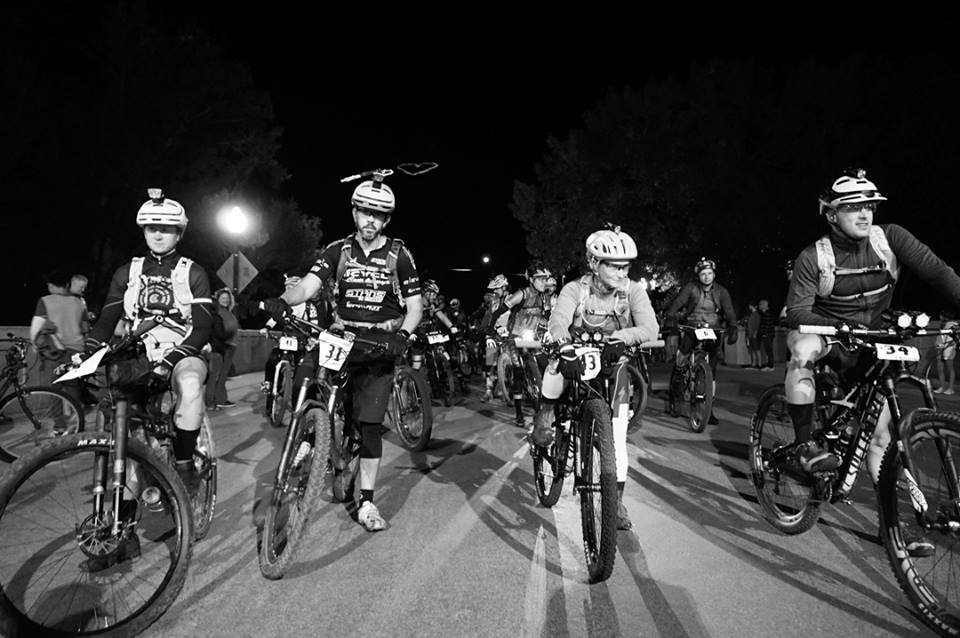
I stayed at the very front of the group during the rollout for safety reasons, and as soon as the race started up the first road/climb, I settled into the pace I’d hold for the rest of the night and part of the next day. A lot of people passed me- according to Earl (VT125 Moto official and Manager at Absolute Bikes), who was recording numbers/times of racers as they entered the Colorado Trail, there were only 9 people behind me (out of 46 starters). I knew that there were a handful of women ahead of me, including Tracy Thelan (VT125 veteran and seasoned endurance racer). She’d taken off really fast at the start, and I knew that chasing at that time was a bad idea.

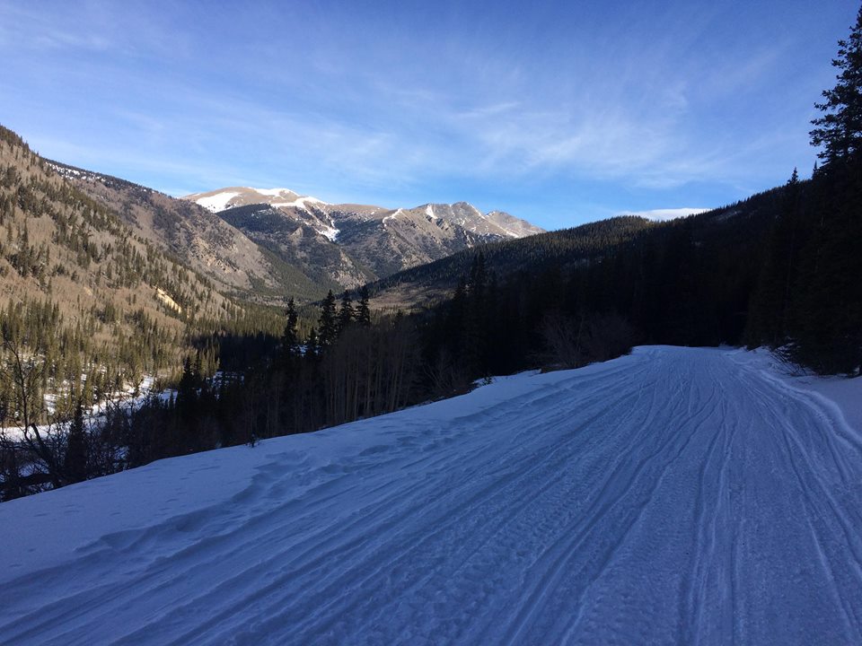
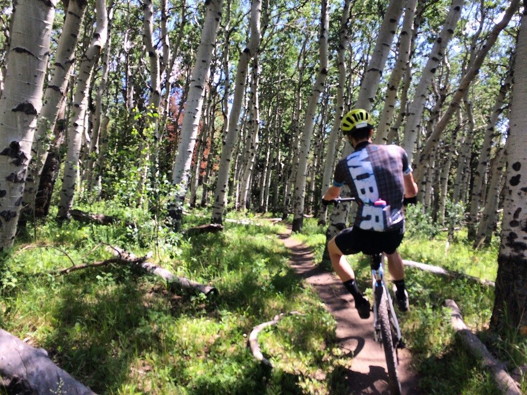
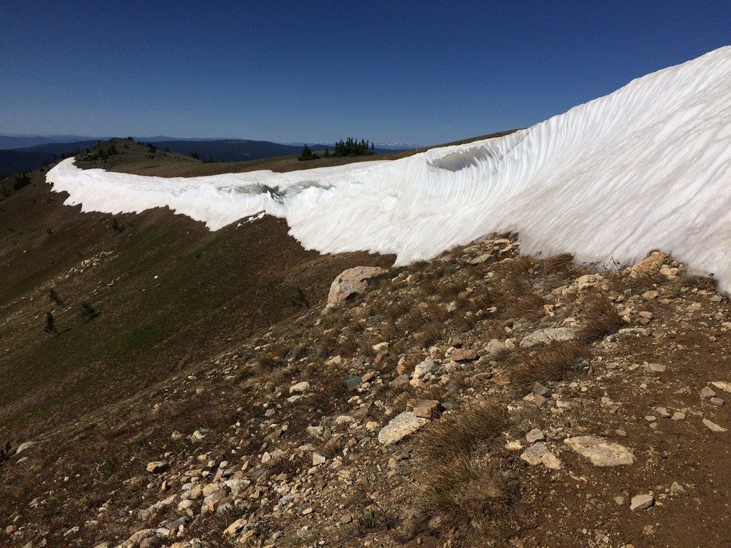
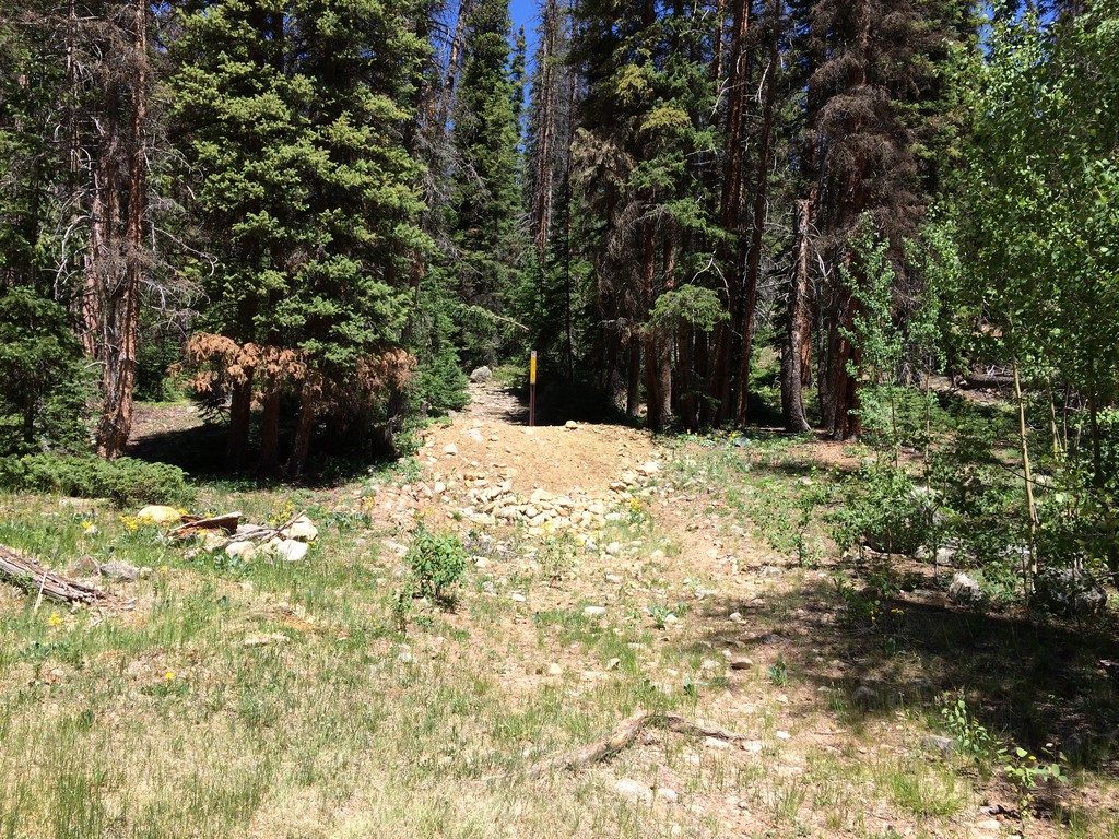
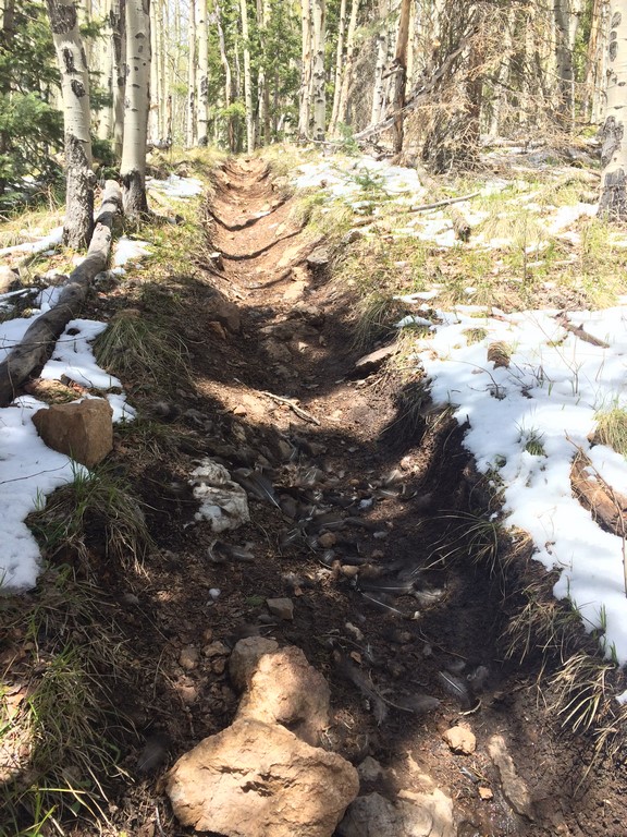
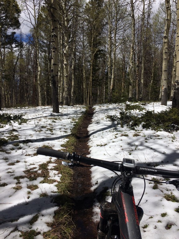
The Colorado Trail was in great shape. Afternoon rain showers meant hero dirt, so the traction was beautiful. I was feeling strong and really starting to warm up, but resisted the urge to burn any matches. I took it easy down the last CT descent (holy sketchballs) and rolled in to the first aid station. At that point, I was a little sleepy and the course ahead was daunting. However, at Aid 1, I saw a bunch of 92Fifty friends. It was a highly motivating and uplifting place to pass through at that time of night- exactly what I needed before riding off into the meat of the course.

The next few hours was more of the same. I paced myself, ate, drank, played songs in my head, and generally tried to think positive thoughts. The time flew by quickly, and, soon enough I was on the final hike-a-bike up Granite Mountain before dropping down Canyon Creek to Aid 2. I’d been only using my handlebar light on low for the anything that was non-technical climbing, and near the top of the hike, that battery finally died. It surprised me a little, and I exclaimed, “Oh, perfect timing!” The person hiking just ahead startled at my exclamation and took off up the trail. I then realized that I’d caught Tracy (for the first time).

I wasn’t in a hurry to chase at that point. It was <50 miles into the race, and the upcoming descent was really rowdy in some spots. I plugged in my backup battery, zipped my jacket, ate a snack, and generally made myself cozy before turning on the high beams and rallying down the mountain. I have some great lights (Light & Motion Seca 2000 on both handlebar and helmet), and I comfortably set a PR time down to the final bump in the trail before Aid 2.

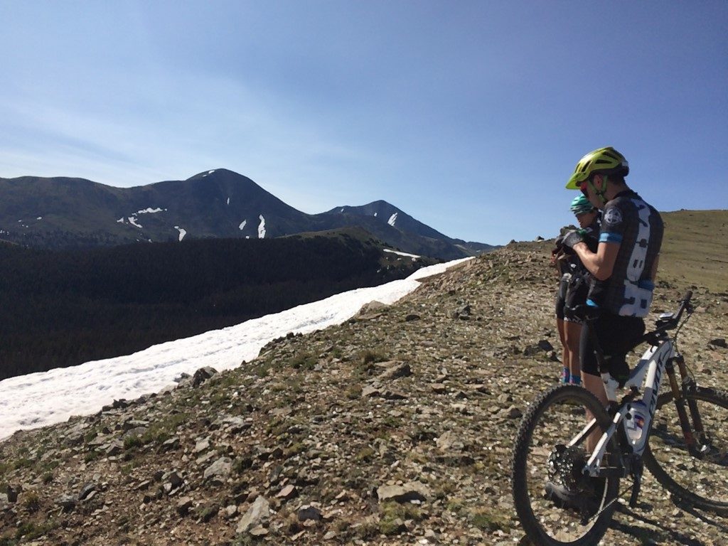
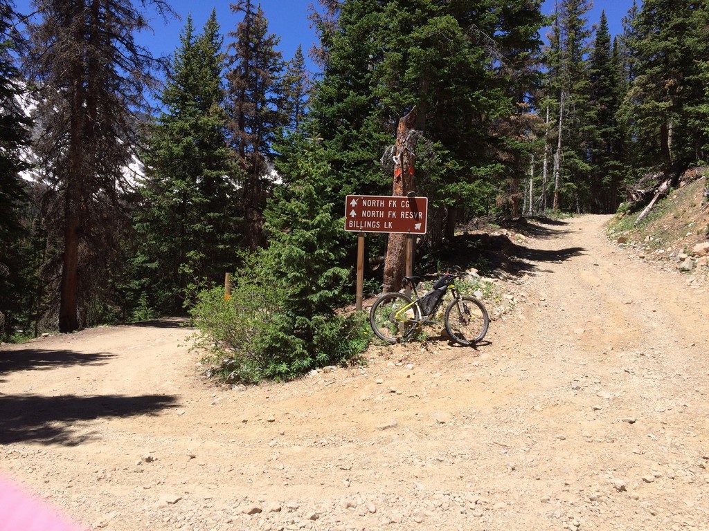
At Aid 2, I saw Tom Purvis, and he let me know that Tracy had just left before I got there. I hit up the bathroom, refilled bottles, and ate a piece of breakfast sausage. I knew that the climb up Monarch Pass was the only thing between me and warm, dry socks and shoes. It’s also one of the parts of the course that poses the largest mental test to racers- you’ve been awake, pedaling all night, and the climb is a monotonous 9.25 miles of gravel road. The combination of sleep deprivation and physical exhaustion can be overwhelming.

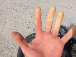
I didn’t feel good up the climb, but I expected that. The sun hadn’t risen over the top of the mountains, so my body was still wondering why TF it hadn’t slept all night, and, though my pacing/eating/hydration were good, my legs and stomach were whiny. My back hurt a lot from carrying a *pack and helmet light all night.

*The pack didn’t have water in it- just my light battery and my “Alpine Kit” that I always carry  when I’m going to be in the backcountry and up high for long enough to get hypothermic if I were to get caught in rain/thunder. It’s a waterproof jacket, rain pants, warm gloves, and a thin wool hat. I feel irresponsible carrying less for outings at Vapor Trail elevations. It’s saved me more than once.

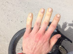
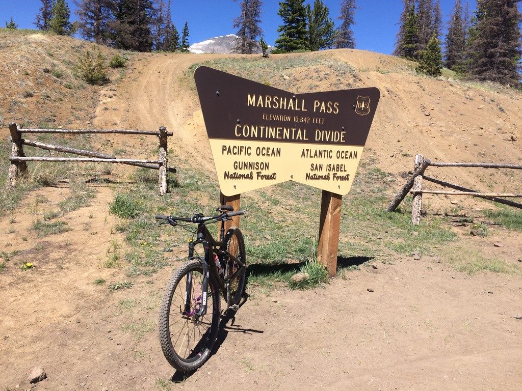
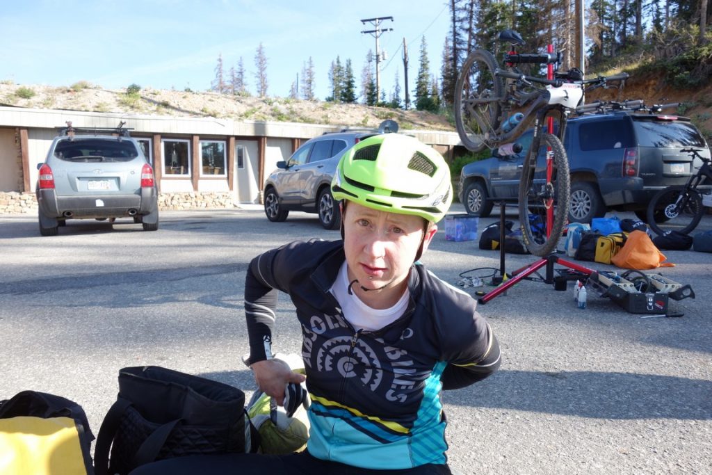
I had to really work to keep it together up that climb. The back pain was terrible, though the immense amount of discomfort was doing a good job of keeping me from falling asleep while riding. My legs kept trying to slow down, but I willed them on with the thought of dropping the pack and switching to a lightweight helmet at the next aid station. I finally made it up the pass and across the short, but seemingly endless section of Continental Divide Trail that connects Old Monarch Pass to (new) Monarch Pass.

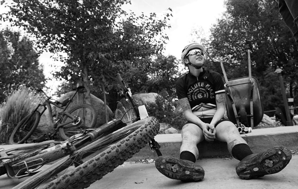
At Aid 3, I caught up to Tracy again. She was about to leave as I rolled in. I felt bad, so I dumped my bike on the ground and immediately started the process of doing what I needed to do to feel better. Right then, I was only thinking about survival and finishing, but, in the back of my mind, I knew that the short break, lightening of my clothes, and sunlight above treeline were probably going to bring me out of my hole.

Also, they had bacon and peanut butter sandwiches, which magically sounded like the most delicious thing in the world, even though my body had been rejecting all thoughts of solid food prior to that moment.

DSC00773

DSC00774

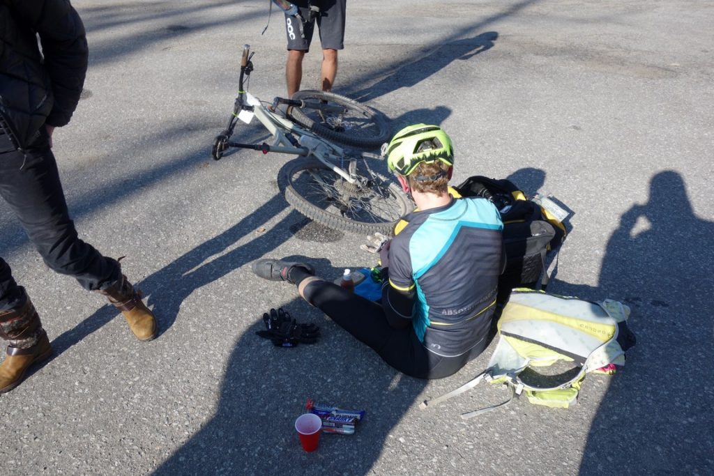
Matt was there to help out and take photos of my exhaustion.

It’s easy to dwell too long at Monarch. Everyone is nice, there’s food, and the asphalt is warm to sit on.

The knowledge that it’s possible to emerge from the sort of hole I was in is something that you only gain through many races of experience. Very slowly, the pain lessened in my back, and the full sunlight brought some awareness back to my senses. My body started to come back online, and I was able to dig up the strategy I’d thought of the night before- go back to the same pace I’d started with and then start going harder after negotiating the Starvation Creek/Poncha Creek loop.

Crest

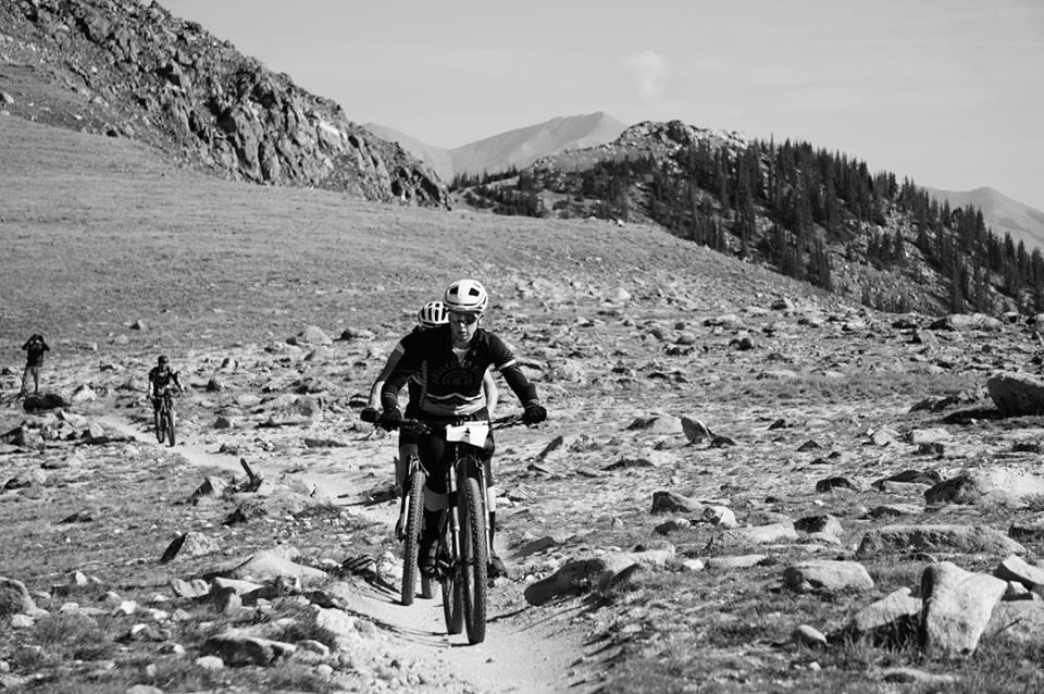
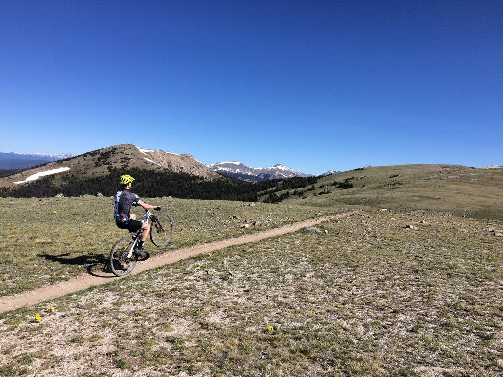
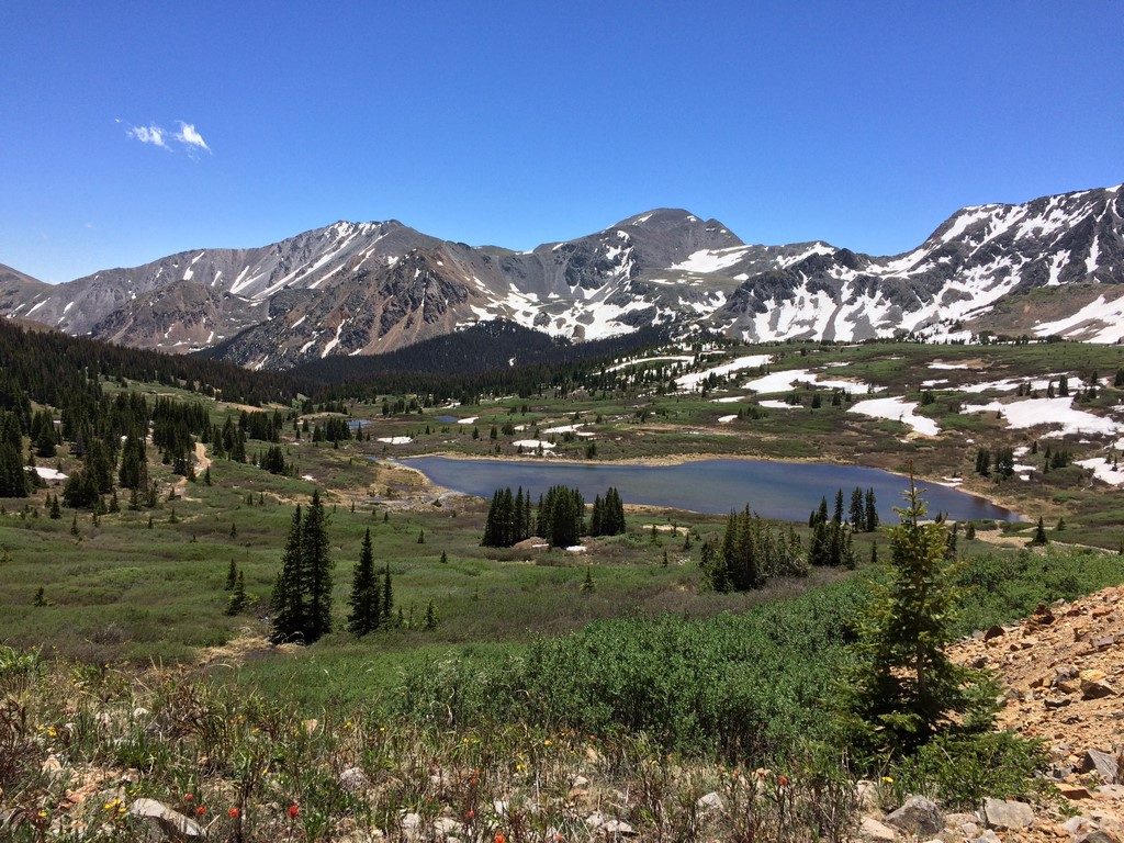
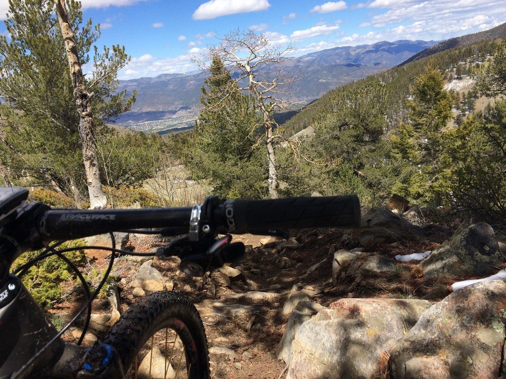
I can only assume that all of the people being shuttled up there were told that there’d be Vapor Trail 125 racers on the Monarch Crest trail, because everyone I passed seemed to let me by quickly.

The Marshall Pass aid station sits at the top of the Starvation/Poncha Creek loop, so you pass it twice. When I arrived there, my coworkers Leah and Roland were there and let me know that Tracy had JUST left. I drank some warm Coke and saw some sort of monstrosity of a creme-filled maple-glazed doughnut that looked like the best thing in the world, so I crammed half of it in my mouth and left the other half for my return trip.

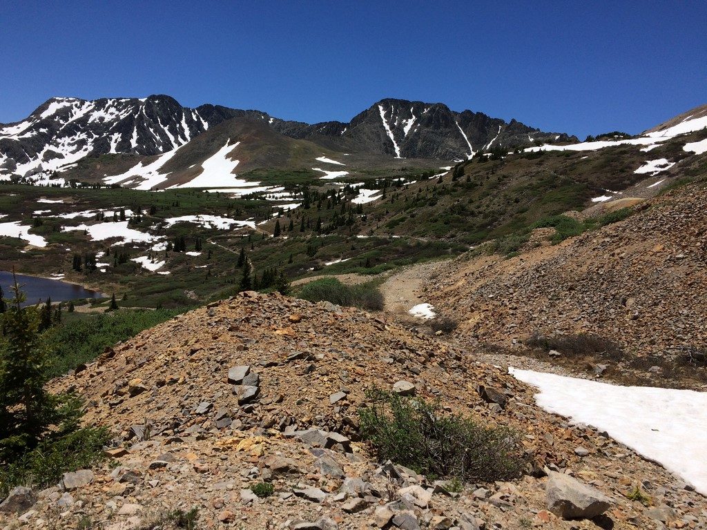
The Starvation Creek jeep road that leads to the trail takes you up a mind-melting series of rollers that seem to get progressively steeper and longer. Every time you think you’re finished with them, another bigger/steeper one is in front of you. It was there that I caught Tracy. She was walking. I got off to walk a particularly steep pitch, passed her, and then got back on my bike to ride the last one. I didn’t look back… I just started riding as if she were going full-gas to chase me down.

Somehow, at that point, it was as if I hadn’t been riding all night. I set a PR time down the Starvation Creek singletrack, then, when I made the turn to go back up Poncha Creek road, I was able to settle right back in to climb it at a decent pace. I encountered Earl on his moto about halfway up the climb, and his enthusiasm of seeing me leading the race snowballed into my energy up the climb. I ended up with the Strava QOM for the loop, knocking it out in an hour and a half.

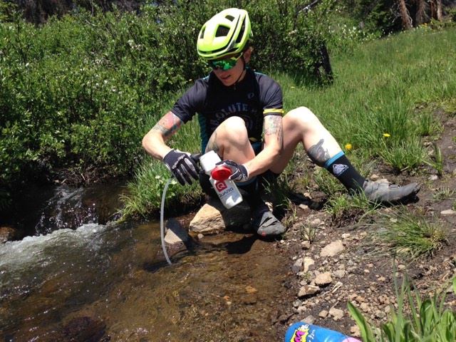
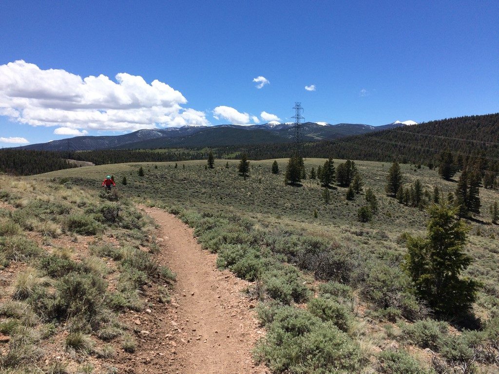
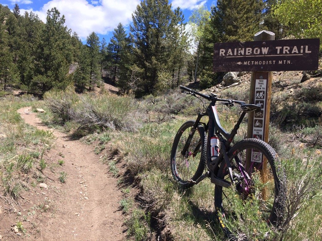
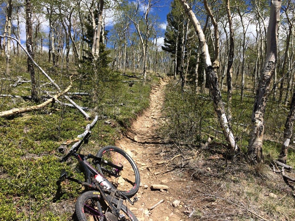
At the top, there was some thunder in the distance. I inhaled the other half of my magical doughnut, filled just one bottle, and took off as quickly as possible. The course from there is mostly downhill (except for the parts where it’s not), so I switched from endurance pace to cross-country pace (well, as close to XC pace as you can get at mile 90something). At the top of the Silver Creek trail, I paused briefly to slam some Roctane gel and some water in order to ensure a strong finishing pace on the Rainbow Trail at the bottom.

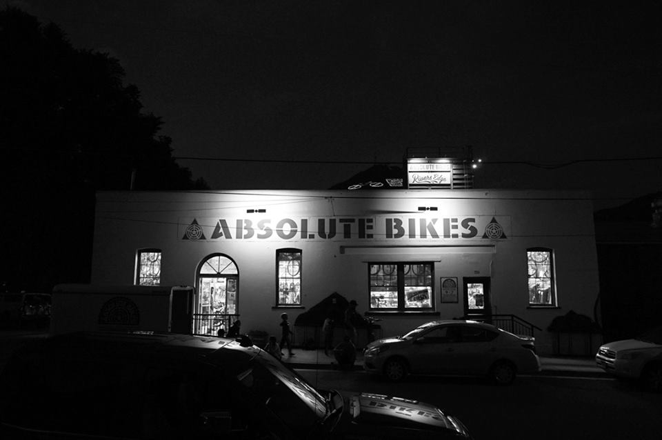
I miraculously felt like the remainder of the course flew by. I had no idea how far back Tracy was, but I kept riding as if she were closing in fast any time I’d let up. I rolled in to the parking lot of Absolute Bikes at 2:16pm- finishing time of 16 hours and 16 minutes, and 11th overall…

finish

As soon as I sat down, my backbone was the only thing providing my body with any structural integrity

finish2

Link to Strava: https://www.strava.com/activities/1178438336

Winning Vapor Trail is something I didn’t think I’d ever do. I’ve felt burnt out on endurance races for a hot minute now, so the fact that I wanted to push myself that hard was somewhat surprising (Cross Country is whole ‘nother thing that I’ve been thoroughly enjoying). I feel like this performance was a perfect last chapter to the previous 6 years of endurance-distance competitions. It feels a little conflicted, because I’ve finally gotten good at it. But, knowing how to race a 100 miler means nothing if you don’t have the motivation to do it.

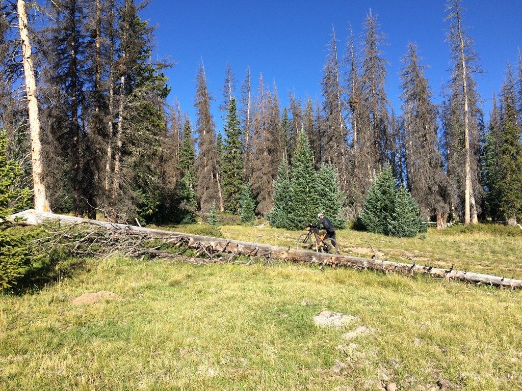
The long races have always served me as a vehicle for seeing new trail and new adventure. Now, living in Salida in such close proximity to so many new trails and new adventures, I am ready to explore outside the confines of the race course.

Hoodrich Transients, Volume 2

A couple of weekends ago, I was torn between several different choices in 3-day-weekend adventure. The Breck Epic was happening, and I strongly considered driving up to spectate and hanging out a few days. I was waffling on that when the guy who does the Singletrack Sampler videos came through the shop. I chatted with him a bit, and we talked about going for a ride down Green’s Creek in the morning. Then, I got a text from friend Levi, who was out on the Colorado trail, riding from Denver towards Durango…

LEVI

He arrived just before I was off of work, had a beer, and we went to get some pizza. Lots and lots of pizza.

IMG_1702

Over dinner, it was decided that I’d pack up and ride with him the next day, spend a night out, then ride back to Salida in the morning. He didn’t much care to do the climb up Fooses Creek where he’d left off, so I suggested the long and gentle climb up Marshall Pass instead. It’d cut off some of the scenery of the Monarch Crest section of Colorado Trail, but it would allow us to go without using the car or doing more hike-a-bike than what we were already in for with Segment 16 of the CT.

With the requisite trips to WalMart and dropping Marley off at dog daycare, we weren’t trail-ready until around 11am. I packed up the One Nine since it’s the most packable bike I have right now (hoping to get an Oveja Negra bag made to fit a full suspension Pivot 429 this winter).

IMG_1705

The trip to and up Marshall Pass road was a long one. We took a break about halfway up to snack

IMG_1706

I warned Levi ahead of time that the last mile-ish at the top is always a headwind.

IMG_1707

Our last water stop for hours was near the pass, so we filled up and headed south.

IMG_1708

I’m really familiar with the CT from there to the Silver Creek trail that you turn off on if you’re riding the Monarch Crest route. After that, all I had to go off of was people’s reports of terrible moto-thrashed hike-a-bike. There was some of that, but there was also a lot of awesome.

IMG_1709

Segment 16 is burly as ufck. A loaded hardtail is not the ideal bike for the terrain, and I’d love to go back and ride it on the Switchblade. My front roll buzzed my tire at about half fork travel, so I ended up hiking down the gnarliest of the gnar. We reached Tank Seven creek after a few hours where we made our final water refill before venturing up Sargent’s Mesa.

IMG_1711

I’ve never actually experienced anything like Sargent’s Mesa. The view was totally unique to me.

IMG_1713

IMG_1715

IMG_1716

We found a spot to camp near the top right at treeline. I cooked my first camp dinner ever- ramen noodles with dehydrated veggies and a vacuum-sealed pack of salmon- one of my most memorable meals ever. It was also one of the most amazing sunsets I’ve ever witnessed.

IMG_1727

IMG_1718

My sleep setup is dialed for the chilly weather at that elevation (somewhere over 11k feet). I can get all the way inside my sleeping bag and draw the top shut, which probably makes its 20 degree rating pretty accurate. It’s pretty hard to get out of in the morning except that I wanted to see if the sunrise was as awesome as the sunset. Close…

IMG_1720

IMG_1721

We had breakfast and headed on our ways… Levi kept trucking south and I went back down to the Tank Seven trail we’d passed before.

IMG_1722

No filter… the sky here is actually that color blue.

I took Tank Seven Trail back to the Sargent’s side of Marshall Pass Road and climbed back up to where we’d turned off the day before. I rolled in to town at about 24 hours on the nose to when we’d left.

Word of advice- don’t make another trip to WalMart your first interaction with the general public following 24 hours in the peace of the woods. I went in for one small thing, and I promptly became massively overstimulated and couldn’t remember what it was once I was there.

 “He who fights with monsters should be careful lest he thereby become a monster. And if thou gaze long into an abyss, the abyss will also gaze into thee.” People become what they love and hate, because their mind focuses on it.”

This quote has always had a dark undertone to me. However, I feel like it’s more positive when applied to spending prolonged time in the mountains. I came home with a strong craving to go right back.


Adventure Dump #2- Matt Visits Salida

Before we get started, I just want to mention that the deer in Salida are pretty out of control. They aren’t afraid of people, and sometimes even act aggressively towards pets. They also poop everywhere.

IMG_1348

Now that’s over, time for Adventure Dump #2. Matt came to visit, and since he has been living at sea level since mid-may, I made the riding plans sub-epic (I don’t GAF, I’m taking that word back). It was perfect timing for more reasonable adventure, because I was racing on a duo team for Firecracker 50 the Tuesday following Matt’s visit.

Day 1, we rode Marshall Pass up to the Continental Divide/Colorado Trail to Starvation Creek. Afterwards, we hung out at the river and visited the local shooting range. I’ve shot plenty of shotguns and a rifle or two, but it was my first time shooting a handgun. It’s definitely a little harder to aim.

IMG_1388

Day 2, we rode some Colorado Trail from Blank’s Cabin. The section from Blank’s to the Angel of Shavano Campground is one of my favorites because of the Aspens.

IMG_1386

Day 3 was definitely the raddest. We caught the first shuttle of the year up to the Monarch Crest Trail. I had only ridden the full trail twice- once on my first-ever trip to Salida and once during Vapor Trail 125 (I honestly don’t remember much of the VT125 passage because I’d been riding all night).

IMG_1390

IMG_1391

IMG_1394

IMG_1395

There were still a couple of large snowdrifts to hike over.

IMG_1396

It’s a lot of fun to play around above treeline for a handful of miles on a clear/sunny day.

We stopped at my favorite water refill spot on Marshall Pass. I’ve been using an MSR Trailshot filter and loving it.

filter

You might notice from the photos that I put the RS1 fork on the 429sl. If you haven’t already heard me talk about it on Just Riding Along, I will say it again here- the RS1 is the cross-country Pike that I’ve always dreamt about. It’s not SID-WC light (weighs in between 1600-1700g), but it’s stiff, plush, and freaking awesome. If you have the $$, and you’re on the fence about it, I say go for it.

The three days of “normal person” adventures was a perfect lead-in to the Firecracker 50 race. I teamed up with Brad Berger- one of my other new-this-season Gates Carbon Drive teammates. He hammered a 2:12 lap, which put me someplace in the top 10 of 65 teams. I managed to reel in some of the ladies ahead of me, but also got passed by Cody (who turned a 2:02 lap)- the dude half of the eventual winners. My lap time was 2:27- fastest of any of the women who were on teams, and comparable to the mid-pack pro times. We ended up in 3rd place… not shabby, considering we were the only SS team on the podium.

F50 podium

The short/hard effort of XC-distance racing is a good blast of intensity to keep the watts topped off while I’m exploring for hours otherwise. With a couple of days of hard rest, I was ready for the hike-a-bike extravaganza that was my next weekend off/next blog post.

Adventure Dump #1

Re-occurring three day weekends are one of the greatest things I’ve ever experienced. You’d think with all that time, I’d be able to post here more regularly, but the opposite happens- I venture out into the backcountry and make more adventures than I could ever describe in the small amount of time that I make to sit down and stop moving for a few minutes.

The month of June is a micro-shoulder season around Salida. The low trails are hot and dusty, but the high country is still snowy and wet. I spent a lot of time scouting up Marshall Pass and riding “backwards” on the Monarch Crest Trail as far as the snow drifts would allow.

IMG_1188

Sometimes I have a hard time stopping to take photos because the iphone will never, ever really capture how amazing the scenery I’m looking at really is. If you look at any of these, just imagine them being 10x more awesome in person than how they appear on your screen.

June is also Tour Divide and American Trail Race season at the shop. The two cross-country routes meet up just north of Salida and share a path through town, staying together until they’re over Marshall Pass. The leaders of both races rode through town within about two hours of each other. If you follow my instagram account, you’ve seen the multiple drivetrain replacements I’ve performed for riders on both courses.

Pro tip- if you’re racing across country, start with a new drivetrain, brake pads, and tires.

One of our Just Riding Along show listeners is a member of a group of gravel riders in Kansas. They have a friend on the Divide route, and wanted to send him a beer via the shop. In keeping with the ethics of self supported racing, if they wanted to do that, then all riders had to have access to a beer at the shop. So, he paypal-ed me a few bucks for beer, and we’ve been offering it to every rider that comes through the shop. I also spent a day on the route up the north side of town offering beers to racers I found on course.

This was my “waiting” spot on the last hill that racers climbed before descending into Salida. Soon after I set up there, I met a couple who were northbound Divide riders. They passed on the beer, but stopped to chat a few minutes before heading off.

IMG_1285

Looking at the Trackleaders site, I could tell I had at least an hour or more before the next rider was through, so I went off in search of a forest road I’d seen on a map that looked like it’d connect to make a loop back to my beer spot. I found the road…

IMG_1286

I also found out that the Everett Cattle Company effs up everything in that area…

IMG_1287

Basically every secondary numbered forest road north of Salida has one of these signs on it. Highly disappointing.

I went back up the hill to wait on the next rider. He showed up after a while and was pleasantly surprised for the beer handup.

IMG_1290

That same weekend, I decided to explore a 4×4 road I’d seen on a map (basically how most of my adventures start). County/Forest road 240 goes into the mountains from Maysville (on highway 50) and ends at Billings Lake. I took the Colorado Trail to 240 in order to skip riding up Highway 50 (though I did end up riding down it to get home)

Route: https://www.strava.com/activities/1052441531

The section of Colorado Trail from Blanks Cabin to 240 is gorgeous and flowy (with a slightly hairy descent at the end). On the way to the trail, I could see my destination in the distance- the low spot in the mountain horizon just to the left of the cow’s head.

IMG_1303

The CT:

IMG_1304

The climb up 240 was tough- about 7 miles of mostly steep and rocky jeep road. However, the scenery at the end was as gorgeous as the climb was difficult.

Along the way, you pass an old trail that goes up the backside of Shavano. Gonna have to explore that one.

IMG_1305

Stay right for maximum mountain enjoyment:

IMG_1306

The area at the end of the road is covered in old mine remains. I’d love to find out more about the history of that spot. You can see the road I came in on to the left of the lake in the first pic-


IMG_1307

IMG_1308

IMG_1314

IMG_1315

IMG_1318

IMG_1319

The opportunities to explore the mountains around here are nearly endless. I spend literal hours looking at a topographical map, then cross-referencing it to strava heatmaps and local trail maps to try and determine if what I’m looking at actually exists as a road or trail. I want to refer to the resulting rides as “Epic,” but that term has become pretty watered down by people whose idea of adventure is a zipline tour or ski resort.

In my next installment, I go higher.


Over the Rainbow (again)

Since my days off from the shop are Thursday, Friday, and Saturday, I have quickly formed a tendency to do something a little “out there” on Thursdays, despite having a race on Saturday. Last week, it was another Rainbow Trail adventure.

If you recall from a recent post, I explored a section of the Rainbow Trail that people generally avoid due to an extended hike-a-bike. After figuring out that I’d gone the “wrong” direction before, I decided to go the other way on this outing.

The skies had been a little threatening most of the morning before I left, but I decided to pack a rain jacket and take my chances anyway. The trails here are super dry now, and any moisture that falls gets soaked up super fast. I headed up county road 110, hitting the Double Rainbow trail along the way. Once I made it to the Rainbow Trail, I started the walk.

IMG_1084

There are a couple of spots you can ride, but they are brief.

IMG_1086

It rained steadily for about half of the hike up. I was prepared, though, and thoroughly enjoyed being at the top of Poncha Mountain at the exact time that the sun re-emerged.

IMG_1089

The aspens up there are hardly believable.

IMG_1087

I have no pictures from the descent, because I was having too much fun. I will say, though, the view of Mt. Ouray on the way down nearly wrecked me with distraction.

The Route: https://www.strava.com/activities/1016899299

I bonked a little on the way home and drank the last of Leah’s almond milk in a recovery shake so I wouldn’t die all the way before I was able to make real food. A ride that includes two and a half hours of climbing isn’t my usual “thursday before a race” routine, but sometimes I just can’t help myself.

Rainbow Trail- Over the Hump

I raced the Gunnison Growler on Sunday (the 28th), but that’s another post.

At the bike shop, I work 4 days (Sunday-Wednesday), then I have 3 days off. That leaves the 3 day weekend to do some big adventures and whatnot. On Saturday, roommate/co-worker Leah and I rode out to the south/west end of the Rainbow Trail.

IMG_0975

It had snowed earlier in the week, so everything above 9ksomething feet in the shade was patchy snowy. It made for some sketchy wet rocks & roots in spots as well as some cool scenery.

IMG_0976 IMG_0977

As it dropped out of the woods, it turned beautiful and dry.

IMG_0978

There’s a section of Rainbow Trail that, since I started visiting Salida, I’ve been told is no fun because it’s blown out, steep, and hike-a-bikey (the trail is open to motorcycles, so it definitely gets loose). Since I was there, and I didn’t have much else to do that day, I figured I’d try it out.

IMG_0979

I was able to ride about the first half of the climb up. As the summer progresses and it gets drier & more moto-trafficked, there will be some spots I rode that won’t be as rideable. The second half is a lot steeper and rockier. I was getting really excited that the other side of “the hump” (the local name for that part of the trail) would be a fun, techy descent much like the stuff I was hiking.

IMG_0980

IMG_0981

IMG_0982

The top of the hump is somewhere around 10k feet, so there was a good bit of slushy snow and water. I eventually made it to the spot where the trail seemed to drop straight off the mountain.

IMG_0984

I was mildly disappointed when I found that the descent was nothing like the climb. It was all gravel & sand surfing. So, next time, I’ll definitely go the other direction and hike up the gravely side and descend the fun side.

I kept riding to county road 108 and descended back down to town. Here’s the Strava file for it:

https://www.strava.com/activities/997741104

It was about 6 hours, door-to-door, so I was stoked to eat a two-person-sized serving of tacos for dinner.

IMG_0986

Adventure number one of many.